MyTopo
Baboon Peak Utah US Topo Map
Couldn't load pickup availability
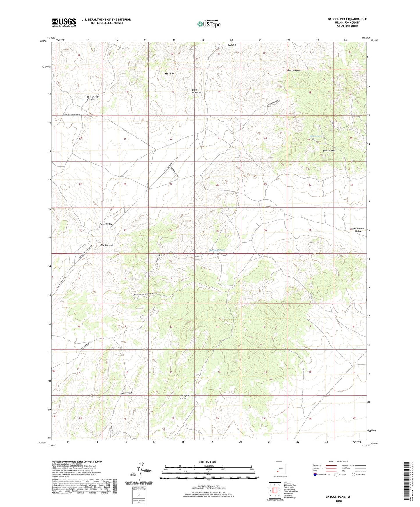
2023 topographic map quadrangle Baboon Peak in the state of Utah. Scale: 1:24000. Based on the newly updated USGS 7.5' US Topo map series, this map is in the following counties: Iron. The map contains contour data, water features, and other items you are used to seeing on USGS maps, but also has updated roads and other features. This is the next generation of topographic maps. Printed on high-quality waterproof paper with UV fade-resistant inks.
Quads adjacent to this one:
West: Badger Peak
Northwest: Thermo
North: Ninemile Knoll
Northeast: Minersville
East: Dry Willow Peak
Southeast: Parowan Gap
South: Enoch NE
Southwest: Enoch NW
This map covers the same area as the classic USGS quad with code o38113a1.
Contains the following named places: Baboon Peak, Baboon Seep, Horse Valley, Little Horse Valley, Marshall Pond, Marshall Well, Mound Mountain, Red Hill, The Narrows