
MyTopo
Wilson Peak Utah US Topo Map
Couldn't load pickup availability
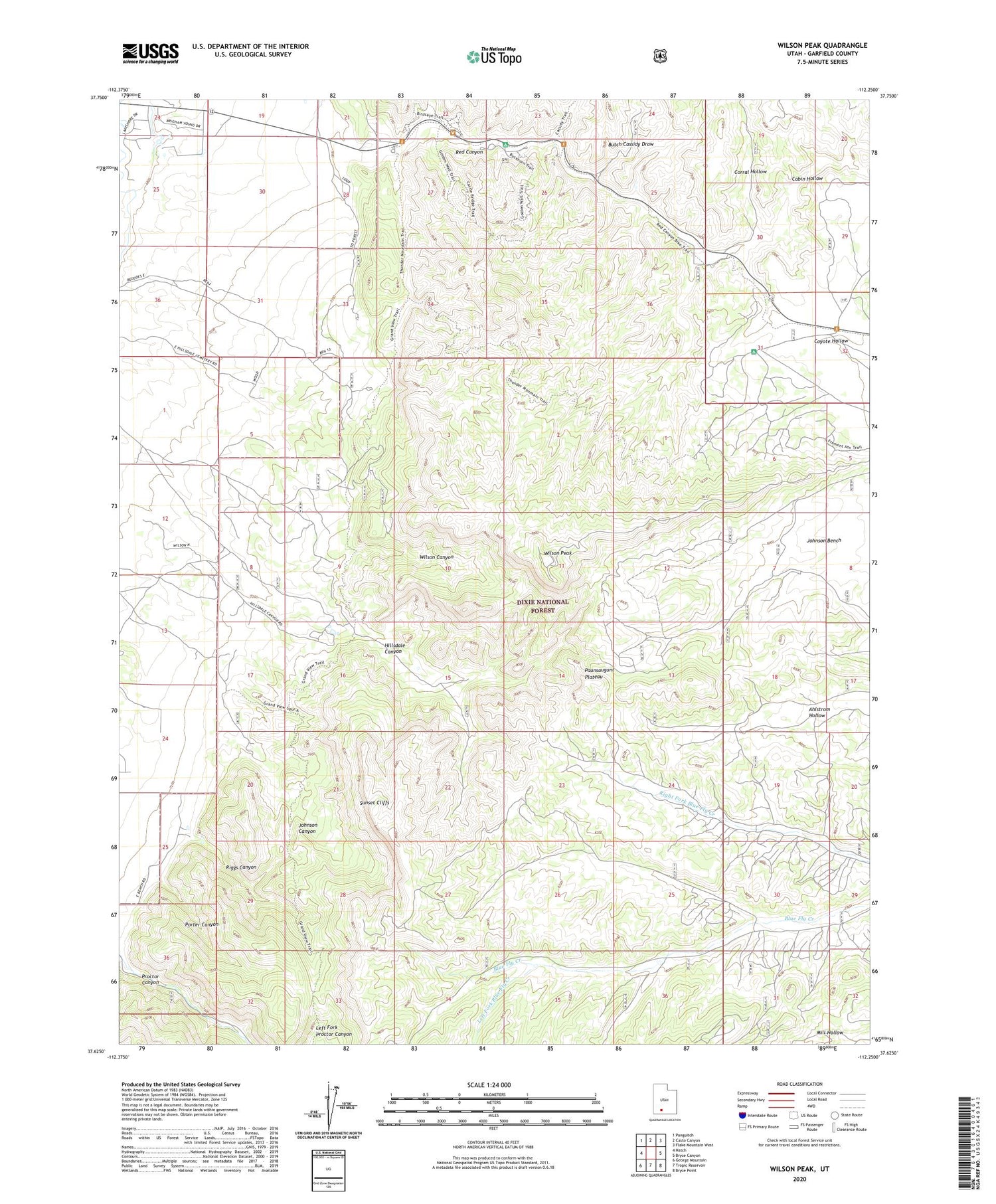
2020 topographic map quadrangle Wilson Peak in the state of Utah. Scale: 1:24000. Based on the newly updated USGS 7.5' US Topo map series, this map is in the following counties: Garfield. The map contains contour data, water features, and other items you are used to seeing on USGS maps, but also has updated roads and other features. This is the next generation of topographic maps. Printed on high-quality waterproof paper with UV fade-resistant inks.
Quads adjacent to this one:
West: Hatch
Northwest: Panguitch
North: Casto Canyon
Northeast: Flake Mountain West
East: Bryce Canyon
Southeast: Bryce Point
South: Tropic Reservoir
Southwest: George Mountain
Contains the following named places: Butch Cassidy Draw, Cabin Hollow, Corral Hollow, Hillsdale Canyon, Johnson Canyon, Left Fork Blue Fly Creek, Porter Canyon, Proctor Canyon, Red Canyon, Red Canyon Campground, Riggs Canyon, Wilson Canyon, Wilson Peak


