MyTopo
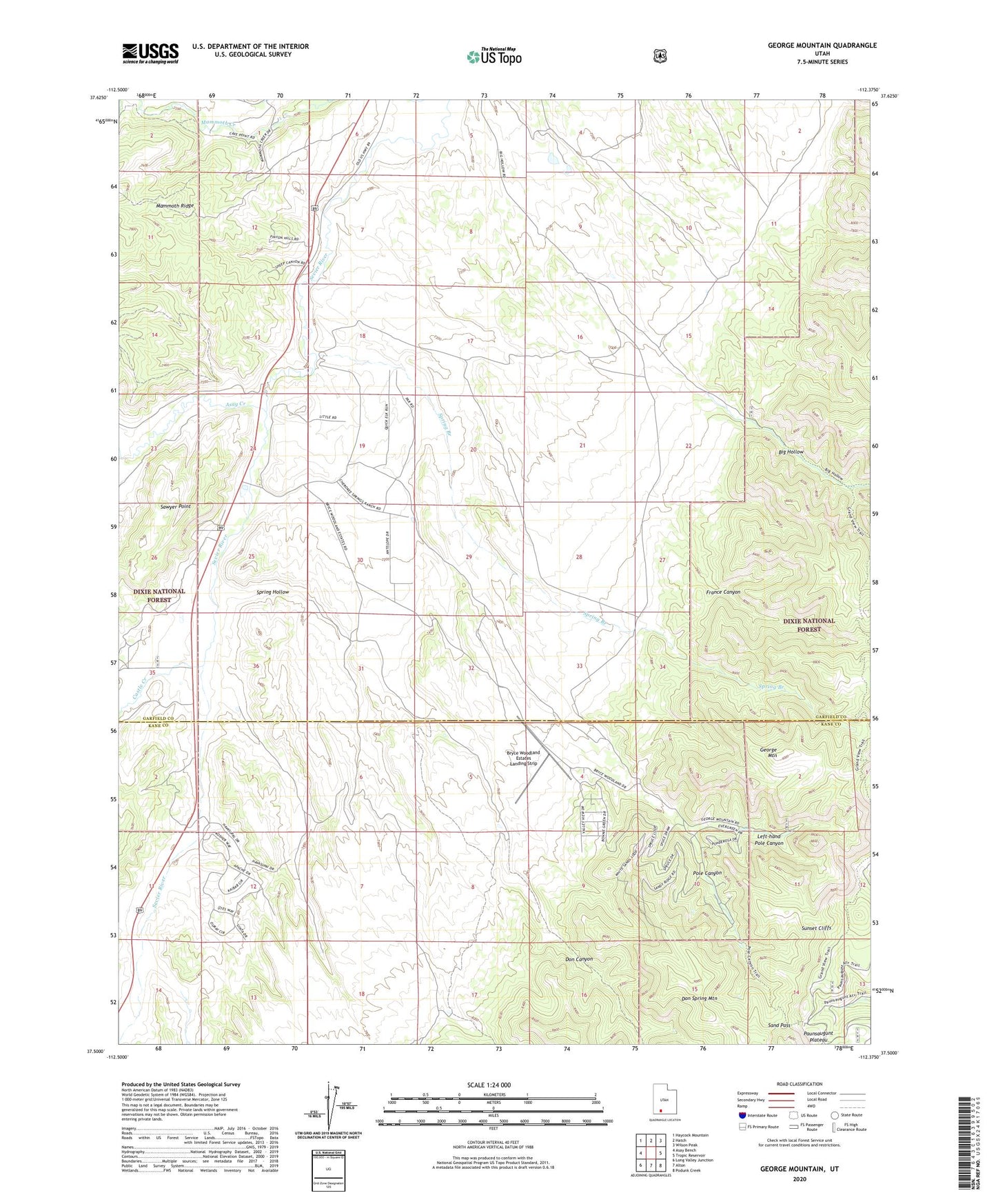
George Mountain Utah US Topo Map
Couldn't load pickup availability
Also explore the George Mountain Forest Service Topo of this same quad for updated USFS data
2023 topographic map quadrangle George Mountain in the state of Utah. Scale: 1:24000. Based on the newly updated USGS 7.5' US Topo map series, this map is in the following counties: Garfield, Kane. The map contains contour data, water features, and other items you are used to seeing on USGS maps, but also has updated roads and other features. This is the next generation of topographic maps. Printed on high-quality waterproof paper with UV fade-resistant inks.
Quads adjacent to this one:
West: Asay Bench
Northwest: Haycock Mountain
North: Hatch
Northeast: Wilson Peak
East: Tropic Reservoir
Southeast: Podunk Creek
South: Alton
Southwest: Long Valley Junction
This map covers the same area as the classic USGS quad with code o37112e4.
Contains the following named places: Asay Creek, Asay Town, Big Hollow, Bryce Woodland Estates Landing Strip, Castle Creek, Don Canyon, Don Spring Mountain, Dry Wash, France Canyon, George Mountain, Left-hand Pole Canyon, Panguitch Fish Hatchery, Pole Canyon, Sand Pass, Spring Branch, Spring Hollow, West Fork Asay Creek