MyTopo
Tropic Reservoir Utah US Topo Map
Couldn't load pickup availability
Also explore the Tropic Reservoir Forest Service Topo of this same quad for updated USFS data
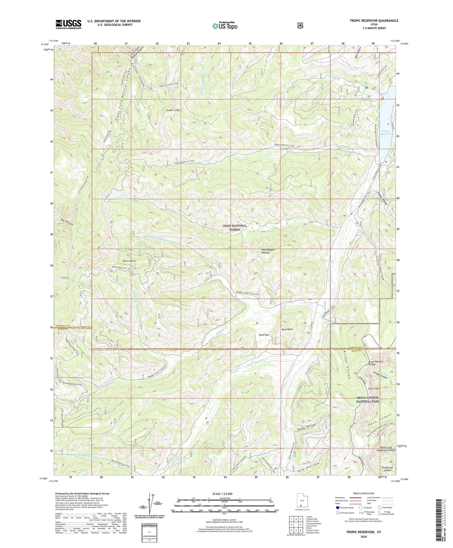
2023 topographic map quadrangle Tropic Reservoir in the state of Utah. Scale: 1:24000. Based on the newly updated USGS 7.5' US Topo map series, this map is in the following counties: Garfield, Kane. The map contains contour data, water features, and other items you are used to seeing on USGS maps, but also has updated roads and other features. This is the next generation of topographic maps. Printed on high-quality waterproof paper with UV fade-resistant inks.
Quads adjacent to this one:
West: George Mountain
Northwest: Hatch
North: Wilson Peak
Northeast: Bryce Canyon
East: Bryce Point
Southeast: Rainbow Point
South: Podunk Creek
Southwest: Alton
This map covers the same area as the classic USGS quad with code o37112e3.
Contains the following named places: Agua Canyon Connecting Trail, Agua Canyon Overlook, Badger Creek, Black Butte, Blubber Creek, Bridge Hollow, Bryce Natural Bridge, Buck Knoll, Clay Creek, Ingram Hollow, King Creek, King Creek Campground, Left Fork Blubber Creek, Left Fork Proctor Canyon, Long Hollow, Middle Fork Blubber Creek, Natural Bridge Overlook, Oak Hollow, Pink Cliffs, Puma Hollow, Right Fork Blubber Creek, Right Fork Proctor Canyon, Sand Pass, Skunk Creek, Sunset Cliffs, Tropic Reservoir, Tropic Reservoir Dam, Upper Kanab Creek