
MyTopo
Bethune NW South Carolina US Topo Map
Couldn't load pickup availability
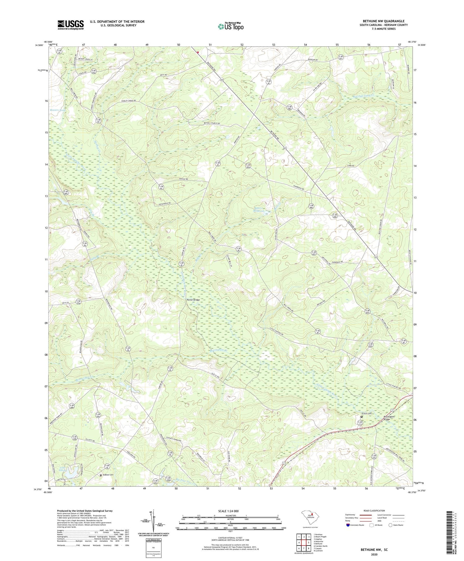
2020 topographic map quadrangle Bethune NW in the state of South Carolina. Scale: 1:24000. Based on the newly updated USGS 7.5' US Topo map series, this map is in the following counties: Kershaw. The map contains contour data, water features, and other items you are used to seeing on USGS maps, but also has updated roads and other features. This is the next generation of topographic maps. Printed on high-quality waterproof paper with UV fade-resistant inks.
Quads adjacent to this one:
West: Westville
Northwest: Kershaw
North: Mount Pisgah
Northeast: Angelus
East: Bethune
Southeast: Lucknow
South: Cassatt
Southwest: Camden North
Contains the following named places: Bakers Millpond, Beaverdam Creek, Bethel Hill Church, Bethune Division, Cassatt Lookout Tower, Cow Branch, DuBose Cemetery, Gates Hill Community House, Gully Branch, Kershaw County Fire Department Gates Ford Station, Lake Elliott, McGougans Bridge, Mill Creek School, Mills Creek, Mills Creek Church, Pleasant Grove School, Porter Bridge, Providence Church, Providence School, Scotch Cemetery, Shamrock Church, Shamrock School, Shirley Creek, South Carolina Noname 28011 D-2514 Dam, Stevens Millpond, West Branch School, ZIP Code: 29009


