MyTopo
Bethune South Carolina US Topo Map
Couldn't load pickup availability
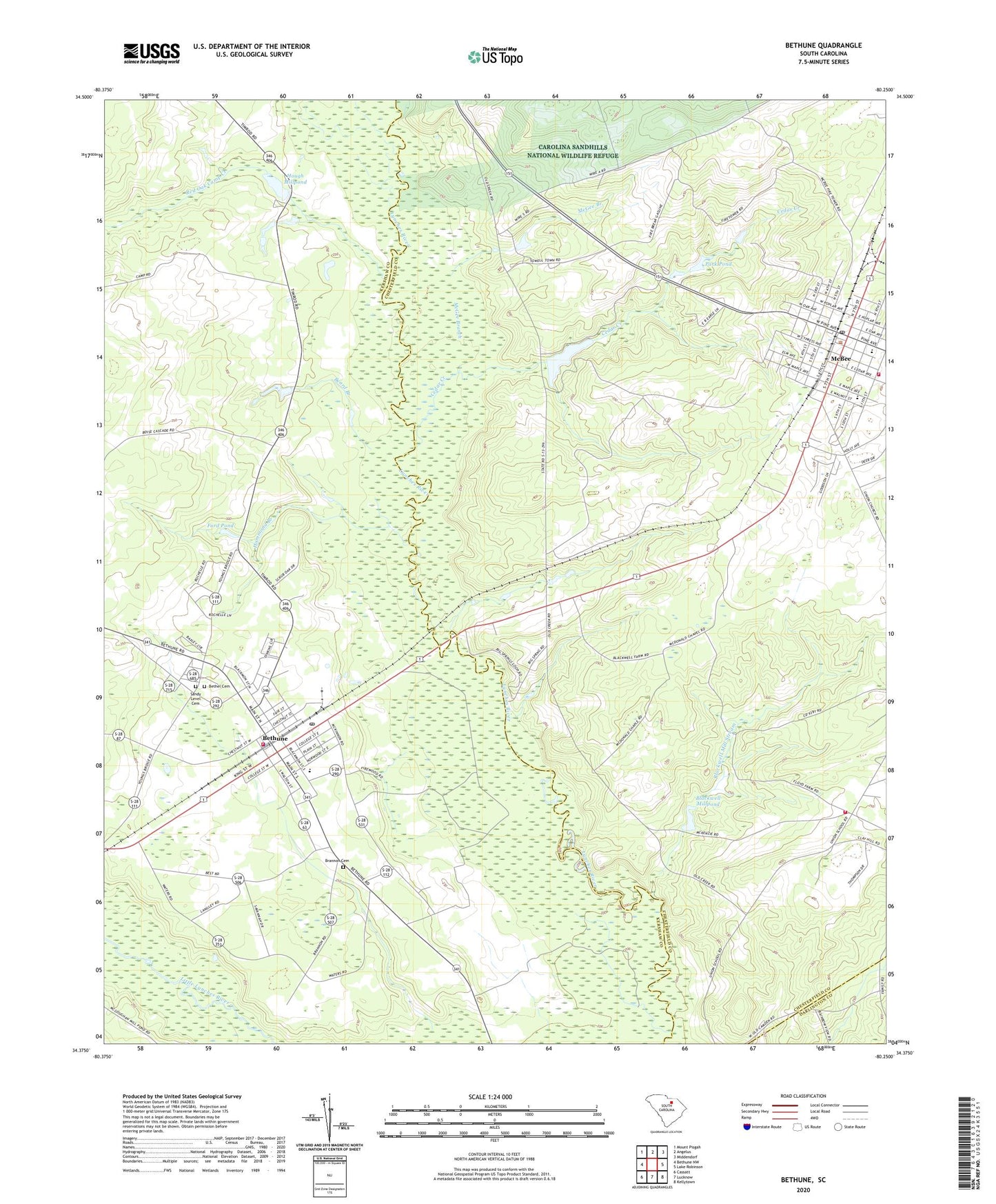
2024 topographic map quadrangle Bethune in the state of South Carolina. Scale: 1:24000. Based on the newly updated USGS 7.5' US Topo map series, this map is in the following counties: Chesterfield, Kershaw, Darlington. The map contains contour data, water features, and other items you are used to seeing on USGS maps, but also has updated roads and other features. This is the next generation of topographic maps. Printed on high-quality waterproof paper with UV fade-resistant inks.
Quads adjacent to this one:
West: Bethune NW
Northwest: Mount Pisgah
North: Angelus
Northeast: Middendorf
East: Lake Robinson
Southeast: Kellytown
South: Lucknow
Southwest: Cassatt
This map covers the same area as the classic USGS quad with code o34080d3.
Contains the following named places: Alligator Fire Department, Alligator Fire Department Union, Baxley, Beard Branch, Bethel Cemetery, Bethune, Bethune Baptist Church, Bethune City Hall, Bethune High School, Bethune Middle School, Bethune Police Department, Bethune Post Office, Bethune Public Library, Bethune Volunteer Rescue Squad, Big Springs, Big Springs Station, Blackwell Mill Stream, Blackwell Millpond, Blackwell Millpond Dam D-3187, Blackwells Mill, Blue Spring, Brannon Cemetery, Carver School, Catoe Church, Cedar Creek, Ford Pond, Freewill Church, Hammond Branch, Harmony Baptist Church, Hough Millpond, Kershaw County Fire Station Bethune, McBee, McBee Elementary School, McBee Lookout Tower, McBee Police Department, Mcbee Rescue Squad, McCoys Crossroads, McGee Branch, Meares Pond, Mount Pleasant Church, Park Pond, Pine Forest High School, Pine Village, Providence Church, Providence Church Cemetery, Providence School, Red Oak Camp Creek, Sandhills State Forest, Sandy Level Cemetery, Sandy Level Church, Sexton Pond, South Carolina Noname 13029 D-3186 Dam, South Carolina Noname 13035 D-3184 Dam, South Carolina Noname 28008 D-2515 Dam, Sullivan Pond Dam D-3185, Town of Bethune, Town of McBee, Union School, Youngs Bridge