MyTopo
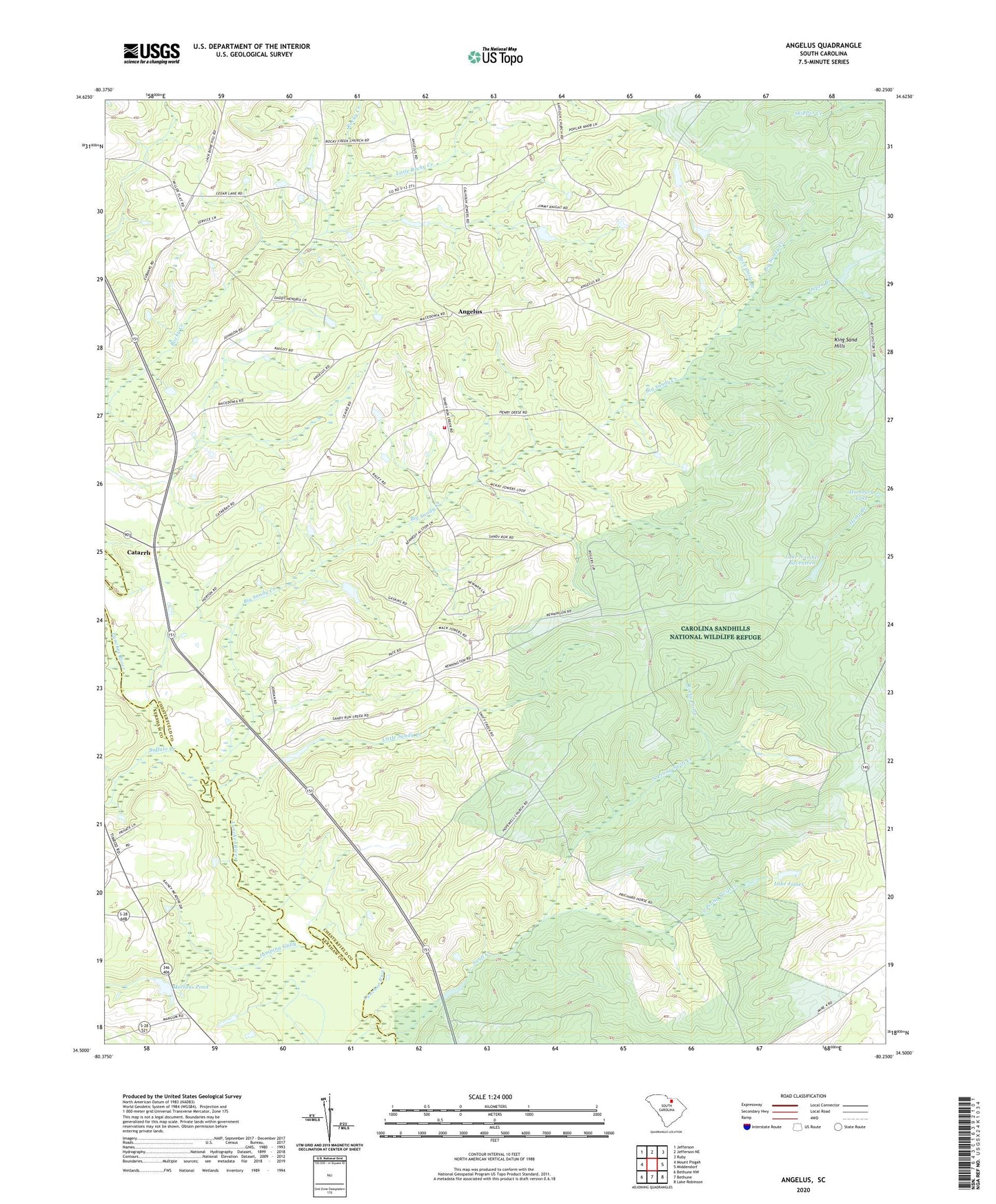
Angelus South Carolina US Topo Map
Couldn't load pickup availability
2024 topographic map quadrangle Angelus in the state of South Carolina. Scale: 1:24000. Based on the newly updated USGS 7.5' US Topo map series, this map is in the following counties: Chesterfield, Kershaw. The map contains contour data, water features, and other items you are used to seeing on USGS maps, but also has updated roads and other features. This is the next generation of topographic maps. Printed on high-quality waterproof paper with UV fade-resistant inks.
Quads adjacent to this one:
West: Mount Pisgah
Northwest: Jefferson
North: Jefferson NE
Northeast: Ruby
East: Middendorf
Southeast: Lake Robinson
South: Bethune
Southwest: Bethune NW
This map covers the same area as the classic USGS quad with code o34080e3.
Contains the following named places: Angelus, Angelus Church, Antioch Baptist Church, Batts Mill, Beauford Baptist Church, Beauford Church Cemetery, Big Sandy Creek, Buffalo Creek, Catarrh, Clarks Church, Evans Ford, Hamburg Lake, Herb Leard Pond Dam D-3181, Hopewell Baptist Church, Hopewell Church Cemetery, Hopewell School, Hortons Pond, Jumping Gully, Junction, Kirkleys Pond, Kirkleys Small Pond Dam D-3238, Kirley Pond Dam D-1812, Lake James, Lake Number Seventeen, Little Rocky Creek, Little Sandy Creek, Macedonia Church, Macedonia Church Cemetery, Macedonia School, Mount Elon Church, Mount Elon Church Cemetery, Mount Elon School, North Prong Swift Creek, Oxpen Branch, Rocky Creek Church, Rocky Creek Church Cemetery, Rocky Prong, Sandhill Volunteer Fire Department Station 2, Sandy Run Baptist Church, Sandy Run Church Cemetery, Sandy Run School, Sevenmile Branch, South Carolina Noname 13036 D-3227 Dam, South Carolina Noname 28009 D-2513 Dam, South Prong Swift Creek, Swift Creek, Tim Rod Church, Timrod School, Wesley Chapel, ZIP Code: 29718