MyTopo
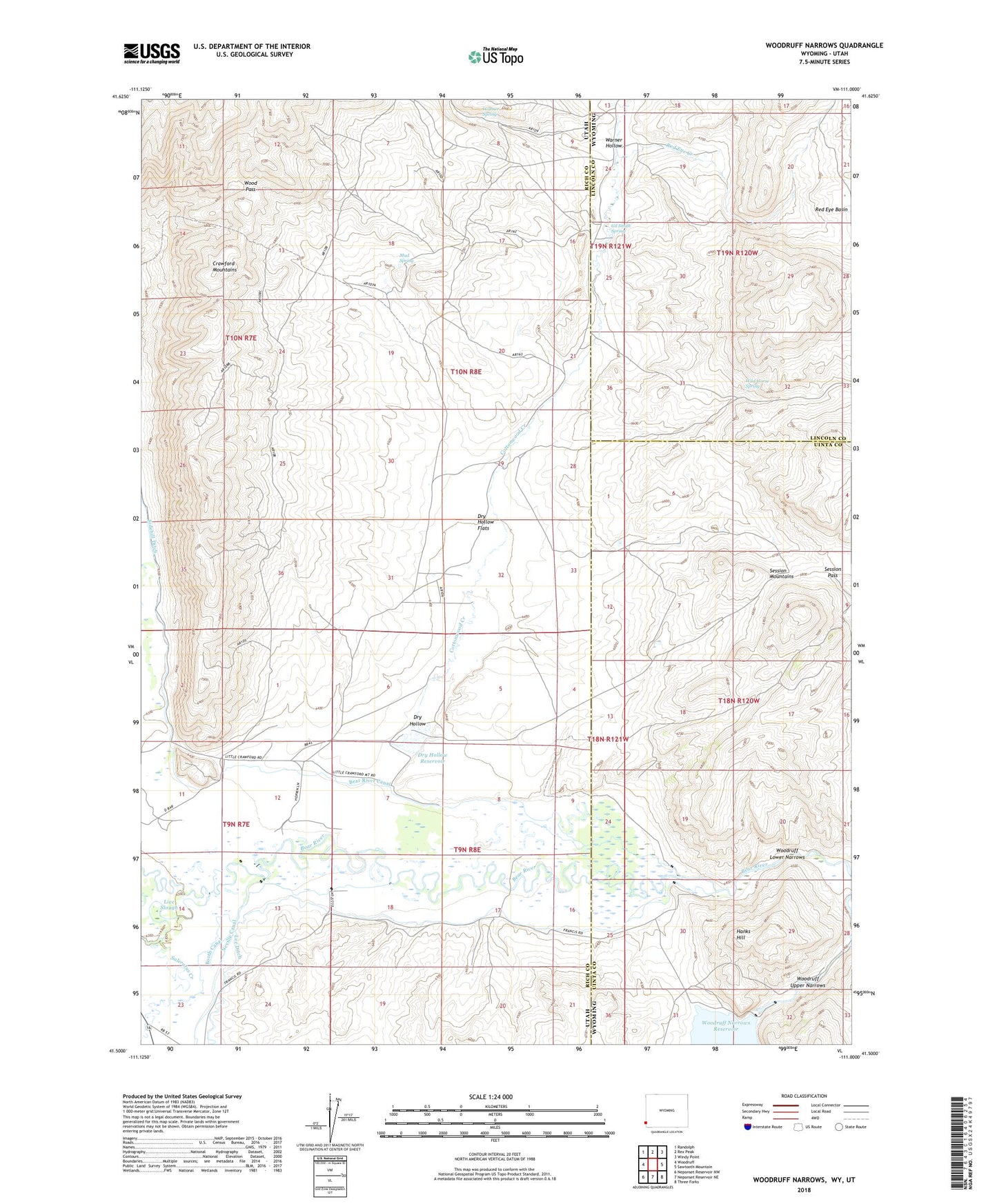
Woodruff Narrows Wyoming US Topo Map
Couldn't load pickup availability
2021 topographic map quadrangle Woodruff Narrows in the states of Utah, Wyoming. Scale: 1:24000. Based on the newly updated USGS 7.5' US Topo map series, this map is in the following counties: Uinta, Rich, Lincoln. The map contains contour data, water features, and other items you are used to seeing on USGS maps, but also has updated roads and other features. This is the next generation of topographic maps. Printed on high-quality waterproof paper with UV fade-resistant inks.
Quads adjacent to this one:
West: Woodruff
Northwest: Randolph
North: Rex Peak
Northeast: Windy Point
East: Sawtooth Mountain
Southeast: Three Forks
South: Neponset Reservoir NE
Southwest: Neponset Reservoir NW
Contains the following named places: Bear River Canal, Booth Canal, Cottonwood Creek, Dry Hollow, Dry Hollow Flats, Dry Hollow Reservoir, Gil Smith Spring, Hanks Hill, Lee Ditch, Live Slough, Mud Spring, Neville Canal, Red Eye Basin, Red Eye Creek, Rees Canal, Rees Well, Saleratus Creek, Session Mountains, Session Pass, Sidehill Ditch, Uinta Well, Warner Hollow, Warner Spring, Wild Horse Spring, Wood Pass, Woodruff Lower Narrows, Woodruff Narrows Dam, Woodruff Upper Narrows