MyTopo
Randolph Utah US Topo Map
Couldn't load pickup availability
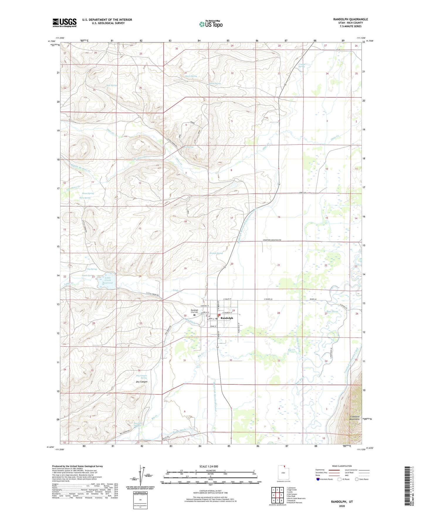
2023 topographic map quadrangle Randolph in the state of Utah. Scale: 1:24000. Based on the newly updated USGS 7.5' US Topo map series, this map is in the following counties: Rich. The map contains contour data, water features, and other items you are used to seeing on USGS maps, but also has updated roads and other features. This is the next generation of topographic maps. Printed on high-quality waterproof paper with UV fade-resistant inks.
Quads adjacent to this one:
West: Old Canyon
Northwest: Laketown
North: Sage Creek
Northeast: Leefe
East: Rex Peak
Southeast: Woodruff Narrows
South: Woodruff
Southwest: Birch Creek Reservoirs
This map covers the same area as the classic USGS quad with code o41111f2.
Contains the following named places: Atkins Spring, Barn Spring, Big Creek, Big Ditch, Brough Spring, City Spring, Crystal Spring, Dry Canyon, Dry Canyon Spring, Hatch Spring, Hawk Spring, House Spring, Jacobsen Springs, Kennedy Ditch, Little Creek, Little Creek Campground, Little Creek Reservoir, Lost Spring, Middle Branch Otter Creek, Pump Ditch, Randolph, Randolph Camp Historical Monument, Randolph City Cemetery, Randolph Fire Department, Randolph Post Office, Randolph Ranger Station, Randolph Woodruff Extension Canal, Rex Spring, Rich County, Rich County Ambulance Mobile Unit, Rich County Sheriff's Office, Rich High School, Sage Creek Canal, South Branch Otter Creek, South Rich Elementary School, The Church of Jesus Christ of Latter Day Saints, Town of Randolph, ZIP Code: 84064