MyTopo
Woodruff Utah US Topo Map
Couldn't load pickup availability
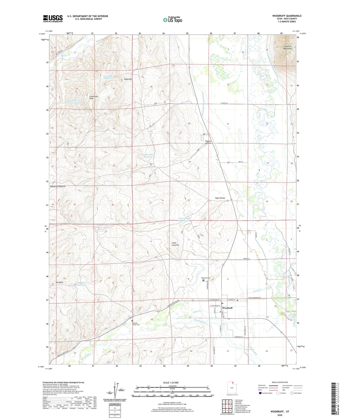
2023 topographic map quadrangle Woodruff in the state of Utah. Scale: 1:24000. Based on the newly updated USGS 7.5' US Topo map series, this map is in the following counties: Rich. The map contains contour data, water features, and other items you are used to seeing on USGS maps, but also has updated roads and other features. This is the next generation of topographic maps. Printed on high-quality waterproof paper with UV fade-resistant inks.
Quads adjacent to this one:
West: Birch Creek Reservoirs
Northwest: Old Canyon
North: Randolph
Northeast: Rex Peak
East: Woodruff Narrows
Southeast: Neponset Reservoir NE
South: Neponset Reservoir NW
Southwest: Meachum Ridge
This map covers the same area as the classic USGS quad with code o41111e2.
Contains the following named places: Crawford Thompson Canal, Dry Basin, Dry Basin Reservoir, Dry Creek, Eastman Family Cemetery, Genes Creek, Higgins Hollow, Higgins Hollow Reservoir, Limestone Peak, Limestone Reservoir, Little Long Hill, Little Long Hill Reservoir, Randolph Woodruff Canal, Rich County Ambulance Mobile Unit - Woodruff, Sage Hollow, Sage Hollow Reservoir, South Big Creek Reservoir Number 2, Sugarloaf, The Church of Jesus Christ of Latter Day Saints, Town of Woodruff, Woodruff, Woodruff Cemetery, Woodruff Post Office, Woodruff Volunteer Fire Department