MyTopo
Three Forks Wyoming US Topo Map
Couldn't load pickup availability
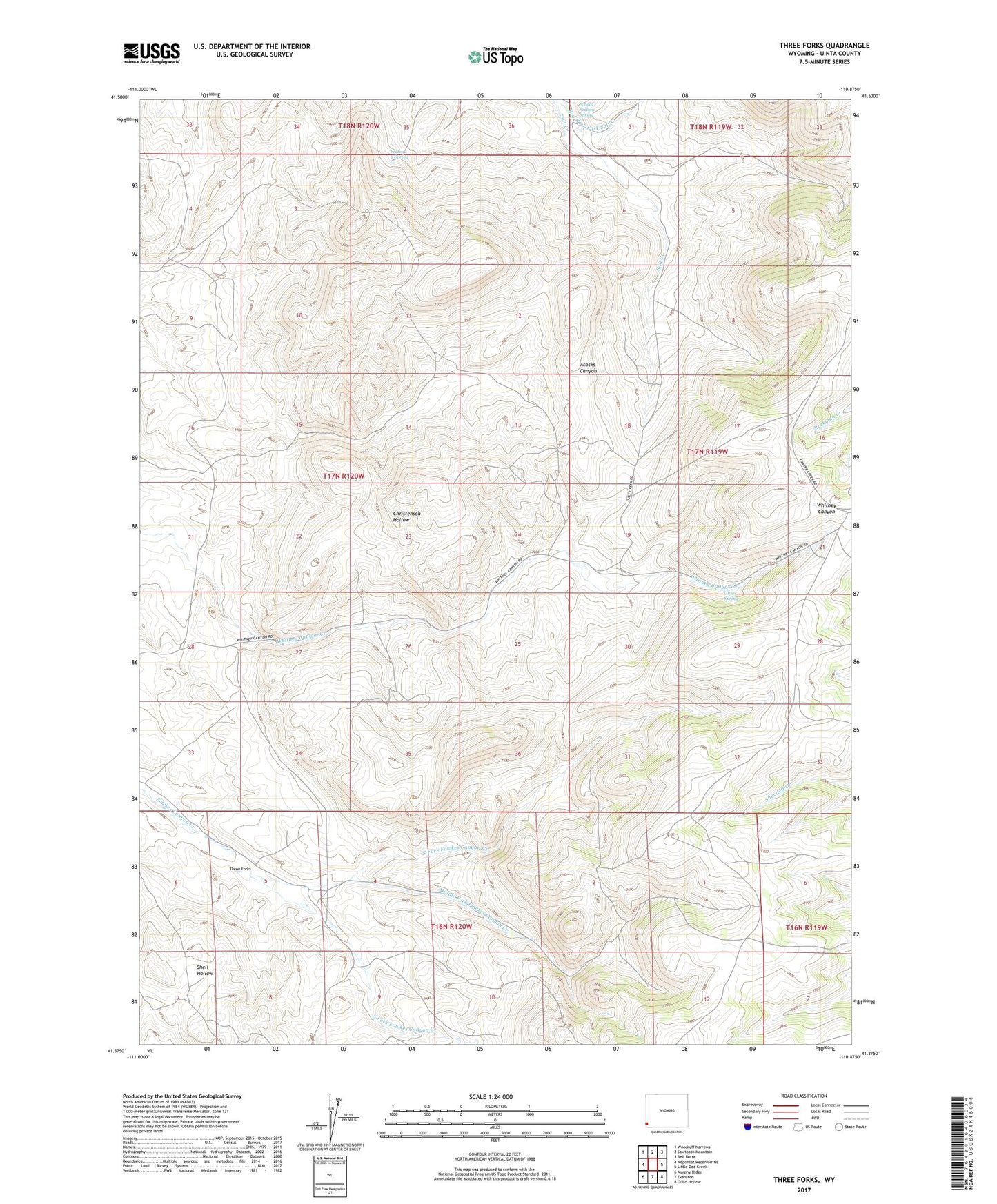
2021 topographic map quadrangle Three Forks in the state of Wyoming. Scale: 1:24000. Based on the newly updated USGS 7.5' US Topo map series, this map is in the following counties: Uinta. The map contains contour data, water features, and other items you are used to seeing on USGS maps, but also has updated roads and other features. This is the next generation of topographic maps. Printed on high-quality waterproof paper with UV fade-resistant inks.
Quads adjacent to this one:
West: Neponset Reservoir NE
Northwest: Woodruff Narrows
North: Sawtooth Mountain
Northeast: Bell Butte
East: Little Dee Creek
Southeast: Guild Hollow
South: Evanston
Southwest: Murphy Ridge
This map covers the same area as the classic USGS quad with code o41110d8.
Contains the following named places: Fowkes Canyon, Grove Spring, Middle Fork Fowkes Canyon Creek, North Fork Fowkes Canyon Creek, Red Rock Fork Salt Creek, School Section Spring, Section 2 Spring, South Fork Fowkes Canyon Creek, Three Forks