MyTopo
Afton North Carolina US Topo Map
Couldn't load pickup availability
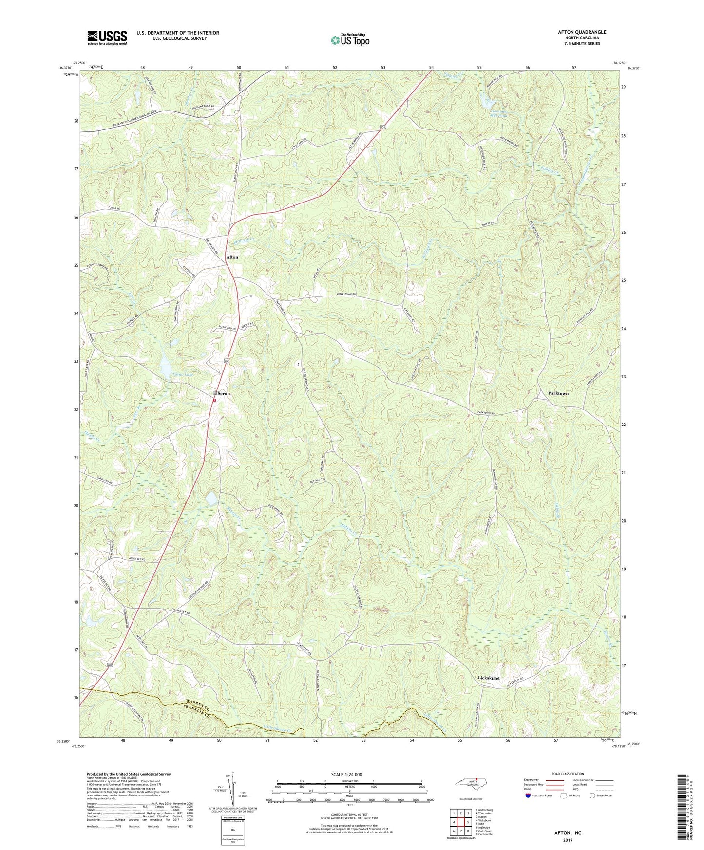
2019 topographic map quadrangle Afton in the state of North Carolina. Scale: 1:24000. Based on the newly updated USGS 7.5' US Topo map series, this map is in the following counties: Warren, Franklin. The map contains contour data, water features, and other items you are used to seeing on USGS maps, but also has updated roads and other features. This is the next generation of topographic maps. Printed on high-quality waterproof paper with UV fade-resistant inks.
Quads adjacent to this one:
West: Vicksboro
Northwest: Middleburg
North: Warrenton
Northeast: Macon
East: Inez
Southeast: Centerville
South: Gold Sand
Southwest: Ingleside
Contains the following named places: Afton, Afton - Elberon Volunteer Fire Department, Baltimore Church, Bridle Creek, Bute County, Cabin Branch, Coley Springs Church, Elberon, Greenwood School, Hammes Mill Pond, Hammes Mill Pond Dam, Hecks Grove School, Jerusalem Church, Jones Springs, Jordens Chapel, Lake Largo Dam, Largo Lake, Lees Branch, Lickskillet, Parktown, Possumquarter Creek, Providence Church, Richneck Creek, South Warren School, Spring Green Church, Stony Lawn Church, Sulphur Springs Church, Township of Shocco, Warren Academy, ZIP Code: 27589