MyTopo
Ingleside North Carolina US Topo Map
Couldn't load pickup availability
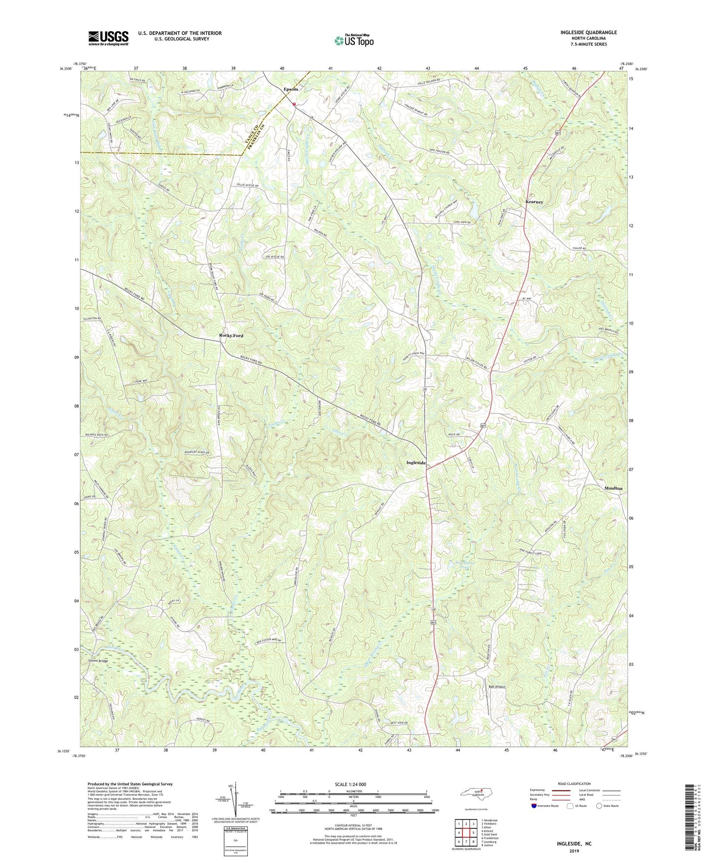
2022 topographic map quadrangle Ingleside in the state of North Carolina. Scale: 1:24000. Based on the newly updated USGS 7.5' US Topo map series, this map is in the following counties: Franklin, Vance. The map contains contour data, water features, and other items you are used to seeing on USGS maps, but also has updated roads and other features. This is the next generation of topographic maps. Printed on high-quality waterproof paper with UV fade-resistant inks.
Quads adjacent to this one:
West: Kittrell
Northwest: Henderson
North: Vicksboro
Northeast: Afton
East: Gold Sand
Southeast: Justice
South: Louisburg
Southwest: Franklinton
This map covers the same area as the classic USGS quad with code o36078b3.
Contains the following named places: Ball Airport, Buffalo Creek, Corinth Church, Eaves Creek, Epsom, Epsom Elementary School, Epsom Fire and Rescue Department, Franklin Academy, Giles Creek, Gills Little Mill Creek, Haywood Church, Highland Chapel, Ingleside, Kearney, Lake View, Lake View Dam, Letha, Locust Grove Church, Lynch Creek, Mitchell Church, Moulton, New Bethel Church, Pine Grove Church, Rocky Ford, Rolling Chapel, Simms Bridge, Strickland Pond, Strickland Pond Dam, Tooles Creek, Township of Hayesville, Trinity Church