MyTopo
Vicksboro North Carolina US Topo Map
Couldn't load pickup availability
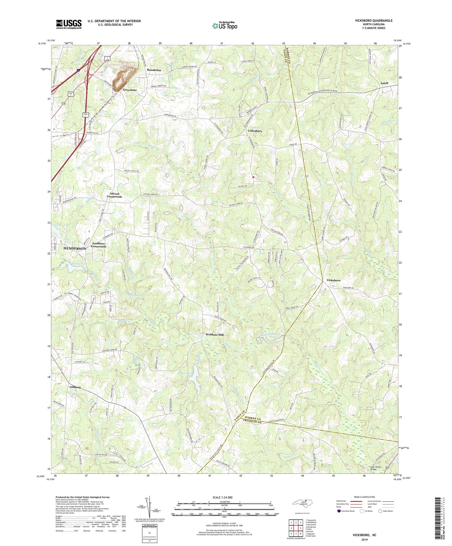
2022 topographic map quadrangle Vicksboro in the state of North Carolina. Scale: 1:24000. Based on the newly updated USGS 7.5' US Topo map series, this map is in the following counties: Vance, Warren, Franklin. The map contains contour data, water features, and other items you are used to seeing on USGS maps, but also has updated roads and other features. This is the next generation of topographic maps. Printed on high-quality waterproof paper with UV fade-resistant inks.
Quads adjacent to this one:
West: Henderson
Northwest: Townsville
North: Middleburg
Northeast: Warrenton
East: Afton
Southeast: Gold Sand
South: Ingleside
Southwest: Kittrell
This map covers the same area as the classic USGS quad with code o36078c3.
Contains the following named places: Adcock Crossroads, Axtell, Aycock School, Ayscues Pond, Ayscues Pond Dam, Brookston, Browns Church, Buzzard Branch, Carey Church, Carver School, Cattail Creek, Club Pond, Cokesbury, Cokesbury Fire Department, Dickies Creek, Dickies Grove Church, Ellis Pond, Ellis Pond Dam, Faulkner Crossroads, Fox Reservoir, Gillburg, Greystone, Greystone Quarry, Harringtons Pond, Harringtons Pond Dam, Hecks Grove Church, Henderson City Lake, Henderson City Lake Dam, Henderson Fire Tower, High Tower Bridge, Hughes Grove Church, Jones Chapel, Martin Creek, Mount Carmel United Methodist Church, Mount Olive Church, New Sandy Creek Church, Phipps Chapel, Pounder Branch, Roland Pond, Rowland Pond Dam, Rowlands Pond, Shatter Post Office, Shocco Church, Southerlands Pond, Southerlands Pond Dam, Thomas Chapel, Township of Sandy Creek, Vance Senior High School, Vaughn Branch, Vicksboro, Weaver Creek, Weldons Mill, Weldons Pond Dam, Young Memorial Church