MyTopo
Gold Sand North Carolina US Topo Map
Couldn't load pickup availability
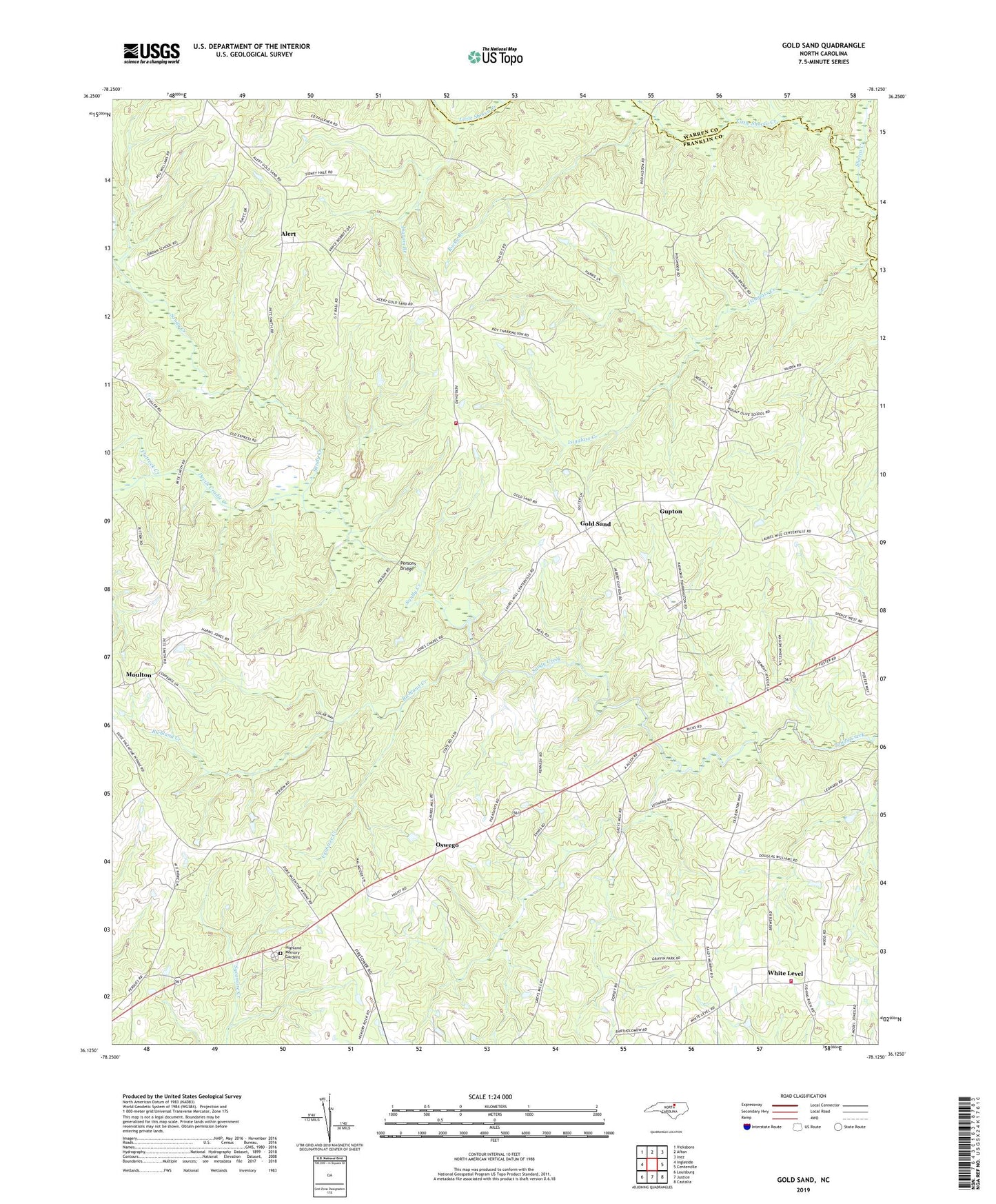
2022 topographic map quadrangle Gold Sand in the state of North Carolina. Scale: 1:24000. Based on the newly updated USGS 7.5' US Topo map series, this map is in the following counties: Franklin, Warren. The map contains contour data, water features, and other items you are used to seeing on USGS maps, but also has updated roads and other features. This is the next generation of topographic maps. Printed on high-quality waterproof paper with UV fade-resistant inks.
Quads adjacent to this one:
West: Ingleside
Northwest: Vicksboro
North: Afton
Northeast: Inez
East: Centerville
Southeast: Castalia
South: Justice
Southwest: Louisburg
This map covers the same area as the classic USGS quad with code o36078b2.
Contains the following named places: Alert, Best School, Crabtree Creek, Devils Cradle Creek, Flatrock Creek, Gold Sand, Gold Sand Middle School, Gold Sand Rural Fire Department Station 11, Gold Sand School, Gupton, Hickory Grove Church, Ingram Branch, Isinglass Creek, Jones Chapel, Lancaster Memorial Park, Laurel, Little Shocco Creek, Long Grove Church, Mount Gilead Church, Mount Zion Church, Mountain Grove Church, Oswego, Persons Bridge, Richland Creek, Rocky Branch, Sandy Creek Church, Schlosstown, Sukey Young Crossroads, Township of Sandy Creek, White Level, White Level Airfield, White Level Church, White Level Fire Department, White Level Volunteer Rescue Squad, WYFL-FM (Henderson)