MyTopo
Centerville North Carolina US Topo Map
Couldn't load pickup availability
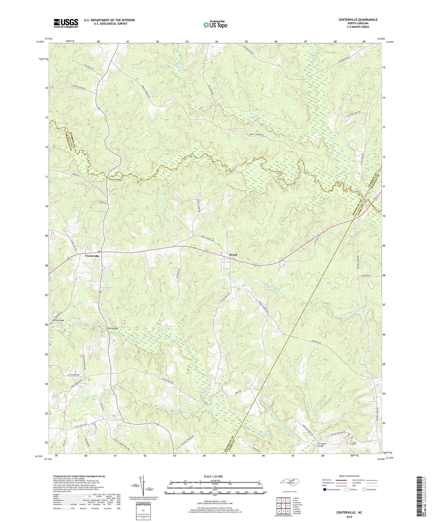
2022 topographic map quadrangle Centerville in the state of North Carolina. Scale: 1:24000. Based on the newly updated USGS 7.5' US Topo map series, this map is in the following counties: Franklin, Warren, Nash, Halifax. The map contains contour data, water features, and other items you are used to seeing on USGS maps, but also has updated roads and other features. This is the next generation of topographic maps. Printed on high-quality waterproof paper with UV fade-resistant inks.
Quads adjacent to this one:
West: Gold Sand
Northwest: Afton
North: Inez
Northeast: Hollister
East: Essex
Southeast: Red Oak
South: Castalia
Southwest: Justice
This map covers the same area as the classic USGS quad with code o36078b1.
Contains the following named places: Argo, Arrington Bridge, Bass Bridge, Boling Bridge, Centerville, Centerville Census Designated Place, Centerville Volunteer Fire and Rescue Department, Community Church, Deer Branch, Fork Chapel, Gilfield Church, Harpers Store, Harrison School, Hogpen Branch, Maple Branch, Mayflower School, Mount Hebron Church, Perry Chapel, Ransoms Bridge, Red Bud Church, Serepta Church, Shelley Branch, Shocco Bridge, Shocco Creek, Town of Centerville, Township of Gold Mine, Wood, Young School