MyTopo
Altamont Utah US Topo Map
Couldn't load pickup availability
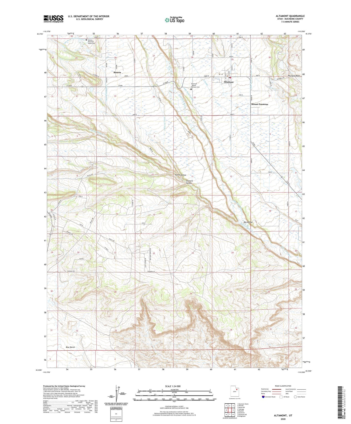
2020 topographic map quadrangle Altamont in the state of Utah. Scale: 1:24000. Based on the newly updated USGS 7.5' US Topo map series, this map is in the following counties: Duchesne. The map contains contour data, water features, and other items you are used to seeing on USGS maps, but also has updated roads and other features. This is the next generation of topographic maps. Printed on high-quality waterproof paper with UV fade-resistant inks.
Quads adjacent to this one:
West: Talmage
Northwest: Mountain Home
North: Altonah
Northeast: Neola NW
East: Bluebell
Southeast: Bridgeland
South: Duchesne NE
Southwest: Duchesne
Contains the following named places: Altamont, Altamont - Mount Emmons Cemetery, Altamont Elementary School, Altamont Fire Department, Altamont High School, Altamont Post Office, Big Hollow, Boneta, Boneta - Mountain Home Cemetery, C Canal, Clement Hollow, Kuntz Hollow, Lake Fork Canal, Lake Fork Extension Canal, Mount Emmons, P X Ranch, Pigeon Water Creek, South Boneta Canal, The Church of Jesus Christ of Latter Day Saints, Town of Altamont, ZIP Code: 84001