MyTopo
Bridgeland Utah US Topo Map
Couldn't load pickup availability
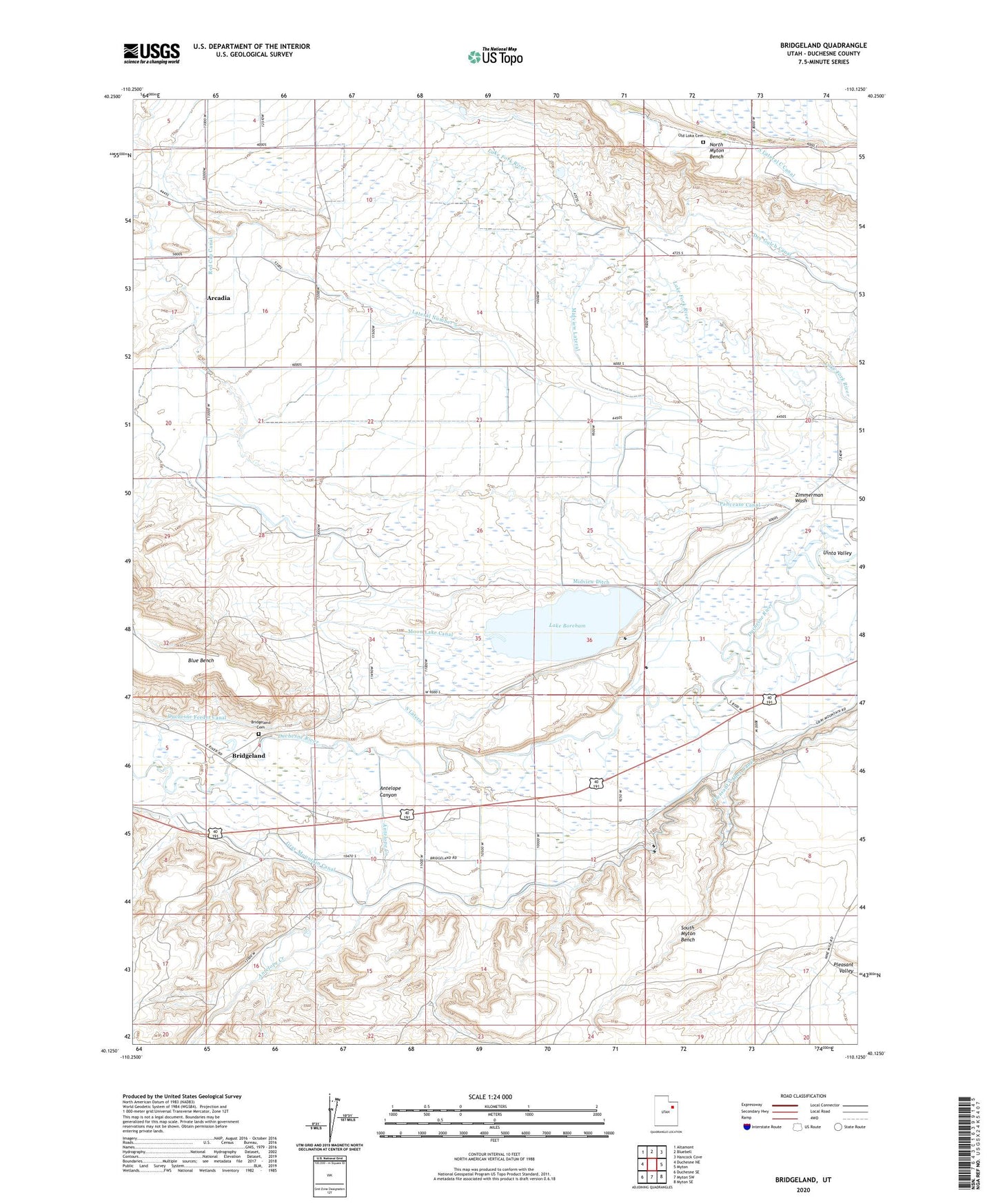
2023 topographic map quadrangle Bridgeland in the state of Utah. Scale: 1:24000. Based on the newly updated USGS 7.5' US Topo map series, this map is in the following counties: Duchesne. The map contains contour data, water features, and other items you are used to seeing on USGS maps, but also has updated roads and other features. This is the next generation of topographic maps. Printed on high-quality waterproof paper with UV fade-resistant inks.
Quads adjacent to this one:
West: Duchesne NE
Northwest: Altamont
North: Bluebell
Northeast: Hancock Cove
East: Myton
Southeast: Myton SE
South: Myton SW
Southwest: Duchesne SE
This map covers the same area as the classic USGS quad with code o40110b2.
Contains the following named places: Antelope Canyon, Antelope Creek, Arcadia, Boreham Memorial, Bridgeland, Bridgeland Cemetery, Duchesne Feeder Canal, Gray Mountain Canal, Jehovahs Witnesses Arcadia Congregation, Lake Boreham, Lateral Number 5, Midview Ditch, Midview Lateral, Moon Lake Canal, Old Loka Cemetery, Pahcease Canal, Red Cap Canal, Sheep Camp Corral, South Lateral, The Church of Jesus Christ of Latter Day Saints, Zimmerman Wash