MyTopo
Bluebell Utah US Topo Map
Couldn't load pickup availability
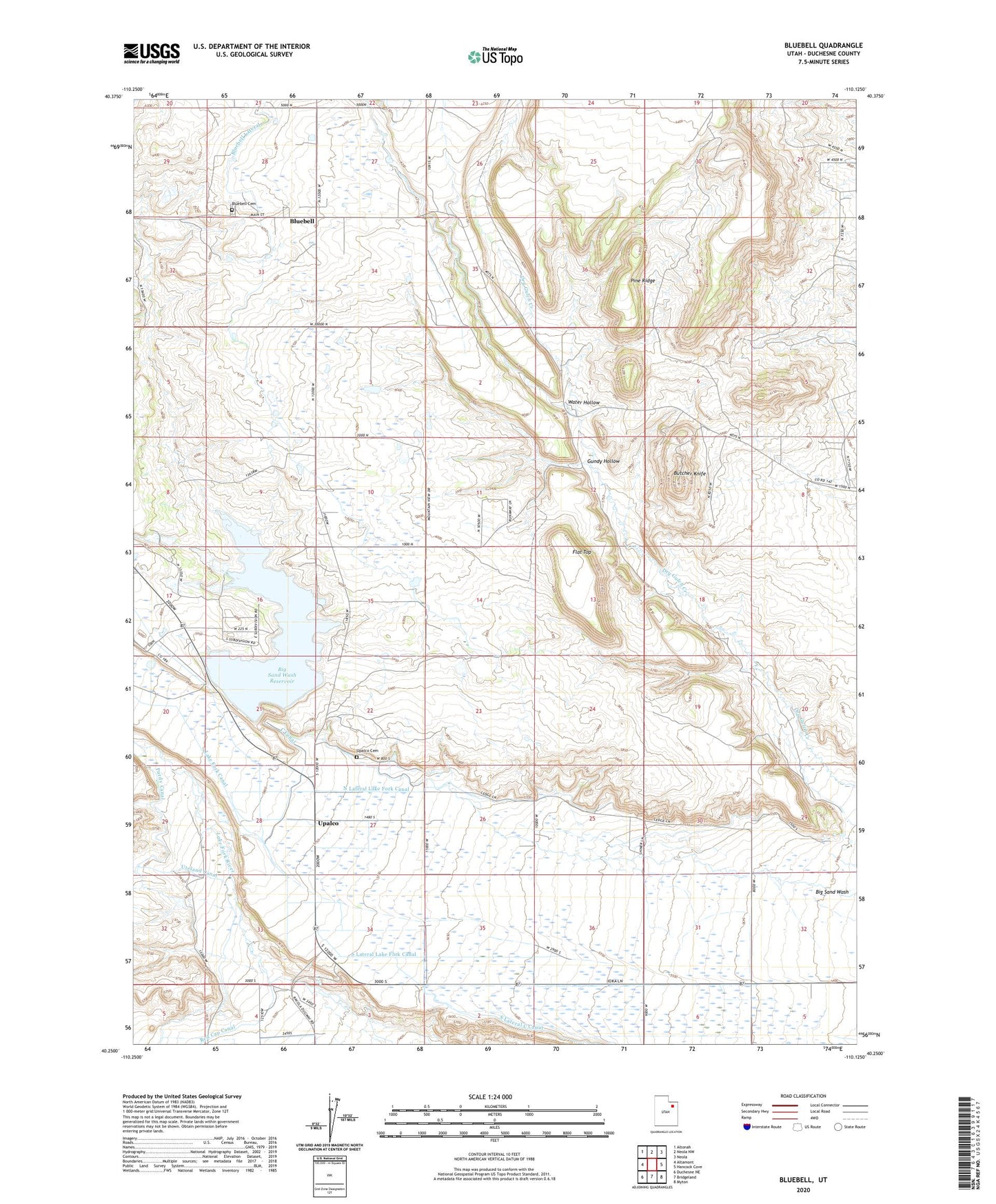
2023 topographic map quadrangle Bluebell in the state of Utah. Scale: 1:24000. Based on the newly updated USGS 7.5' US Topo map series, this map is in the following counties: Duchesne. The map contains contour data, water features, and other items you are used to seeing on USGS maps, but also has updated roads and other features. This is the next generation of topographic maps. Printed on high-quality waterproof paper with UV fade-resistant inks.
Quads adjacent to this one:
West: Altamont
Northwest: Altonah
North: Neola NW
Northeast: Neola
East: Hancock Cove
Southeast: Myton
South: Bridgeland
Southwest: Duchesne NE
This map covers the same area as the classic USGS quad with code o40110c2.
Contains the following named places: Big Sand Lake Campground, Big Sand State Park, Big Sand Wash Dam, Big Sand Wash Reservoir, Bluebell, Bluebell Cemetery, Bluebell Census Designated Place, Bluebell Lateral, Butcher Knife, Flat Top, Gundy Hollow, North Lateral Lake Fork Canal, Pine Ridge, Purdy Canal, Roosevelt Division, South Lateral Lake Fork Canal, Upalco, Upalco Cemetery, Uteland Canal, Water Hollow, ZIP Code: 84007