MyTopo
Altonah Utah US Topo Map
Couldn't load pickup availability
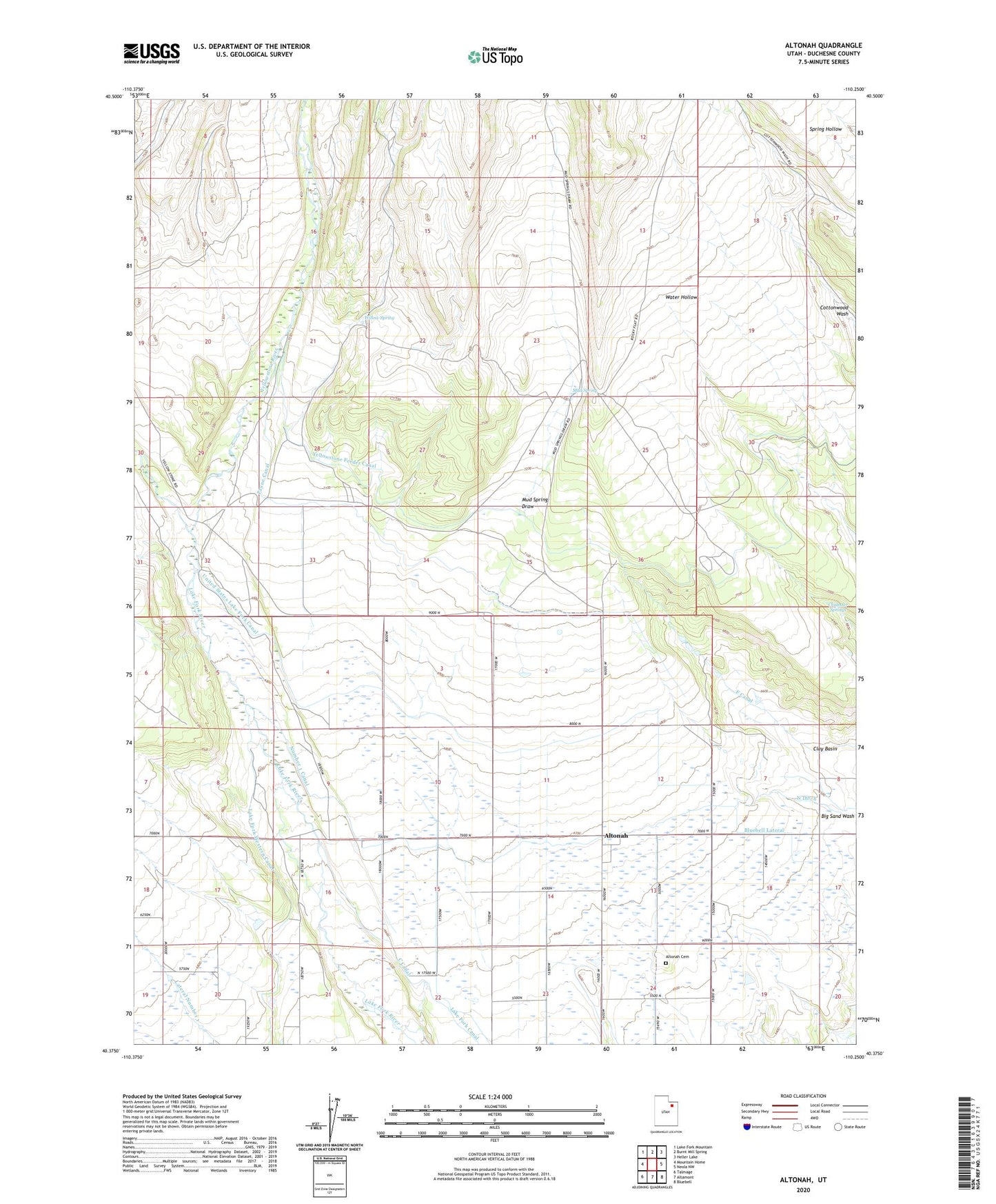
2023 topographic map quadrangle Altonah in the state of Utah. Scale: 1:24000. Based on the newly updated USGS 7.5' US Topo map series, this map is in the following counties: Duchesne. The map contains contour data, water features, and other items you are used to seeing on USGS maps, but also has updated roads and other features. This is the next generation of topographic maps. Printed on high-quality waterproof paper with UV fade-resistant inks.
Quads adjacent to this one:
West: Mountain Home
Northwest: Lake Fork Mountain
North: Burnt Mill Spring
Northeast: Heller Lake
East: Neola NW
Southeast: Bluebell
South: Altamont
Southwest: Talmage
This map covers the same area as the classic USGS quad with code o40110d3.
Contains the following named places: Altonah, Altonah Cemetery, Chidester Springs, Lake Fork Western Canal, Mud Spring, Mud Spring Draw, Number 1 Canal, Payne Canal, United States Lake Fork Canal, Willow Spring, Yellowstone River, ZIP Code: 84002