MyTopo
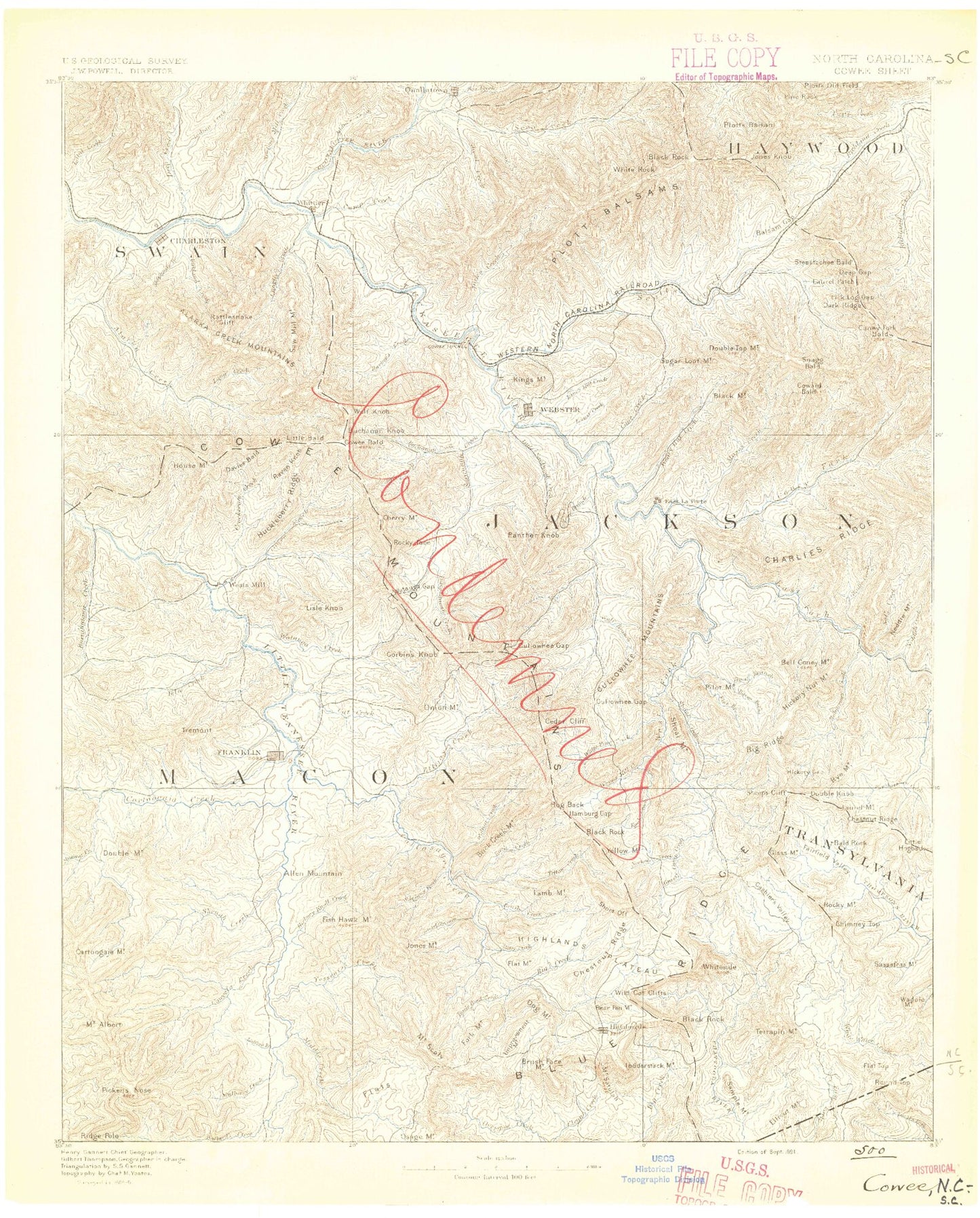
Historic 1891 Cowee North Carolina 30'x30' Topo Map
Couldn't load pickup availability
Historical USGS topographic map of Cowee in the state of North Carolina. Scale: 1:125000. Print size: 17" x 24"
This map was published in 1891 and is in the following counties: Clay, Haywood, Jackson, Macon, Oconee, Rabun, Swain, Transylvania.
The map contains contour lines, roads, rivers, towns, streams, and lakes. Printed on high-quality waterproof paper with UV fade-resistant inks.
Contains the following named places: Abbs Creek, Allens Branch, Ash Branch, Bald Cliff, Bald Gap, Bearwallow Ridge, Beechflat Creek, Beta, Big Branch, Blackrock Creek, Blackrock Ridge, Blake Branch, Blanton Branch, Bryson Branch, Buckeye Gap, Buff Creek, Bumgarner Branch, Campbell Lick, Cane Creek, Caney Fork, Carver Ridge, Chastine Creek, Cherry Gap, Cherry Gap Branch, Cherry Orchard Branch, Chestnut Gap, Chestnut Knob, Cliffside Lake, Cold Spring Gap, Coppermine Creek, Coward Bald, Cox Cove, Craig Creek, Cranberry Creek, Cranberry Ridge, Cranberry Ridge Overlook, Deep Gap, Deep Gap, Dicks Gap, Dills Cove, Dills Creek, Dryland Laurel Branch, East Fork Jenkins Creek, East Fork Moses Creek, Fed Cove, Fed Cove Overlook, Fern Mountain, Firescald Ridge, Fisher Creek, Flat Gap, Flint Spring Gap, Frady Creek, Gooseberry Ridge, Green Mountain, Gribble Gap, Hall, Hampton Lake, Hawkins Knob, Henry Creek, Henson Ridge, Higdon Branch, Hooper Knob, Hornbuckle Creek, Hornbuckle Valley Overlook, Hunter Jim Creek, Indian Camp Branch, Indian Camp Gap, Indian Creek, Jackie Spring Gap, Jeff Creek, Jenkins Creek, Jenny Knob, Joe Mountain, John Brown Branch, Johns Creek, Judaculla Ridge, Judaculla Rock, Kitchen Branch, Little Mill Creek, Little Savannah Creek, Locust Creek, Long Branch, Lost Cove, Lost Knob, Mayapple Gap, Middle Ridge, Milksick Ridge, Mill Creek, Mill Creek, Monteith Branch, Monteith Cove, Moses Creek, Narrows Cove Branch, Open Branch, Out-Off Ridge Overlook, Parker Branch, Parker Gap, Parker Knob, Parris Branch, Polecat Branch, Polly Middleton Gap, Press Cove, Rich Mountain Branch, Rich Mountain Gap, Rocky Face Branch, Rocky Face Ridge, Rocky Knob Ridge, Rough Branch, Rough Branch, Sam Queen Gap, Sapphire Lake, Sassafras Gap, Sheep Knob, Shut-in Creek, Shut-In Gap, Snaggy Bald, Soapstone Creek, Soapstone Gap, Soco Falls, Soco Gap, Soco Gap Parking Area, Sugar Creek, Sugar Creek Gap, Sugar Creek Ridge, Sugarloaf Mountain, Sugarloaf Ridge, Sylva, Sylva Reservoir, Thunderstruck Ridge, Thunderstruck Ridge Overlook, Tuckasegee, Washington Creek, Waterrock Knob, Waterrock Knob Overlook, Wayehutta Creek, Webster Creek, West Fork Jenkins Creek, West Fork Moses Creek, Whiterock Ridge, Wolfpen Gap, Wolfpen Gap, Woods Branch, Yellow Bird Branch, Yellow Face, Yellow-Face Overlook, Hogback Lake, Fairfield Lake, Cedar Cliff Dam, Frady Cove Dam, Frady Cove Lake, McGuire Lake Dam, McGuire Lake, Hodge Dam, Hodge Lake, Jackson Plaza, Sylva Plaza, Blackrock Mountain, Cope Creek, Ochre Hill Creek, Jackson County, Swain County, Fowler Balsam Mountain, Nantahala Game Lands, Abes Creek, Adams Creek, Air Ridge, Alarka Mountains, Allen Branch, Allen Creek, Allen Mountain, Allison Creek, Allison Lake, Ammons Branch, Ammons Branch, Ammons Branch, Anderson Branch, Andy Gap, Arnold Branch, Ash Flat Branch, Bad Branch, Bald Rock Mountain, Baldwin Cove, Ball Creek, Balsam Gap, Balsam Ridge, Barkers Creek, Bart Cove, Bates Branch, Bates Gap, Bates Ridge, Battle Branch, Battle Branch, Battle Cove, Battle Creek, Bear Creek, Bear Creek Ridge, Bear Mountain Gap, Bearmeat Branch, Bearpen Branch, Bearpen Branch, Bearpen Branch, Bearpen Gap, Bearwallow Creek, Beasley Creek, Beasley Gap, Beaugard Ridge, Beck Branch, Beetree Creek, Beetree Gap, Bell Coney Branch, Bennies Branch, Berry Creek, Berry Gap, Betsy Branch, Betsy Falls, Betts Branch, Betty Branch, Betty Creek Gap, Betty Gap, Big Branch, Big Branch, Big Cove, Big Cove, Big Creek, Big Hole, Big Laurel Branch, Big Norton Prong, Big Ridge, Big Witch Creek, Bigspring Gap, Billy Cabin Ridge, Billy Cove, Birch Ridge Creek, Bird Branch, Black Mountain, Black Mountain Branch


