A Legacy of Maps
Topographic maps have a rich history in the United States. The U.S. Geological Survey, founded in 1879, led the way in producing detailed topo maps of America.
Perhaps the most well-known map series is the 7.5-minute, 1:24,000 scale "quad" maps. Begun in 1947 and completed in 1992, this is the definitive topographic map series offering full coverage of the conterminous U.S. in excellent detail. On our site, you can find these as Classic Quads, later replaced by the US Topo map series.
But there were even older maps produced before this. The first map series aiming to systematically cover large areas of the country was the 30' x 30' 1:125,000 scale map series.
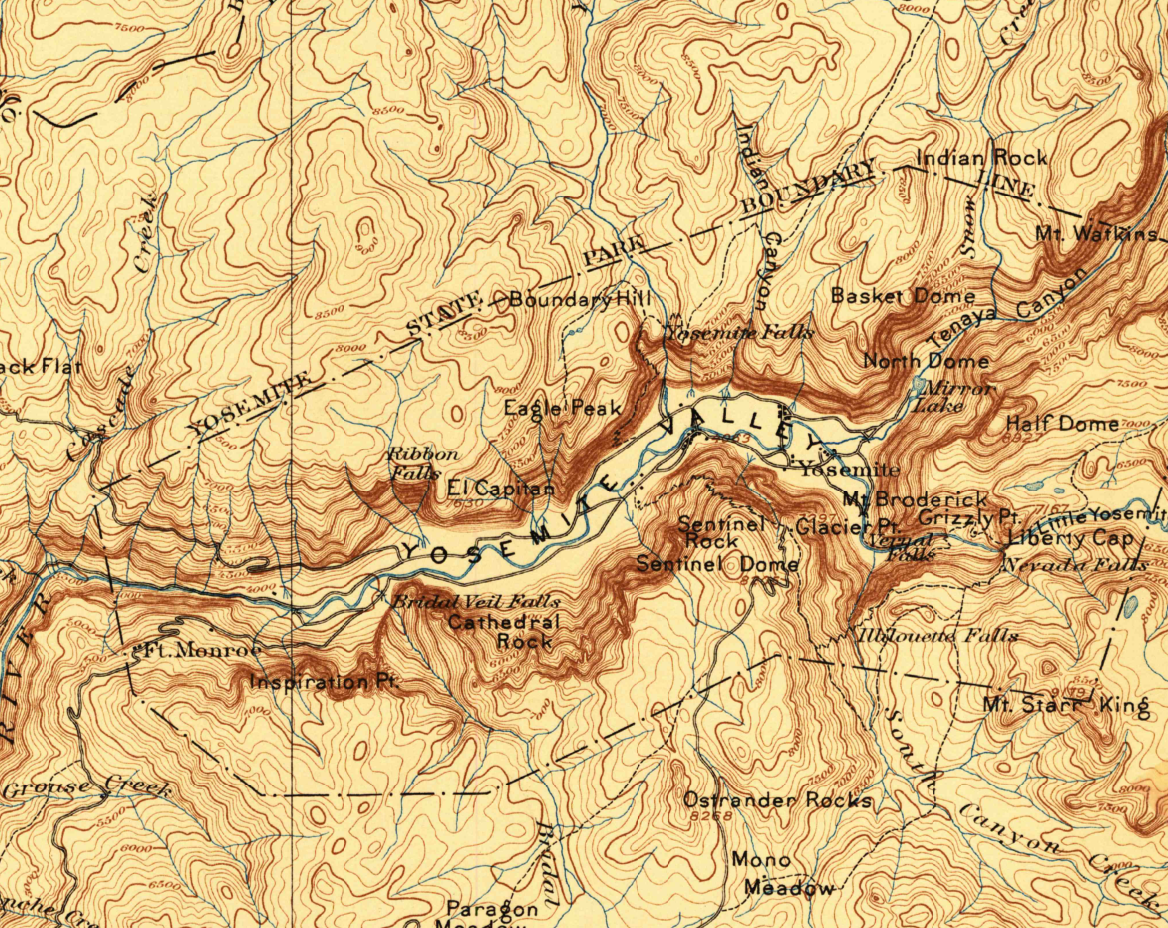
Yosemite Valley, 1897
An excellent example of early cartography in National Parks, this stunning map depicts the topography of Yosemite during the stagecoach touring days.
The 30x30 Minute Historic Series
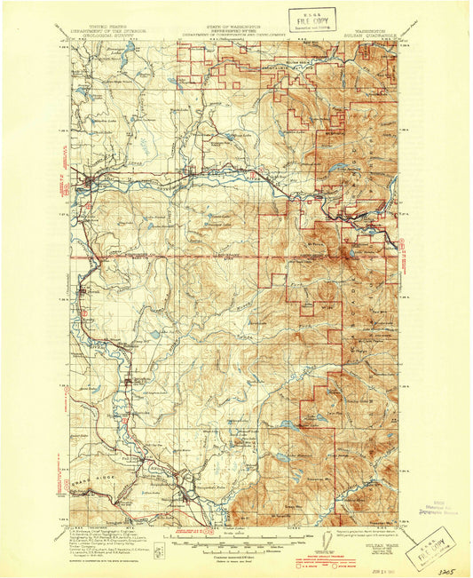
Created at a scale of 1:125,000, this map series was produced from 1883 to 1945. Each map covers 30 minutes (half of one degree of latitude and longitude) in each direction. This means they usually have 20-30 miles on a side. As a medium-scale map, it is detailed enough to get a good look at an area, but general enough to cover a wide area.
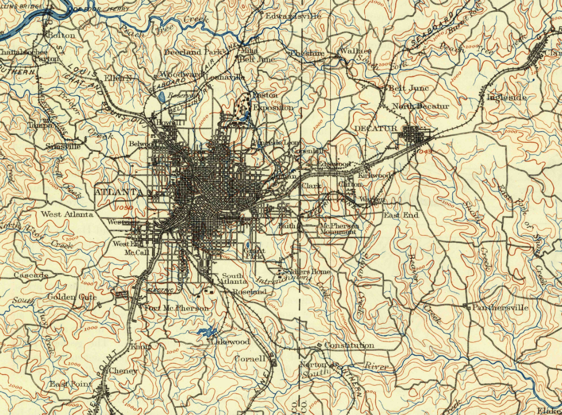
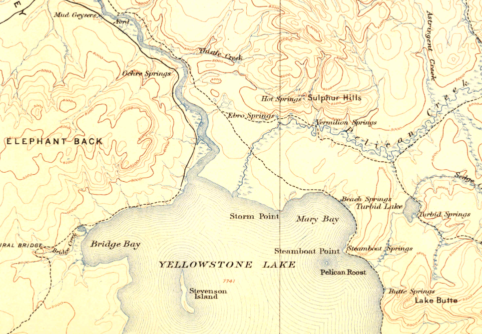
Taking a good look at these maps reveals some amazing details. You can find maps of Yellowstone and Yosemite create just a few years after they became National Parks. Cities like Atlanta, Denver, and Dallas appear as quaint towns before their population exploded.
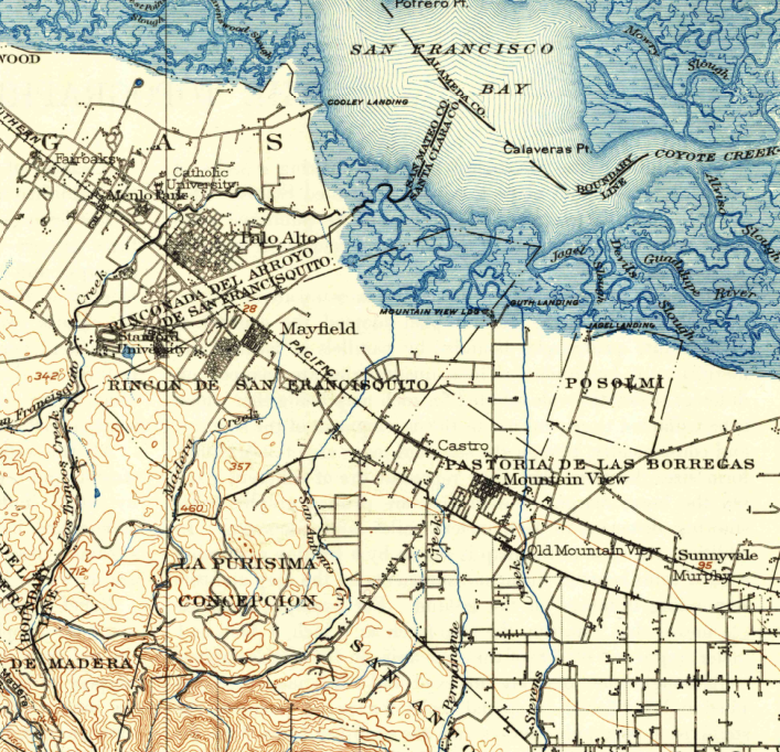
Palo Alto, 1902
Mountain View, Sunnyvale, and Palo Alto appear as small villages on this map, giving no clue that this would become the high-tech center of the country. San Francisco Bay is also visible north of Silicon Valley.
Finding your Historic Map
It's not just major cities and national parks included in these historic maps. There are over 1,600 of them, so there's a good chance the location you want is there. Here's how to find it.
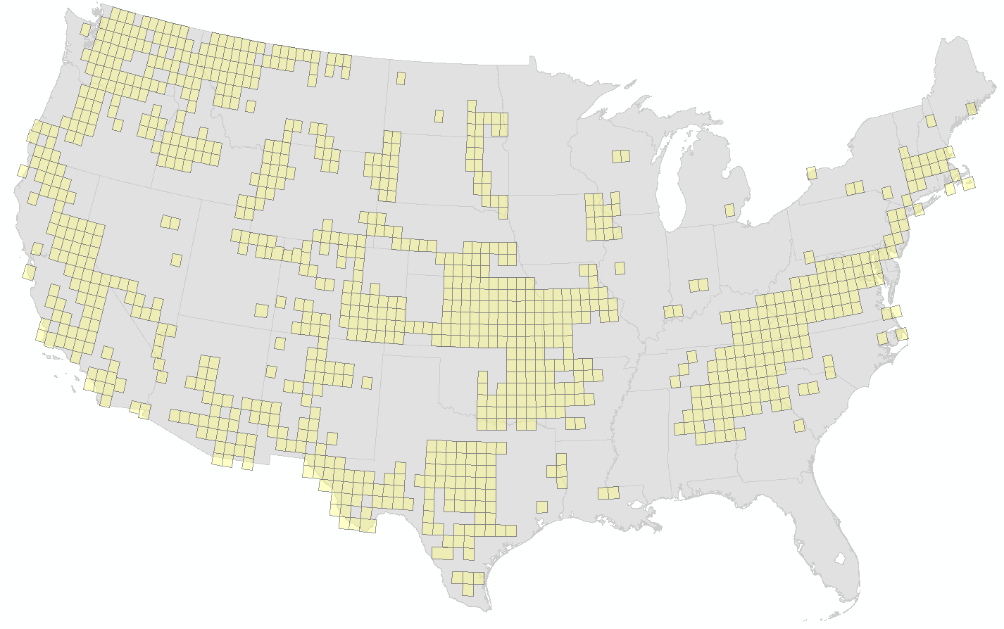
First, you can view a scrollable nationwide map, which shows coverage areas and map names. You can also do a text-based search on our site, and type in a place name along with the keyword 'historic', for example 'Atlanta historic'.
Finally, use our all-purpose map search to bring up your location. Look in the sidebar after you've brought up your area, and you will see historic maps if any are available:
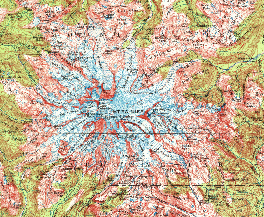
Mount Rainier, 1924
As beautiful as it is historic, this image of the iconic Cascades volcano is as vivid as it was a century ago
Cartographic Techniques
Early cartographers did not have the benefits of photogrammetry, digital data, LIDAR, and other techniques. It is fascinating to look at these historic maps with their hand-drawn contour lines and other features. It is interesting to compare the features on a historic map to modern topographic maps.
Of particular interest to historians and genealogists, these maps show original landscapes and early settlements. You can find what the area looked like before lakes, reservoirs, and highways went in. See old towns and locales that have long since vanished.
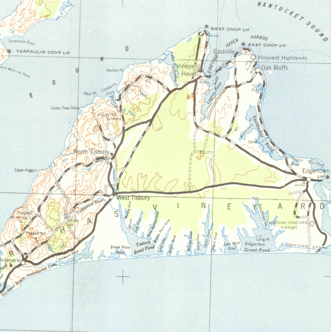
Martha's Vineyard, 1942
A nice-looking vintage map showing the famed island and the water around it
Historic Maps: Not Just for Historians
Here at MyTopo, we appreciate the cartographic talent that goes into these maps, as well as their aesthetic value. These maps have a classic look, with many scans yellowed from age. Maps of locations you care about are great for decorating your space.
We produce beautiful large-format prints of historic maps on waterproof, tearproof paper, perfect for framing and hanging.
Our Most Viewed Historic Maps
View all-
Historic 1905 Penobscot Bay Maine 30'x30' Topo Map
Regular price $21.95Regular priceUnit price per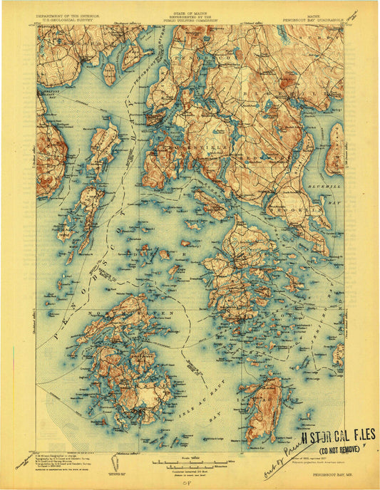
-
Historic 1902 Santa Cruz California 30'x30' Topo Map
Regular price $21.95Regular priceUnit price per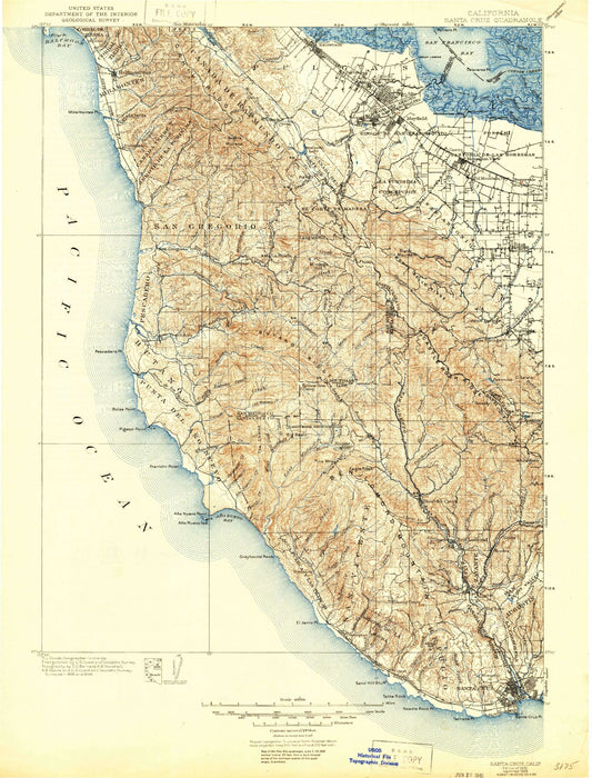
-
Historic 1942 Leadville Colorado 30'x30' Topo Map
Regular price $21.95Regular priceUnit price per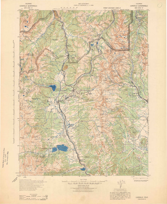
-
Historic 1923 Sultan Washington 30'x30' Topo Map
Regular price $21.95Regular priceUnit price per