MyTopo
Classic USGS Dugas Arizona 7.5'x7.5' Topo Map
Couldn't load pickup availability
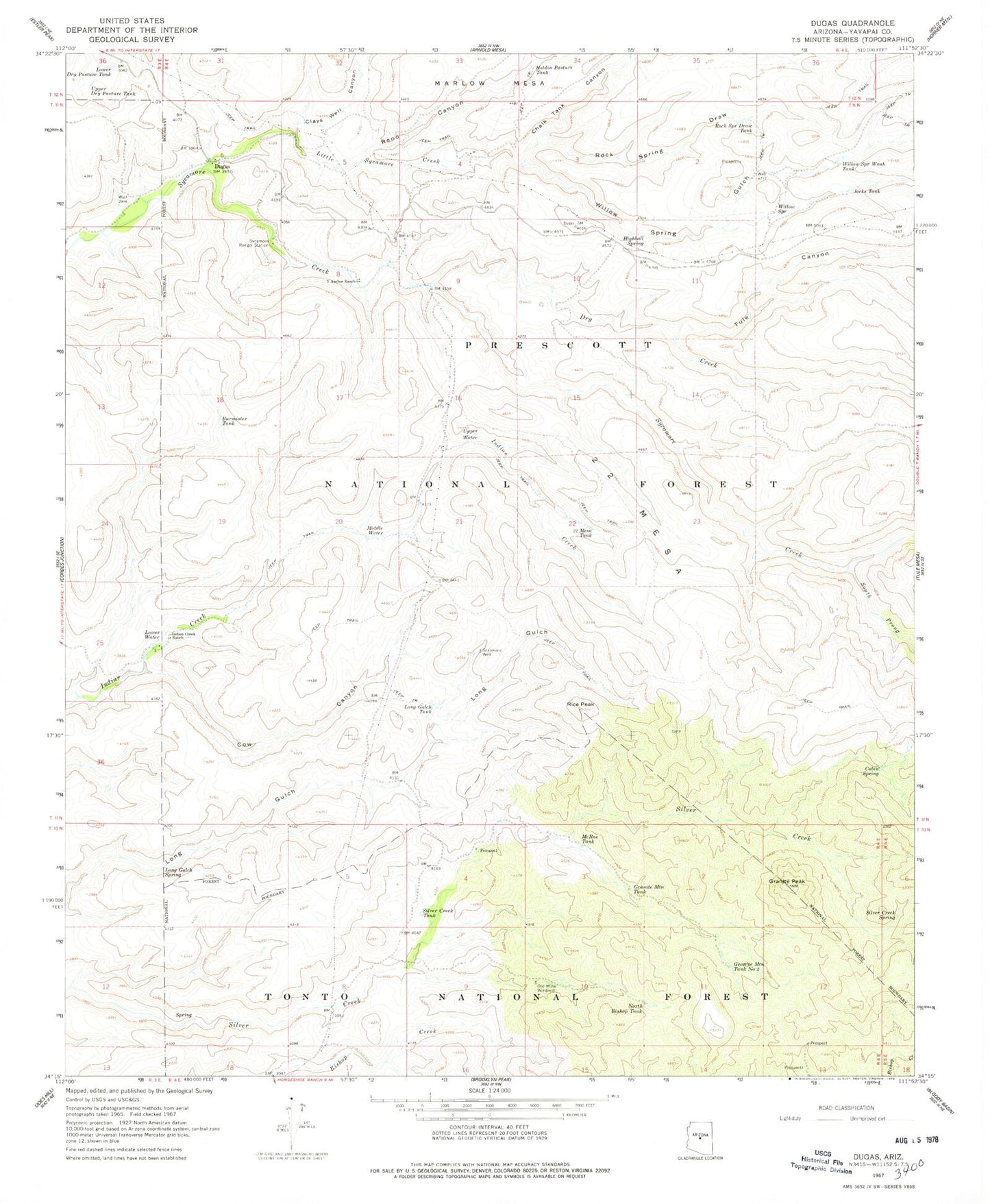
Historical USGS topographic quad map of Dugas in the state of Arizona. Typical map scale is 1:24,000, but may vary for certain years, if available. Print size: 24" x 27"
This quadrangle is in the following counties: Yavapai.
The map contains contour lines, roads, rivers, towns, and lakes. Printed on high-quality waterproof paper with UV fade-resistant inks, and shipped rolled.
Contains the following named places: Blue Rock Tank, Burmister Tank, Cabin Spring, Chalk Tank Canyon, Clays Well Canyon, Cow Canyon, Dry Creek, Dugas, Granite Mountain Tank, Granite Mountain Tank Number Two, Granite Peak, Grapevine Well, Highball Spring, Holdin Pasture Tank, Indian Creek Ranch, Jacks Tank, Little Sycamore Creek, Long Gulch Spring, Long Gulch Tank, Lower Dry Pasture Tank, Lower Water, Marlow Mesa, McRae Tank, Mesa Tank, Middle Water, North Bishop Tank, Old Mine Windmill, Reno Canyon, Rice Peak, Rock Spring Draw, Rock Spring Draw Tank, Silver Creek Spring, Silver Creek Tank, South Prong Sycamore Creek, Sycamore Ranger Station, T Anchor Ranch, Tule Canyon, 22 Mesa, Upper Dry Pasture Tank, Upper Water, Willow Spring, Willow Spring Gulch, Willow Spring Wash Tank, Dry Creek Spring Number One, Dry Creek Spring Number Two, Mud Spring, Pot Hole Tank, Rock Seep, South Tank, Sycamore Substation, Twenty Two Mesa Seep, Mesa Corral, Tule Creek Seep Number One, Dry Creek Water, Hidden Spring, Boundary Corral, Canyon Water, Rock Spring, Reno Spring, Graveyard Spring, Indian Creek Trail Spring, Long Gulch Corral, Blue Rock Dam, Tule Number Two Water, Indian Creek Pipeline Troughs, Cordes Lakes-Mayer Division