MyTopo
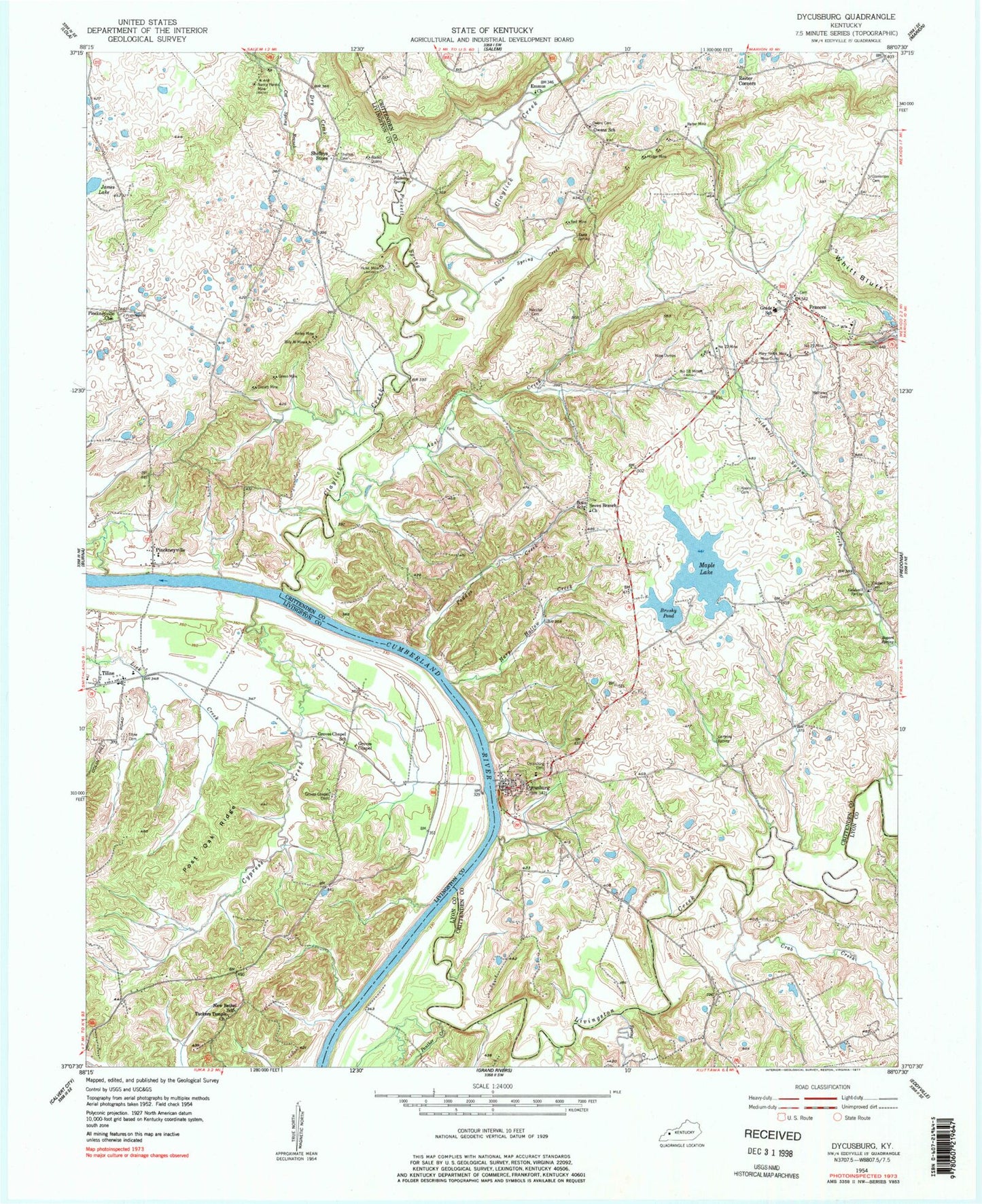
Classic USGS Dycusburg Kentucky 7.5'x7.5' Topo Map
Couldn't load pickup availability
Historical USGS topographic quad map of Dycusburg in the state of Kentucky. Map scale may vary for some years, but is generally around 1:24,000. Print size is approximately 24" x 27"
This quadrangle is in the following counties: Crittenden, Livingston, Lyon.
The map contains contour lines, roads, rivers, towns, and lakes. Printed on high-quality waterproof paper with UV fade-resistant inks, and shipped rolled.
Contains the following named places: Asbridge Cemetery, Axel Creek, Billy Al Mine, Boaz School, Bogard Spring, Brushy Pond, Caldwell Spring, Caldwell Spring Creek, Caldwell Springs Cemetery, Caldwell Springs Volunteer Fire Department, City of Dycusburg, Claylick Creek, Cox Spring Branch, Crab Creek, Cypress Creek, Doan Spring, Doan Spring Creek, Dry Creek, Dycusburg, Dycusburg Cemetery, Dycusburg Post Office, Emmus Church, Frances, Grasen Mine, Green Mine, Groves Chapel, Groves Chapel Cemetery, Groves Chapel School, Harp Hollow Creek, Hodge Mine, Hulet Mine, James Lake, Kelley Mine, Koon Cemetery, Larping Spring, Livingston Creek, Maple Lake, Mary Helen Mine, Mathews Cemetery, Nancy Hanks Mine, New Bethel School, Number 18 Mine, Number 21 Mine, Number 22 Mine, Owens Cemetery, Owens School, Paddys Creek, Panther Creek, Pinckneyville, Pinckneyville Cemetery, Pinckneyville Church, Post Oak Ridge, Puckett Spring, Puckett Spring Creek, Red Mine, Reiter Mine, Seven Branch Church, Shelbys Store, Spring Creek, Stevenson Cemetery, Tiline, Tiline Cemetery, Tuckers Temple Church, Wadell Quarry, Whitt Bluff, ZIP Code: 42037