
MyTopo
Classic USGS Elysian Minnesota 7.5'x7.5' Topo Map
Couldn't load pickup availability
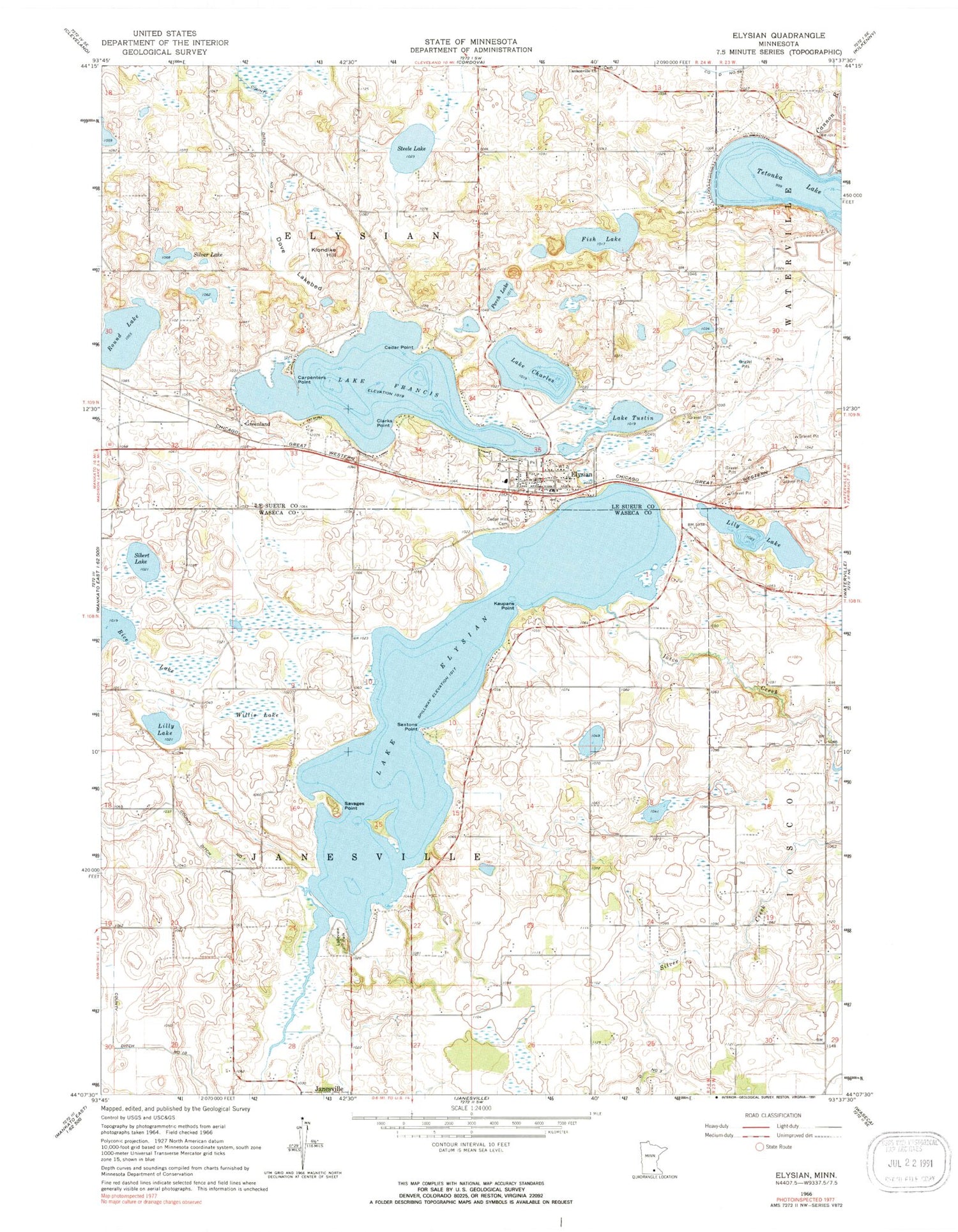
Historical USGS topographic quad map of Elysian in the state of Minnesota. Map scale may vary for some years, but is generally around 1:24,000. Print size is approximately 24" x 27"
This quadrangle is in the following counties: Le Sueur, Waseca.
The map contains contour lines, roads, rivers, towns, and lakes. Printed on high-quality waterproof paper with UV fade-resistant inks, and shipped rolled.
Contains the following named places: Assembly of God Church, Bethlehem Lutheran Church, Cannonville Cemetery, Cannonville Church, Carpenters Point, Cedar Hill Cemetery, Cedar Point, City of Elysian, Clarks Point, County Ditch Number Fiftynine, County Ditch Number Nine, County Ditch Number One, Dehn Family Cemetery, Dove Lakebed, Elysian, Elysian Elementary School, Elysian Fire Department, Elysian Lake, Elysian Lake Dam, Elysian Post Office, Elysian Public Library, Fish Lake, Galler's Airport, Greenland, Greenland Cemetery, Greenland Post Office, Iosco Creek, Irish Mountain Orchard, Kaupans Point, Klondike Hill, Lake Charles, Lake Elysian, Lake Francis, Lake Tustin, Lakeview Lake, Lakeview Park, Le Sueur County Museum, Lilly Lake, Lily Lake, Okaman Cemetery, Perch Lake, Prairie Ridge Golf Course, Rice Lake, Round Lake, Round Lake Cemetery, Saint Andrew's Church, Savages Point, Sextons Point, Sibert Lake, Silver Lake, Steele Lake, Township of Elysian, Township of Janesville, Willis Lake, ZIP Code: 56028


