MyTopo
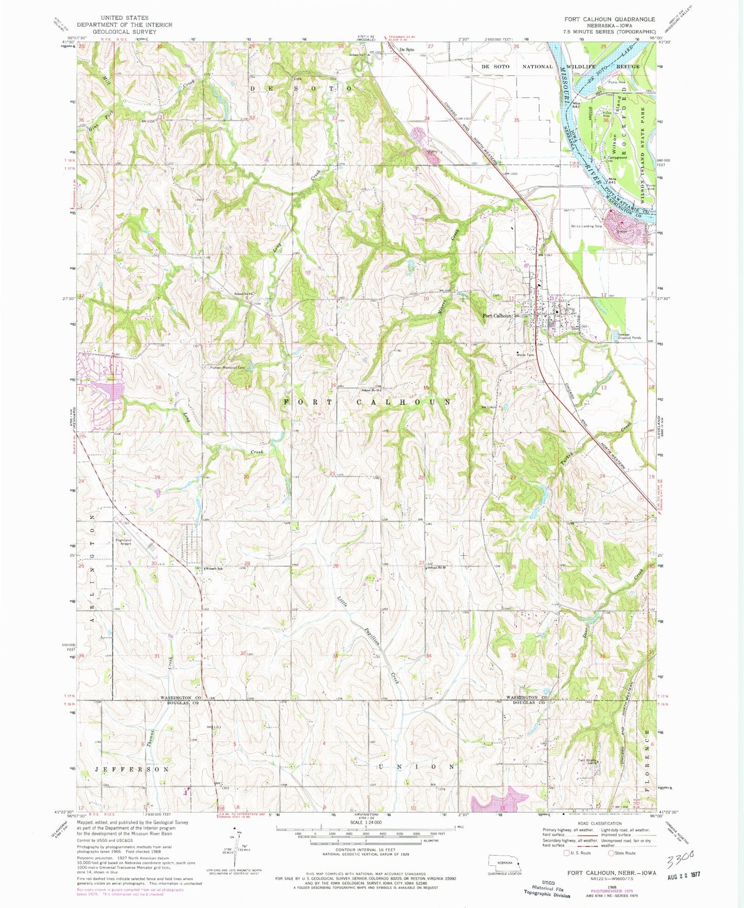
Classic USGS Fort Calhoun Nebraska 7.5'x7.5' Topo Map
Couldn't load pickup availability
Historical USGS topographic quad map of Fort Calhoun in the states of Nebraska, Iowa. Typical map scale is 1:24,000, but may vary for certain years, if available. Print size: 24" x 27"
This quadrangle is in the following counties: Douglas, Pottawattamie, Washington.
The map contains contour lines, roads, rivers, towns, and lakes. Printed on high-quality waterproof paper with UV fade-resistant inks, and shipped rolled.
Contains the following named places: De Soto, De Soto National Wildlife Refuge, Fort Calhoun, Hinz Fork, Mill Creek, Moores Creek, Pioneer Memorial Cemetery, Turkey Creek, Twin Brooks Camp, Wranch School, School Number 49, School Number 56, School Number 7, School Number 8, Blair Municipal Airport, Bil Lo Airport (historical), Township 1, Township 2, Snyder Dam, Snyder Reservoir, Nelson Detention Dam, Nelson Reservoir, Lake Arrowhead Dam, Lake Arrowhead Reservoir, Nelson South Dam, Nelson South Reservoir, Nixon Dam, Nixon Reservoir, Stratbucker Dam, Stratbucker Reservoir, Long Creek Dam, Long Creek Reservoir, Desoto (historical), DeSoto Post Office (historical), Fort Atkinson Trail, Calhoun (historical), Fort Atkinson Historical Marker, Fort Calhoun Post Office, Lewis and Clark Camp Site Historical Marker, Washington County Historical Museum, Fort Calhoun Volunteer Fire and Rescue Department, Fort Calhoun Clinic, Fort Calhoun Elementary School, Fort Calhoun High School, Presbyterian Church, Saint John the Baptist Catholic Church, Fort Calhoun Baptist Church, Fort Atkinson Post Office (historical), Fort Atkinson (historical), Harold W Anderson Visitor Center, Fort Atkinson State Historical Park, City of Fort Calhoun, Old Bones Creek, Wilson Island, Wilson Island State Park, DeSoto Lake