MyTopo
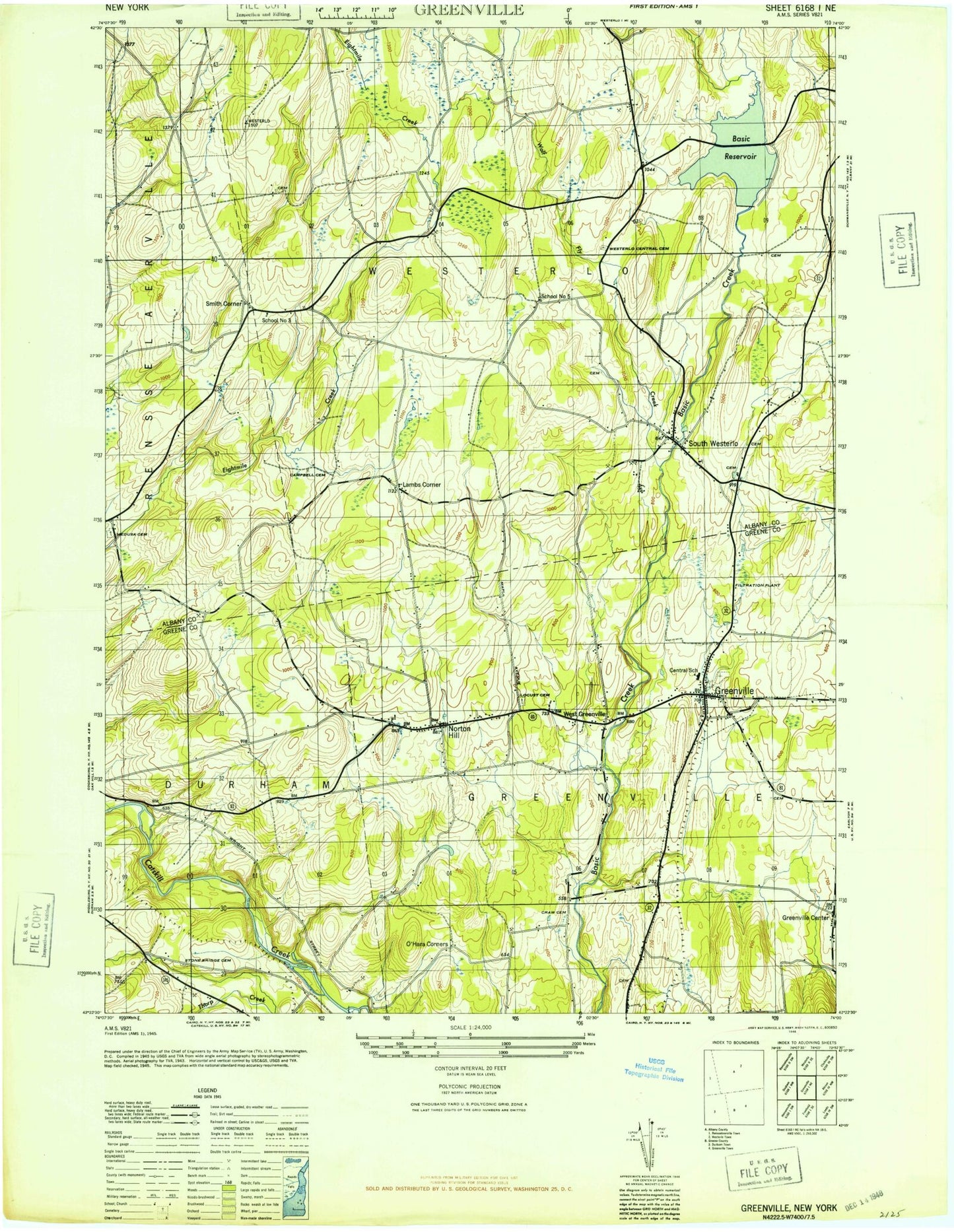
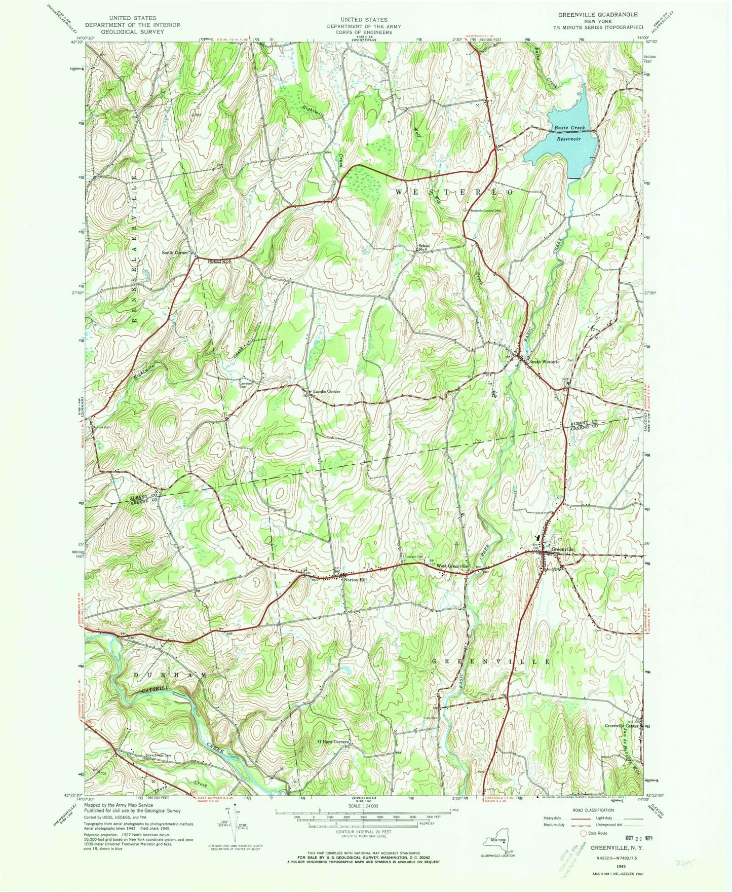
Classic USGS Greenville New York 7.5'x7.5' Topo Map
Couldn't load pickup availability
Historical USGS topographic quad map of Greenville in the state of New York. Map scale may vary for some years, but is generally around 1:24,000. Print size is approximately 24" x 27"
This quadrangle is in the following counties: Albany, Greene.
The map contains contour lines, roads, rivers, towns, and lakes. Printed on high-quality waterproof paper with UV fade-resistant inks, and shipped rolled.
Contains the following named places: Basic Creek Reservoir, Campbell Cemetery, Christ Episcopal Church, Craw Cemetery, Greenville, Greenville Census Designated Place, Greenville Center, Greenville Drive-In, Greenville High School, Greenville Middle School, Greenville Post Office, Greenville Public Library, Greenville Rural Cemetery, Greenville Volunteer Fire Company, Greenville-Rainbow Airport, Kingdom Hall of Jehovahs Witnesses, Lambs Corner, Locust Cemetery, Medusa Cemetery, Medusa Census Designated Place, Norton Hill, O'Hara Cemetery, O'Hara Corners, Saint John the Baptist Church, School Number 3, School Number 5, Scott M Ellis Elementary School, Smith Corner, South Westerlo, Stone Bridge Cemetery, Town of Greenville, Town of Westerlo, Tschinkel Farm, United Methodist Church of Greenville, West Greenville, Westerlo Central Cemetery, Westerlo Rescue Squad, Westerlo Volunteer Fire Company Station 2, Wolf Fly Creek, ZIP Codes: 12083, 12423