MyTopo
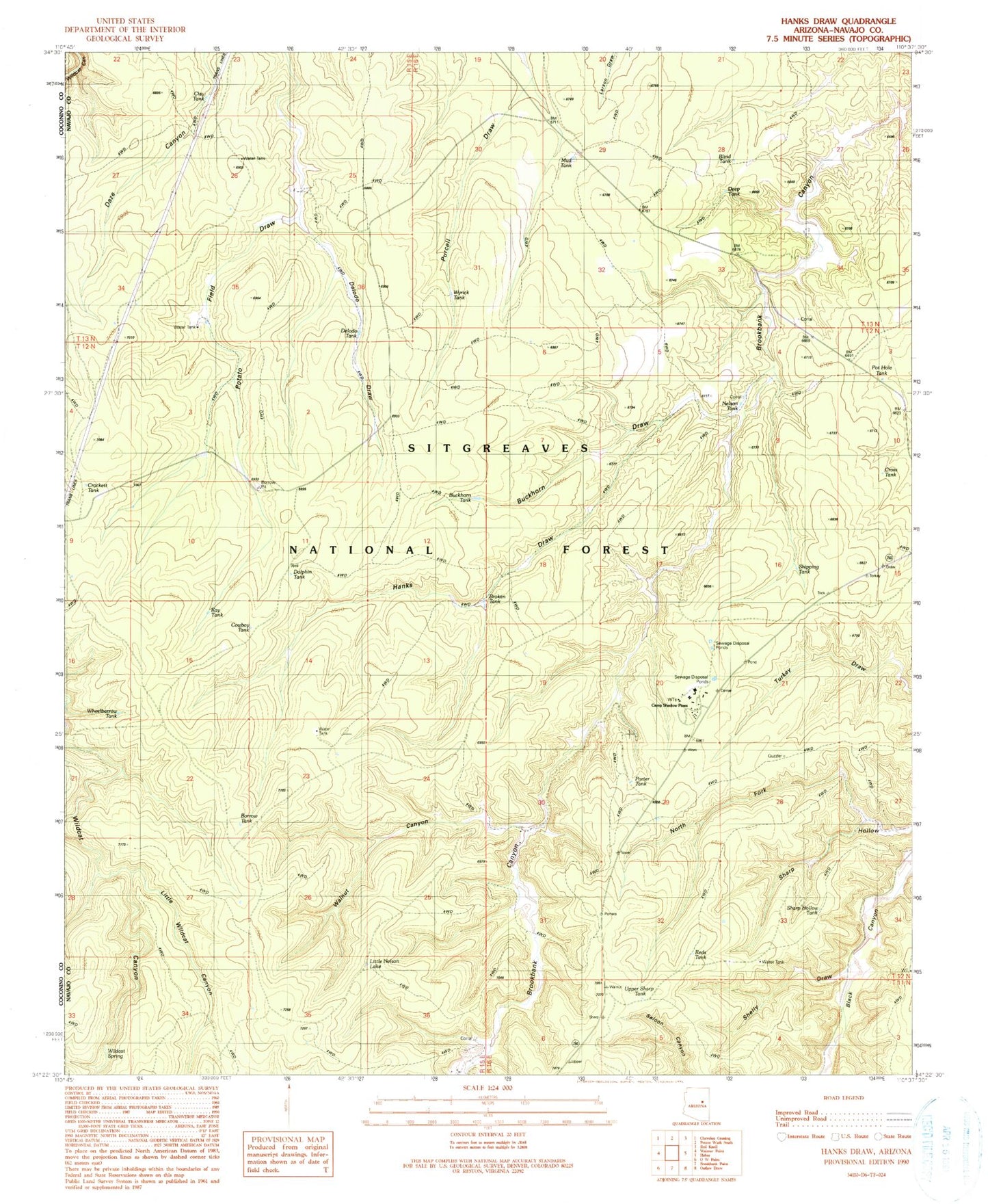
Classic USGS Hanks Draw Arizona 7.5'x7.5' Topo Map
Couldn't load pickup availability
Historical USGS topographic quad map of Hanks Draw in the state of Arizona. Map scale may vary for some years, but is generally around 1:24,000. Print size is approximately 24" x 27"
This quadrangle is in the following counties: Navajo.
The map contains contour lines, roads, rivers, towns, and lakes. Printed on high-quality waterproof paper with UV fade-resistant inks, and shipped rolled.
Contains the following named places: Black Mesa Ranger District, Blind Tank, Borrow Tank, Broken Tank, Buckhorn Draw, Buckhorn Tank, Clay Tank, Cowboy Tank, Crockett Tank, Cross Tank, Deep Tank, Delodo Draw, Delodo Tank, Dolphin Tank, East Fork Hanks Draw, Ellsworth Trick Tank, Hanks Draw, Hanks Trick Tank, Heber Job Corp Conservation Center, Heber Work Center, Heber YCC, Kay Tank, King Phillip Guzzler, King Phillip Trick Tank, Little Nelson Lake, Little Wildcat Canyon, Mud Tank, N-1 Canyon, Nelson Tanks, North Fork Sharp Hollow, Porter Tank, Pot Hole Tank, Reds Tank, Sharp Hollow Tank, Sharp Hollow Trick Tank, Shelley Draw, Shipping Tank, Sponseller Tank, Stermer Trick Tank, Upper Sharp Tank, Upper Turkey Tank, Walnut Canyon, Walnut Ranch, West Fork Hanks Draw, Wheelbarrow Tank, Wildcat Spring, Wyrick Ranch, Wyrick Tank