
MyTopo
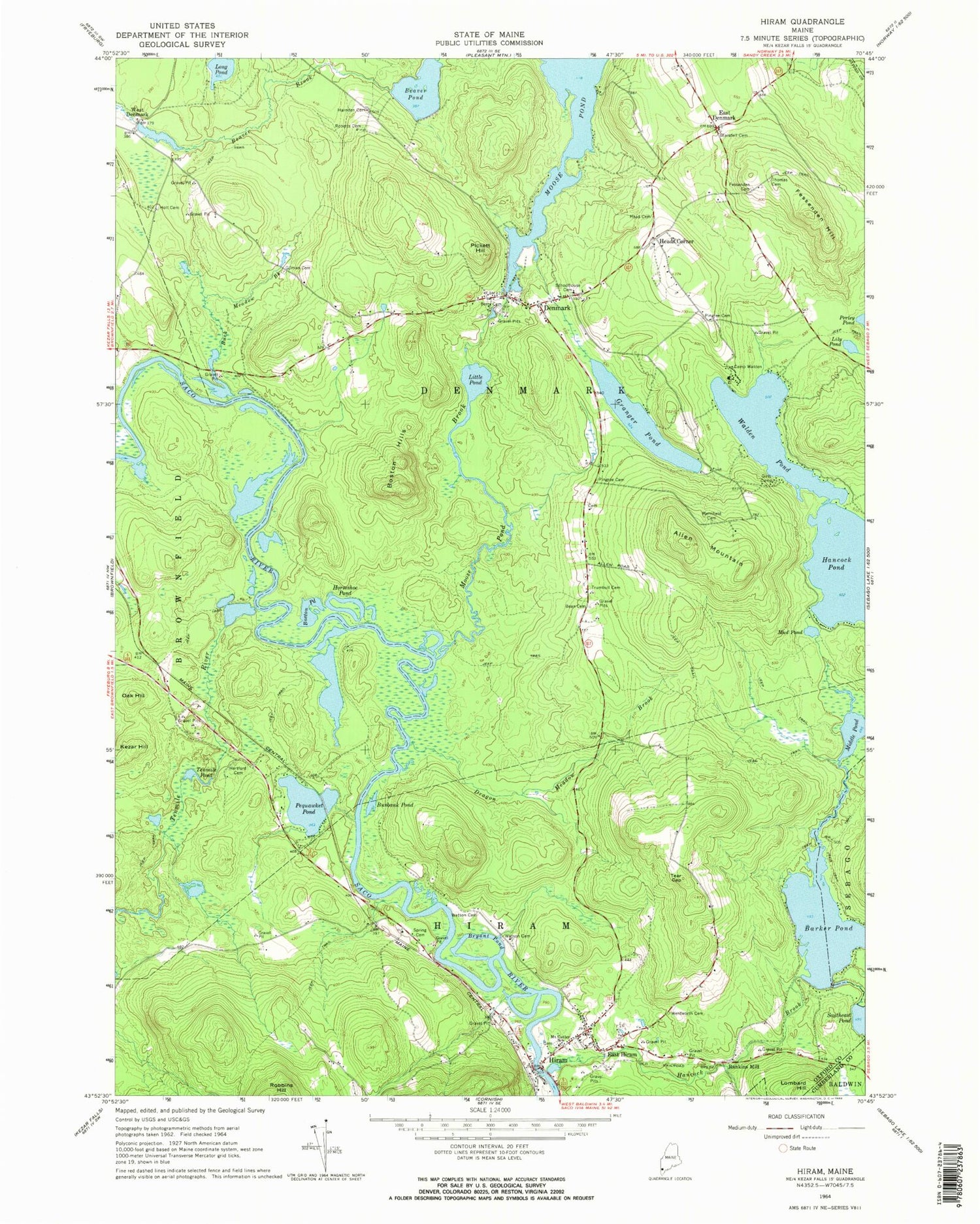
Classic USGS Hiram Maine 7.5'x7.5' Topo Map
Couldn't load pickup availability
Historical USGS topographic quad map of Hiram in the state of Maine. Typical map scale is 1:24,000, but may vary for certain years, if available. Print size: 24" x 27"
This quadrangle is in the following counties: Cumberland, Oxford.
The map contains contour lines, roads, rivers, towns, and lakes. Printed on high-quality waterproof paper with UV fade-resistant inks, and shipped rolled.
Contains the following named places: Allen Mountain, Barker Pond, Bean Cemetery, Beaver Pond, Berry Cemetery, Blaisdell Cemetery, Boston Hills, Boston Pond, Bryant Pond, Buck Meadow Brook, Burbank Pond, Burnt Meadow Brook, Camp Walden, Denmark, Dragon Meadow Brook, East Denmark, East Hiram, Fessenden and Ingalls Cemetery, Fessenden Hill, Gilman Cemetery, Granger Pond, Hancock Brook, Harnden Cemetery, Hartford Cemetery, Head Cemetery, Hiram, Holt Cemetery, Horseshoe Pond, Kezar Hill, Lily Pond, Little Pond, Lombard Hill, Merrifield Cemetery, Middle Pond, Moose Pond Brook, Hiram Elementary School, Mud Pond, Oak Hill, Pequawket Pond, Pickett Hill, Pingree Cemetery, Pingree and Berry Cemetery, Roberts Cemetery, Schoolhouse Cemetery, Spring Cemetery, Tear Cap, Tenmile Pond, Tenmile River, Thomas Cemetery, Trumbull Cemetery, Walden Pond, Watson Cemetery, Watson Cemetery, Wentworth Cemetery, Heads Corner, Rankins Mill, West Denmark, Town of Denmark, Hancock Pond Dam, Moose Pond Dam, Barker Pond Dam, Denmark Christian Church, Brownfield Denmark Elementary School, Denmark Post Office, Soldiers Memorial Library, Dyer's Landing, Denmark Fire Department, Hiram Volunteer Fire Department, Village Cemetery, Pleasant Ridge Cemetery, Denmark Public Library


