MyTopo
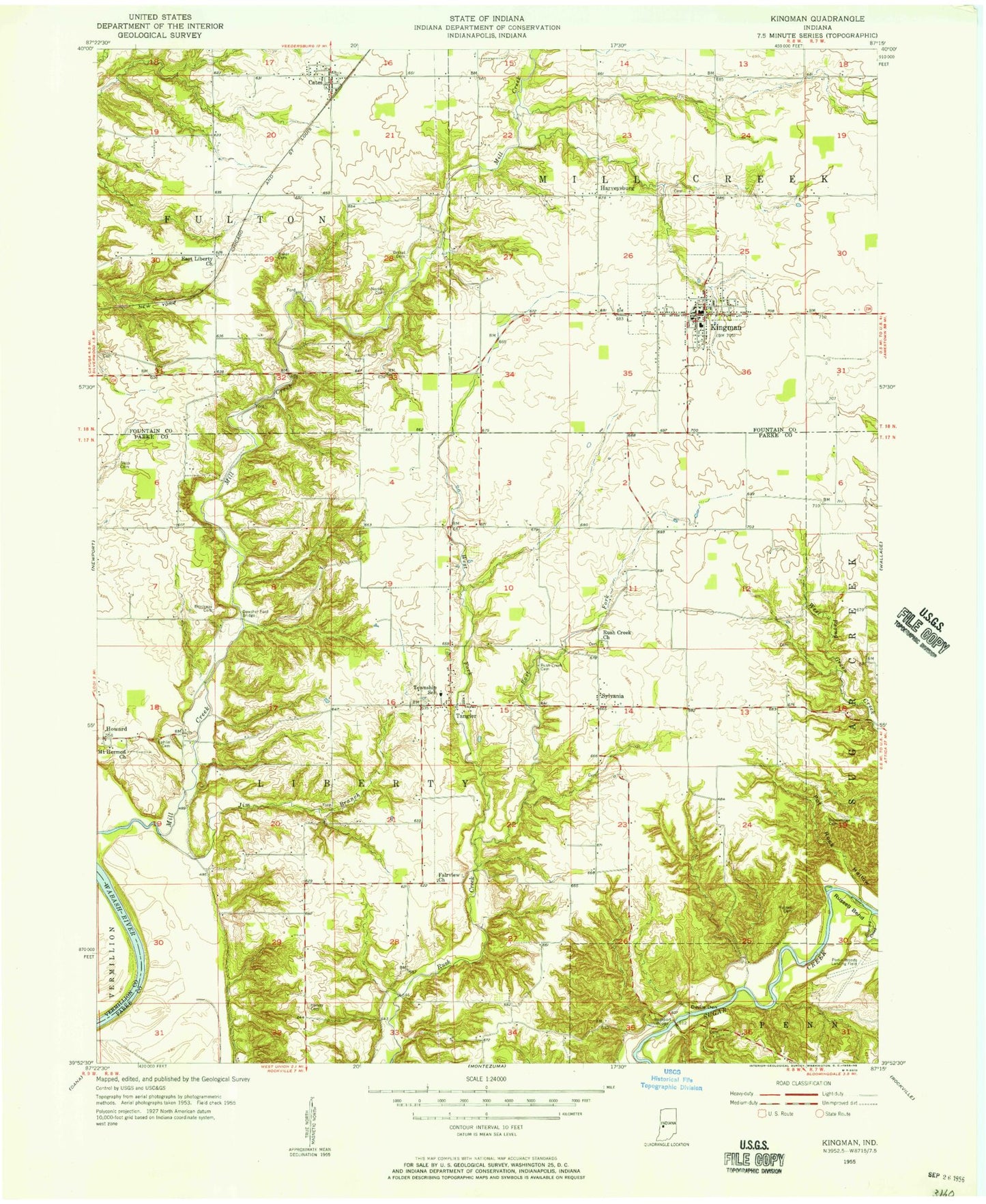
Classic USGS Kingman Indiana 7.5'x7.5' Topo Map
Couldn't load pickup availability
Historical USGS topographic quad map of Kingman in the state of Indiana. Map scale may vary for some years, but is generally around 1:24,000. Print size is approximately 24" x 27"
This quadrangle is in the following counties: Fountain, Parke, Vermillion.
The map contains contour lines, roads, rivers, towns, and lakes. Printed on high-quality waterproof paper with UV fade-resistant inks, and shipped rolled.
Contains the following named places: Baker Cemetery, Bethel Cemetery, Bowsher Ford Bridge, Bristleridge Cemetery, Brockway Cemetery, Cates, Devils Den, East Fork Rush Creek, East Liberty Church, Ephlin Cemetery, Fairview Church, Harvey Cemetery, Harveysburg, Jackson Bridge, Jim Branch, Kingman, Kingman Post Office, Kingman Volunteer Fire Department, Lake Holiday Hide-away, Lake Holiday Hide-Away Dam, Marshall Covered Bridge, Mill Creek Bridge, Mount Hermon Church, Norton Cemetery, Pot Rock Hollow, Roaring Creek, Rockport, Rush Creek Bridge, Rush Creek Cemetery, Rush Creek Church, Russell Bend, Russell Cemetery, Shirk Cemetery, Sylvania, Tangier, Town of Kingman, Township of Liberty, West Fork Rush Creek, ZIP Codes: 47832, 47952