MyTopo
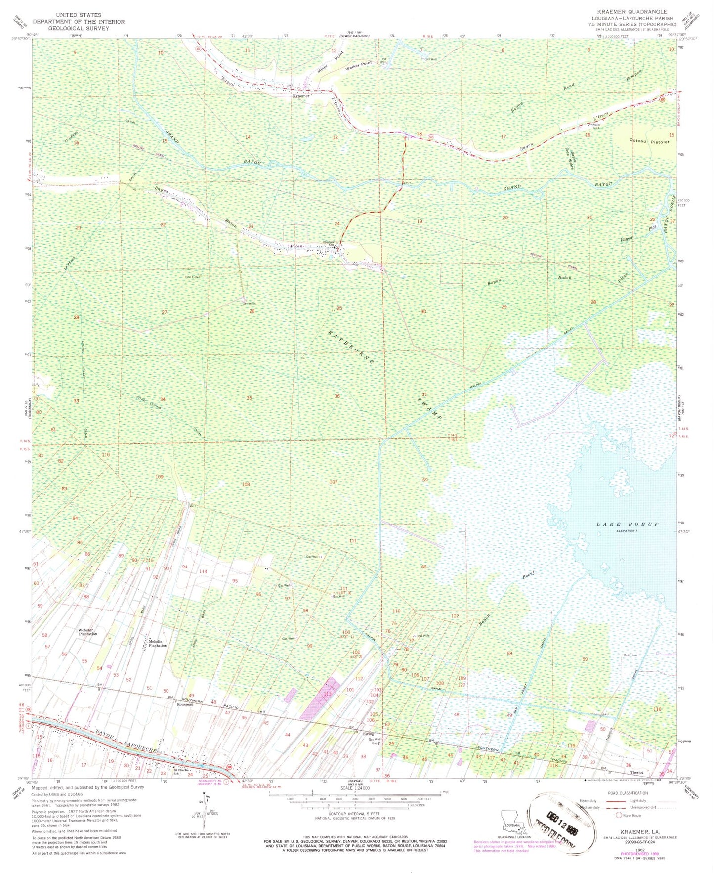
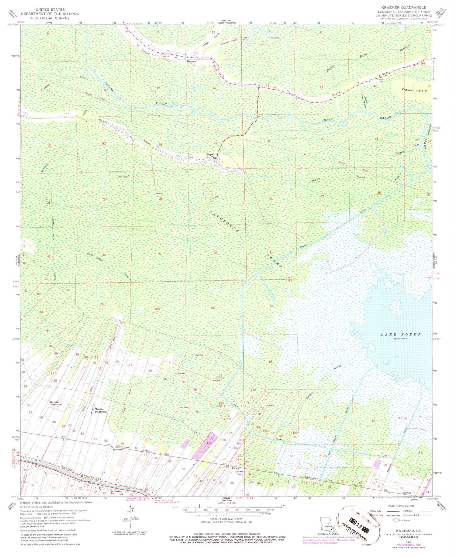
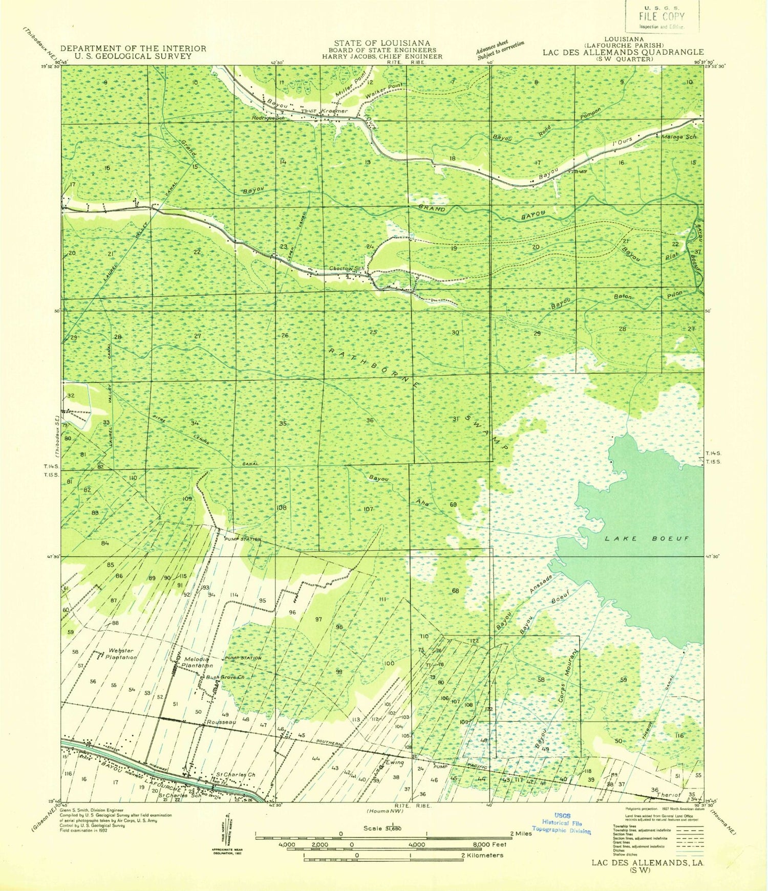
Classic USGS Kraemer Louisiana 7.5'x7.5' Topo Map
Couldn't load pickup availability
Historical USGS topographic quad map of Kraemer in the state of Louisiana. Map scale may vary for some years, but is generally around 1:24,000. Print size is approximately 24" x 27"
This quadrangle is in the following counties: Lafourche.
The map contains contour lines, roads, rivers, towns, and lakes. Printed on high-quality waterproof paper with UV fade-resistant inks, and shipped rolled.
Contains the following named places: Bayou Baton Pilon, Bayou Boeuf, Bayou Jean Webre, Bayou Plat, Choctaw, Choctaw Census Designated Place, Choctaw School Gas Field, Choctaw Volunteer Fire Department Station Number 1, Ewing, Grand Bayou, Halpin Canal, Kraemer, Kraemer Census Designated Place, La Peans Canal, Lafourche Parish Fire District 1 Station 4, Lafourche Parish Fire District 1 Station 7, Lafourche Parish Library Choctaw Branch, Laurel Valley Canal, Melodia Gas Field, Melodia Plantation, Northwest Lake Boeuf Oil and Gas Field, Parish Governing Authority District 2, Parish Governing Authority District 4, Pitre Lening Canal, Rathborne Swamp, Rousseau, Saint Charles, Saint Charles Borromeo Catholic Church, Saint James Chapel, Sam Foret Canal, Sixth Ward Middle School, Southwest Lake Boeuf Gas Field, St Charles Elementary School, Theriot, Theriot Canal, Theriot Field, Walker Point, Ward Six, Webster Plantation