MyTopo
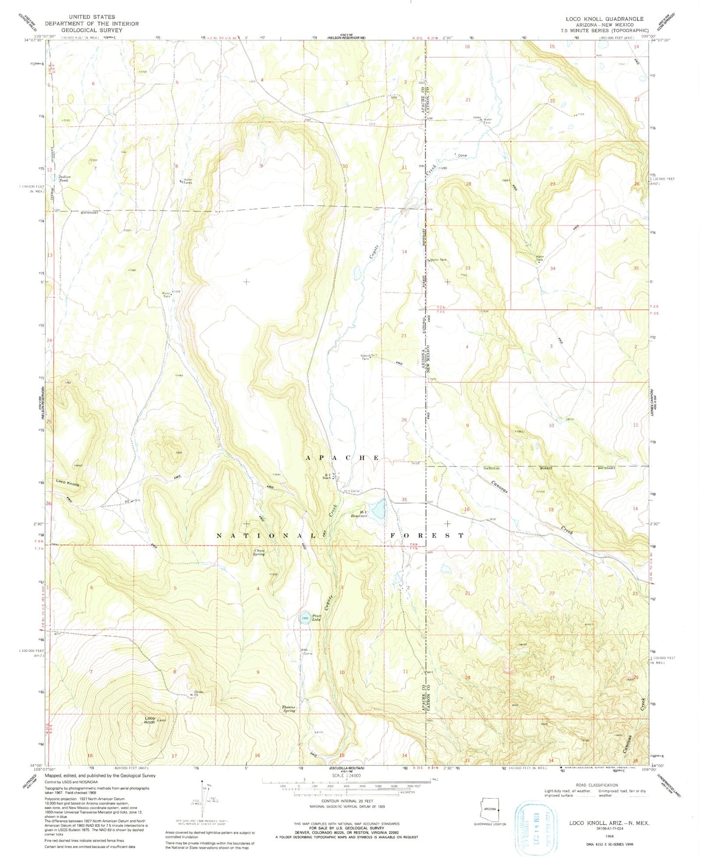
Classic USGS Loco Knoll Arizona 7.5'x7.5' Topo Map
Couldn't load pickup availability
Historical USGS topographic quad map of Loco Knoll in the states of Arizona, New Mexico. Map scale may vary for some years, but is generally around 1:24,000. Print size is approximately 24" x 27"
This quadrangle is in the following counties: Apache, Catron.
The map contains contour lines, roads, rivers, towns, and lakes. Printed on high-quality waterproof paper with UV fade-resistant inks, and shipped rolled.
Contains the following named places: Canovas Creek, Canovas Spring, Canovas Tanks, Chase Spring, Cinder Tank, Clay Mesa Tank, Coyote Creek Volunteer Fire Department, Distributor Tank, Ditch Tank, Escudilla Bonita Census Designated Place, H-V Ranch, H-V Reservoir, H-V Tank, Indian Tank, Loco Knoll, Loco Knoll Number Three Tank, Loco Knoll Well, Loco Knolls, Loco Twentynine Knoll Tank, Pratt Lake, Simpson Ranch, Simpson Well, Steep Tank, Thomas Spring, Towser Ranch, Towser Tank, Towser Well