MyTopo
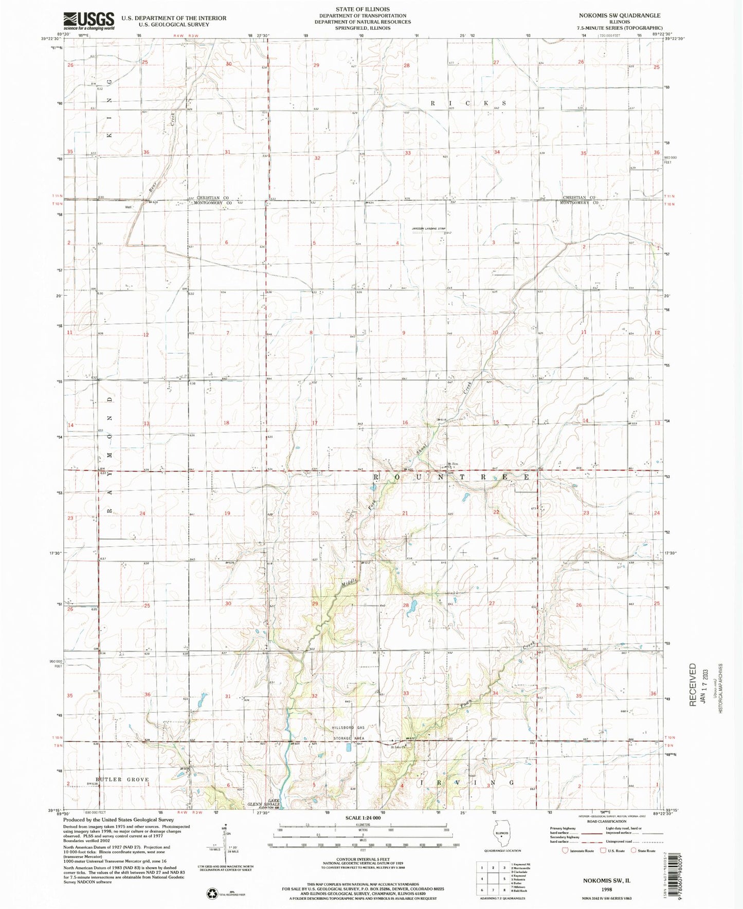
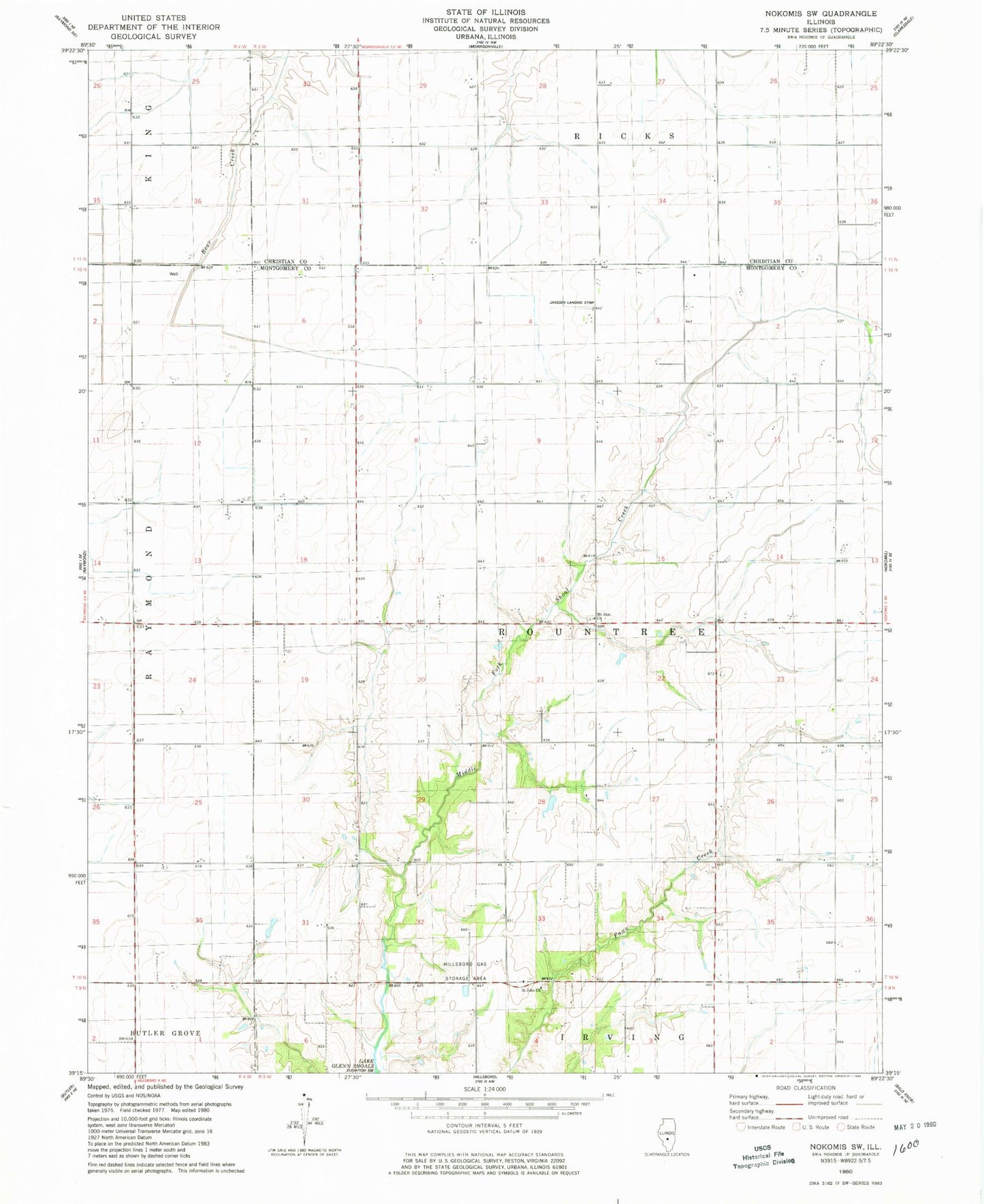
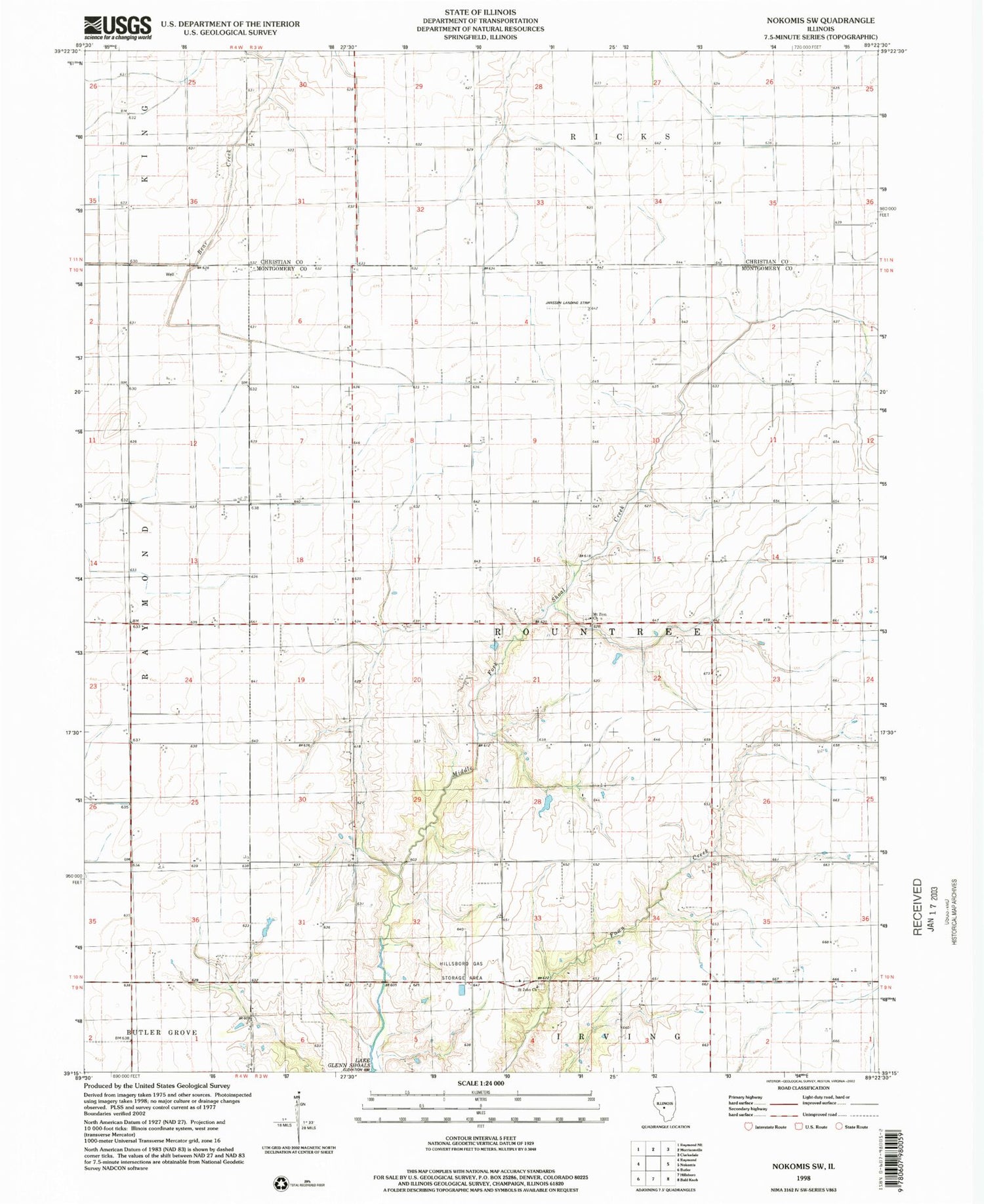
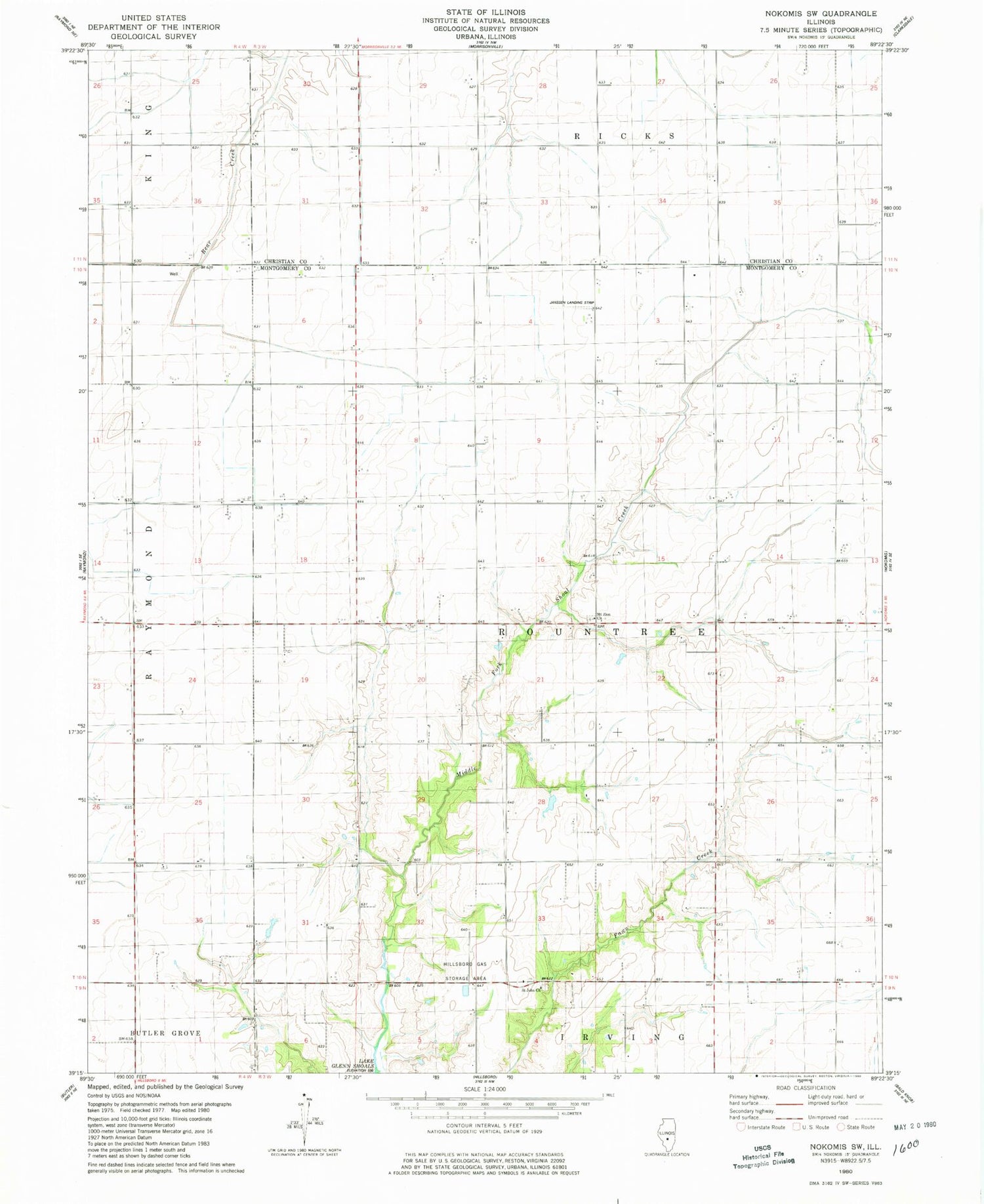
Classic USGS Nokomis SW Illinois 7.5'x7.5' Topo Map
Couldn't load pickup availability
Historical USGS topographic quad map of Nokomis SW in the state of Illinois. Map scale may vary for some years, but is generally around 1:24,000. Print size is approximately 24" x 27"
This quadrangle is in the following counties: Christian, Montgomery.
The map contains contour lines, roads, rivers, towns, and lakes. Printed on high-quality waterproof paper with UV fade-resistant inks, and shipped rolled.
Contains the following named places: Alan B Janssen Airport, Ash Grove School, Craig School, Fawn Creek School, Gragg School, Green Valley School, Hillsboro Gas Storage Area, Lakeside School, Miller School, Mount Zion Church, Oak Grove School, Prairie School, Saint John Church, Saint Johns Cemetery, Shoal Creek School, Shore School, Tester School, Township of Rountree, Union Brick School, Union School