
MyTopo
Classic USGS Reelsville Indiana 7.5'x7.5' Topo Map
Couldn't load pickup availability
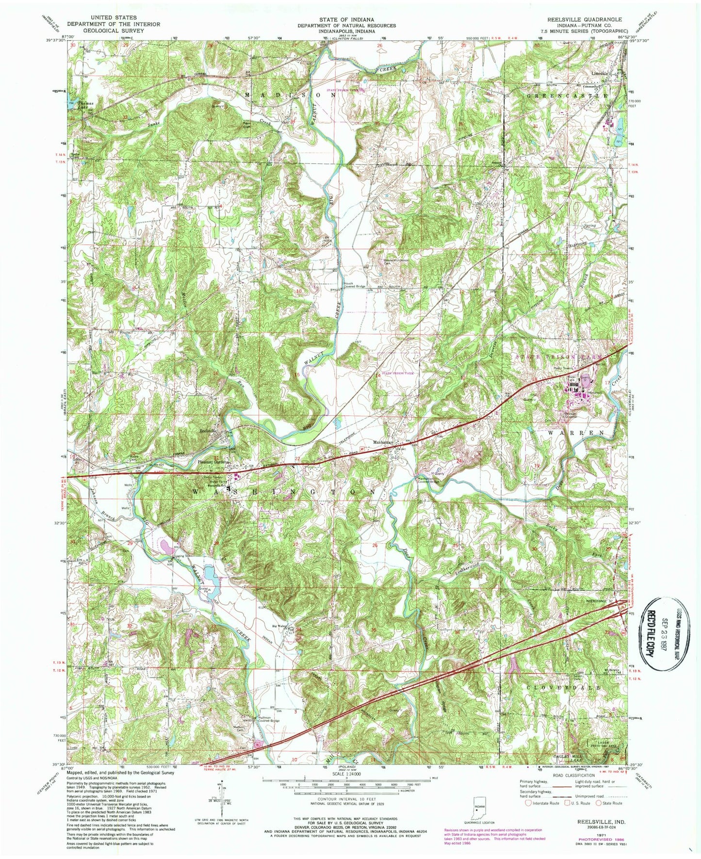
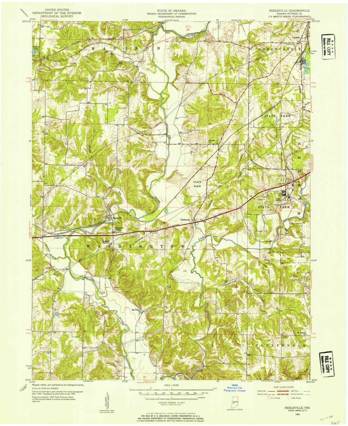
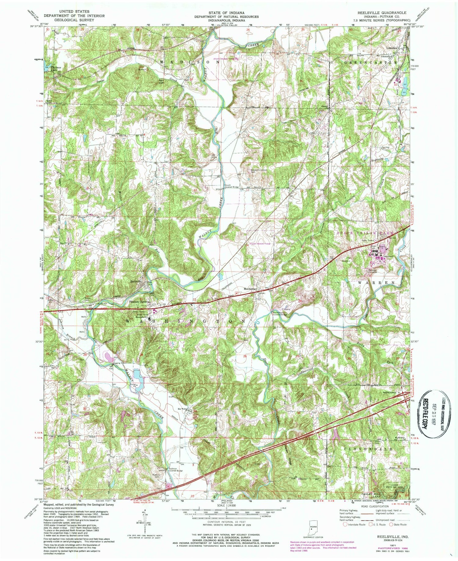
Historical USGS topographic quad map of Reelsville in the state of Indiana. Map scale may vary for some years, but is generally around 1:24,000. Print size is approximately 24" x 27"
This quadrangle is in the following counties: Putnam.
The map contains contour lines, roads, rivers, towns, and lakes. Printed on high-quality waterproof paper with UV fade-resistant inks, and shipped rolled.
Contains the following named places: Antioch Church, Beacon Run, Big Walnut Church, Boone - Hutcheson Cemetery, Canaan Run, Community Church, Cooper Field, Deer Creek, Deweese Branch, Fern Cliff, Hamricks Station Post Office, Houck Covered Bridge, Huffman Covered Bridge, Indian Ridge, Indiana State Police Department District 53, Jenkinsville, Johnson Branch, Leatherwood Creek, Limedale, Little Walnut Creek, Lower Boone Cemetery, Maiden Run, Manhattan, Manhattan Quarry, Manhatten Covered Bridge, Matkin Cemetery, Mosquito Creek, Mount Hebrow Church, Okalla Station, Pleasant Gardens, Putnamville Correctional Facility, Putnamville Correctional Facility Fire Department, Putnamville Quarry, Reelsville, Reelsville - Washington Township Volunteer Fire Department, Reelsville Elementary School, Reelsville Post Office, Rocky Fork, Salem Cemetery, Snake Creek, Thomas Lake, Township of Washington, ZIP Code: 46171