MyTopo
Classic USGS Rosedale Indiana 7.5'x7.5' Topo Map
Couldn't load pickup availability
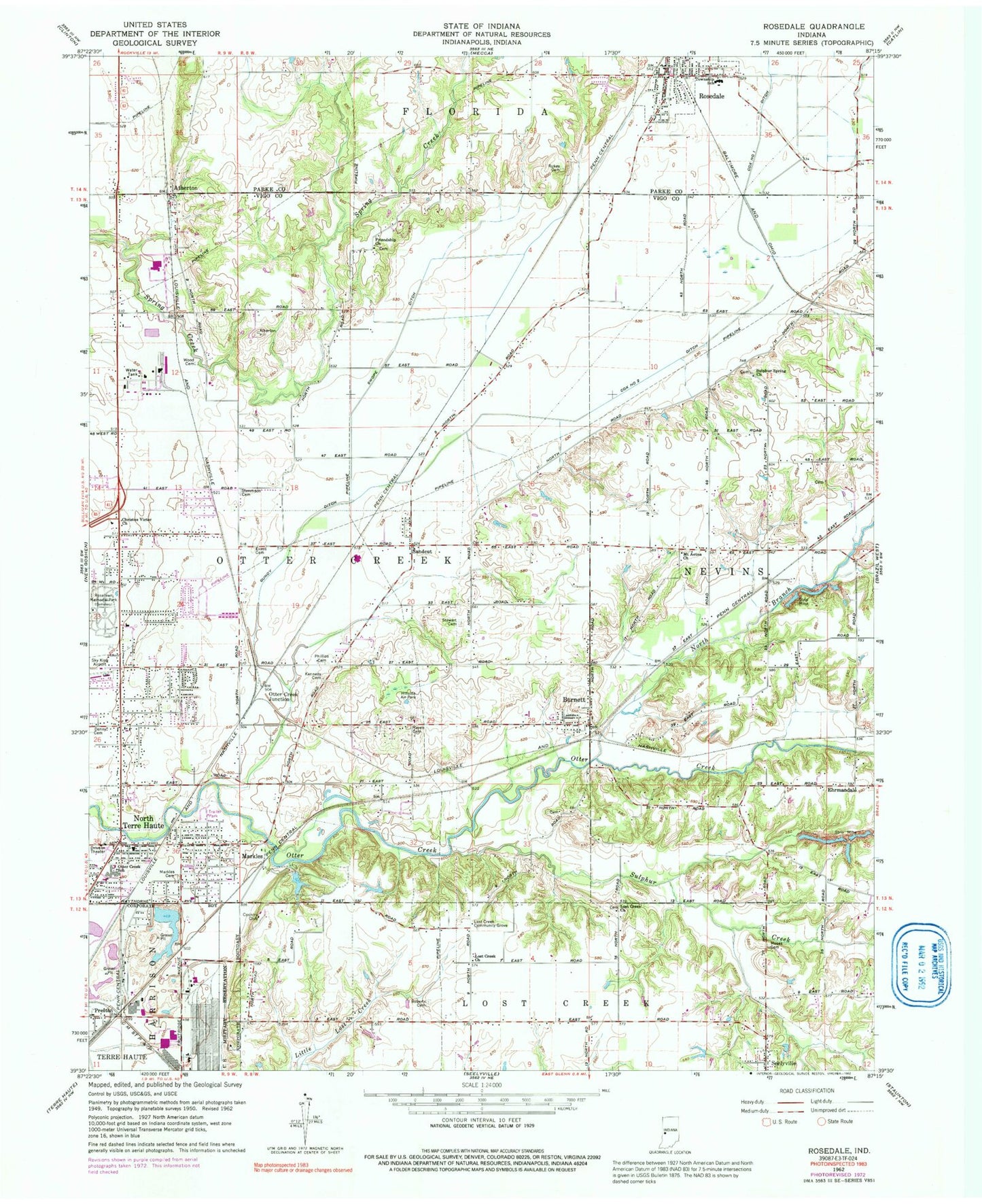
Historical USGS topographic quad map of Rosedale in the state of Indiana. Map scale may vary for some years, but is generally around 1:24,000. Print size is approximately 24" x 27"
This quadrangle is in the following counties: Parke, Vigo.
The map contains contour lines, roads, rivers, towns, and lakes. Printed on high-quality waterproof paper with UV fade-resistant inks, and shipped rolled.
Contains the following named places: Atherton, Burnett, Christus Victor Church, Cox Number One Ditch, Cox Number Two Ditch, Denny Cemetery, Elsworth Station, Evans Cemetery, Forest Park Swimming Pool, Forest Park Swimming Pool Dam, Friendship Church, Gundy Ditch, Haven Cemetery, Kennedy Cemetery, Lost Creek Church, Lost Creek Community Grove, Markle Cemetery, Markles, Milton Station, Moses Cemetery, Mount Aetna Church, North Branch Otter Creek, North Terre Haute, North Terre Haute Census Designated Place, North Terre Haute Post Office, Otter Creek Junction, Otter Creek Junior High School, Otter Creek Township Fire Department Station 1 North Terre Haute Headquarters, Otter Creek Township Fire Department Station 3 Burnett, Phillips Cemetery, Preston, Roberts Cemetery, Rosedale, Rosedale Elementary and High School, Rosedale Police Department, Rosedale Post Office, Rosedale Volunteer Fire Department, Roselawn Memorial Park, Rukes Cemetery, Sandcut, Sandcut Volunteer Fire Department Station 2, Sky King Airport, Snake Creek, Steveson Cemetery, Stewart Cemetery, Sulphur Creek, Sulphur Spring Church, Swope Ditch, Town of Rosedale, Township of Otter Creek, West Atherton, Wood Cemetery, ZIP Code: 47805