MyTopo
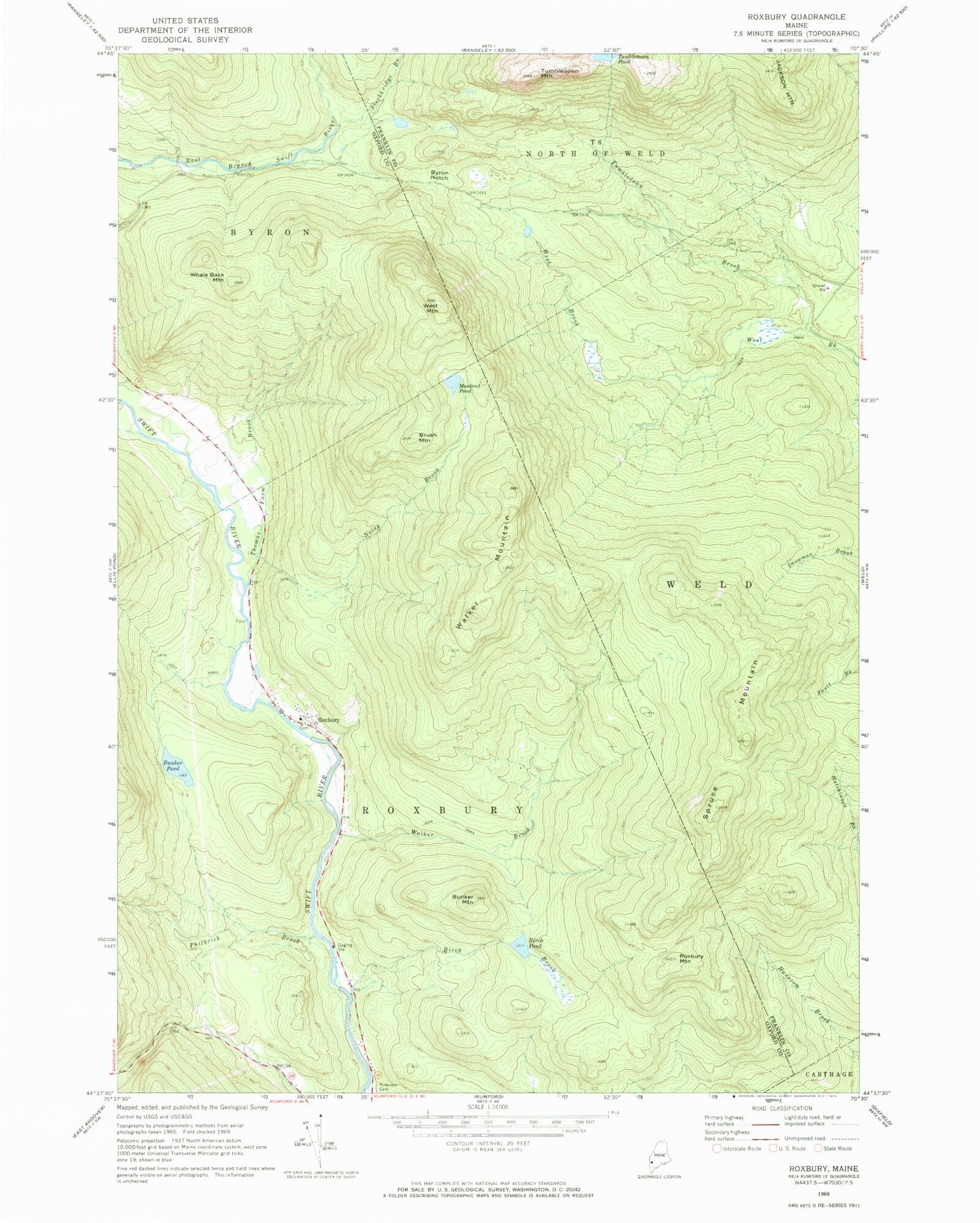
Classic USGS Roxbury Maine 7.5'x7.5' Topo Map
Couldn't load pickup availability
Historical USGS topographic quad map of Roxbury in the state of Maine. Typical map scale is 1:24,000, but may vary for certain years, if available. Print size: 24" x 27"
This quadrangle is in the following counties: Franklin, Oxford.
The map contains contour lines, roads, rivers, towns, and lakes. Printed on high-quality waterproof paper with UV fade-resistant inks, and shipped rolled.
Contains the following named places: Birch Brook, Birch Pond, Brush Mountain, Bunker Mountain, Bunker Pond, Byron Notch, Muskrat Pond, Noisy Brook, Philbrick Brook, Pineview Cemetery, Roxbury, Roxbury Mountain, Spruce Mountain, Stockbridge Branch, Thomas Farm Brook, Tumbledown Brook, Tumbledown Pond, Walker Brook, Walker Mountain, West Mountain, Whale Back Mountain, Town of Roxbury, Brook Trail, Chimney Trail, Thomas Airport, Roxbury Volunteer Fire Department, Roxbury Village Cemetery, Shaw Cemetery