
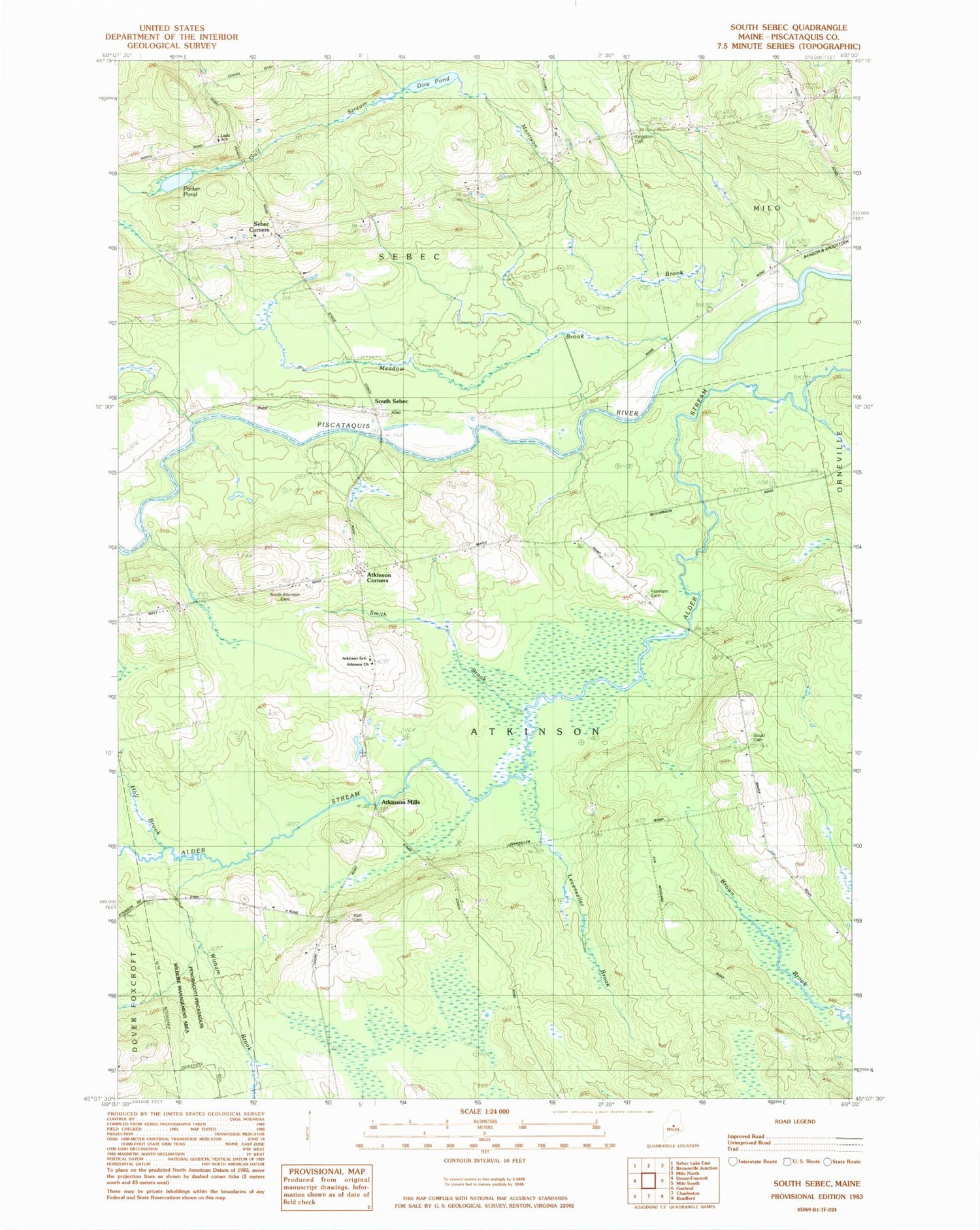
MyTopo
Classic USGS South Sebec Maine 7.5'x7.5' Topo Map
Couldn't load pickup availability
Historical USGS topographic quad map of South Sebec in the state of Maine. Typical map scale is 1:24,000, but may vary for certain years, if available. Print size: 24" x 27"
This quadrangle is in the following counties: Piscataquis.
The map contains contour lines, roads, rivers, towns, and lakes. Printed on high-quality waterproof paper with UV fade-resistant inks, and shipped rolled.
Contains the following named places: Atkinson Corners, Atkinson School, Dow Pond, Farnham Cemetery, Gould Cemetery, Gulf Stream, Hall Brook, Hart Cemetery, Maple School, Meadow Brook, Morrison Brook, Morrison School, Parker Pond, Sebec Corners, Sebec Station, Atkinson Mills, South Sebec, Town of Atkinson, Town of Sebec, Atkinson Church, Kingdom Hall, Ladd School, North Atkinson Cemetery, Sebec Corner Cemetery, Sebec Volunteer Fire Department North Road Station, Chase Cemetery, Clark Cemetery, Town Cemetery


