MyTopo
Wing SW North Dakota US Topo Map
Couldn't load pickup availability
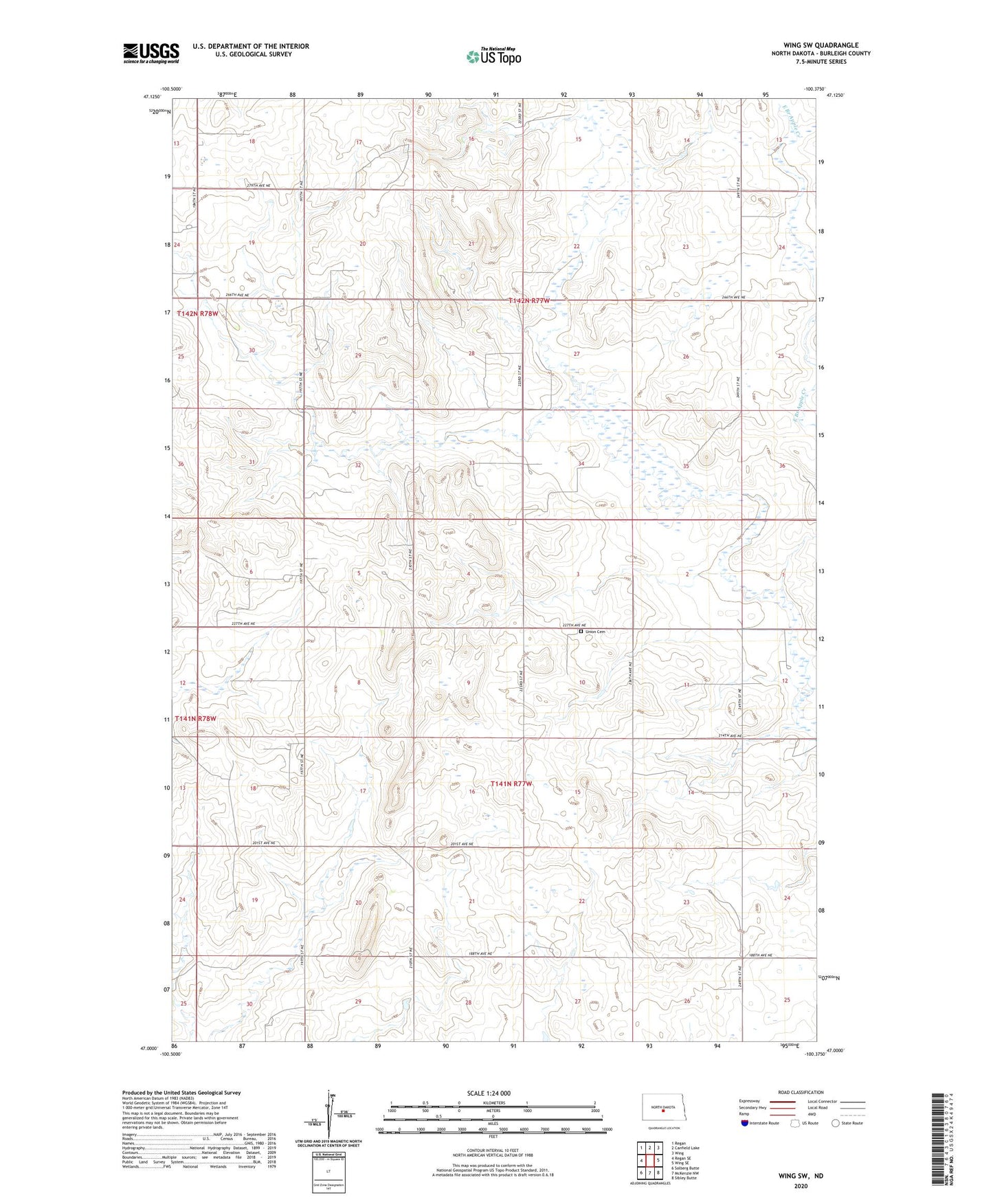
2024 topographic map quadrangle Wing SW in the state of North Dakota. Scale: 1:24000. Based on the newly updated USGS 7.5' US Topo map series, this map is in the following counties: Burleigh. The map contains contour data, water features, and other items you are used to seeing on USGS maps, but also has updated roads and other features. This is the next generation of topographic maps. Printed on high-quality waterproof paper with UV fade-resistant inks.
Quads adjacent to this one:
West: Regan SE
Northwest: Regan
North: Canfield Lake
Northeast: Wing
East: Wing SE
Southeast: Sibley Butte
South: McKenzie NW
Southwest: Solberg Butte
This map covers the same area as the classic USGS quad with code o47100a4.
Contains the following named places: Township of Rock Hill, Township of Trygg, Union Cemetery