MyTopo
Iaqua Buttes California US Topo Map
Couldn't load pickup availability
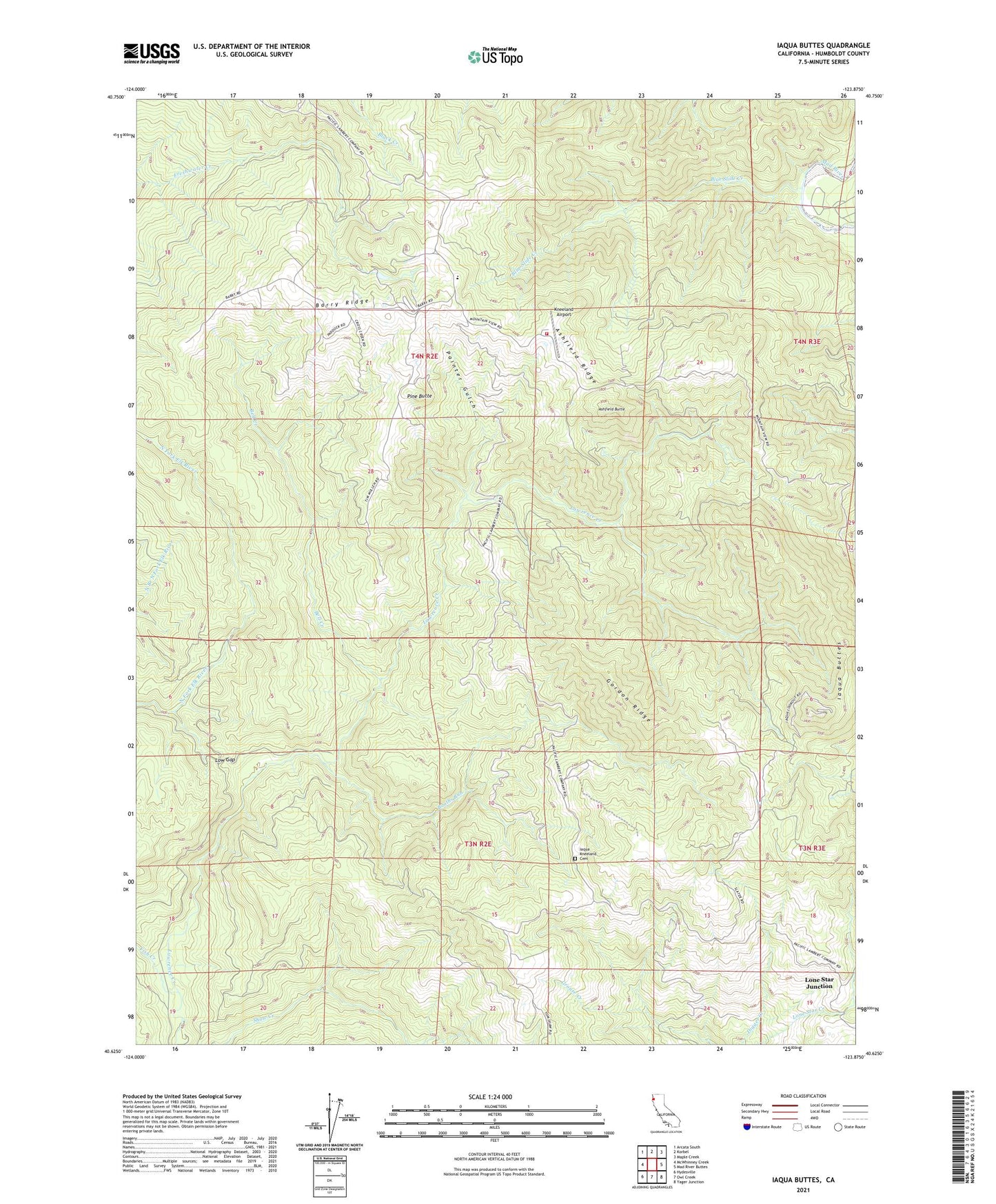
2021 topographic map quadrangle Iaqua Buttes in the state of California. Scale: 1:24000. Based on the newly updated USGS 7.5' US Topo map series, this map is in the following counties: Humboldt. The map contains contour data, water features, and other items you are used to seeing on USGS maps, but also has updated roads and other features. This is the next generation of topographic maps. Printed on high-quality waterproof paper with UV fade-resistant inks.
Quads adjacent to this one:
West: McWhinney Creek
Northwest: Arcata South
North: Korbel
Northeast: Maple Creek
East: Mad River Buttes
Southeast: Yager Junction
South: Owl Creek
Southwest: Hydesville
This map covers the same area as the classic USGS quad with code o40123f8.
Contains the following named places: Ashfield Butte, Ashfield Ridge, Barry Ridge, Bell Creek, Blue Slide Creek, Booths Run, California Department of Forestry and Fire Station Kneeland Helitack Base, Fish Creek, Gordon Ridge, Humboldt County, Iaqua Buttes, Iaqua Kneeland Cemetery, Iaqua School, KAEF-TV (Arcata), KECU-FM (Eureka), KEET-TV (Eureka), KFMI-FM (Eureka), KHSU-FM (Arcata), KIEM-TV (Eureka), Kneeland Airport, Kneeland Elementary School, KRED-FM (Eureka), KVIQ-TV (Eureka), KXGO-FM (Arcata), KZJA-TV (Eureka), Lone Star Junction, Low Gap, Painter Gulch, Pine Butte, ZIP Code: 95549