
MyTopo
Korbel California US Topo Map
Couldn't load pickup availability
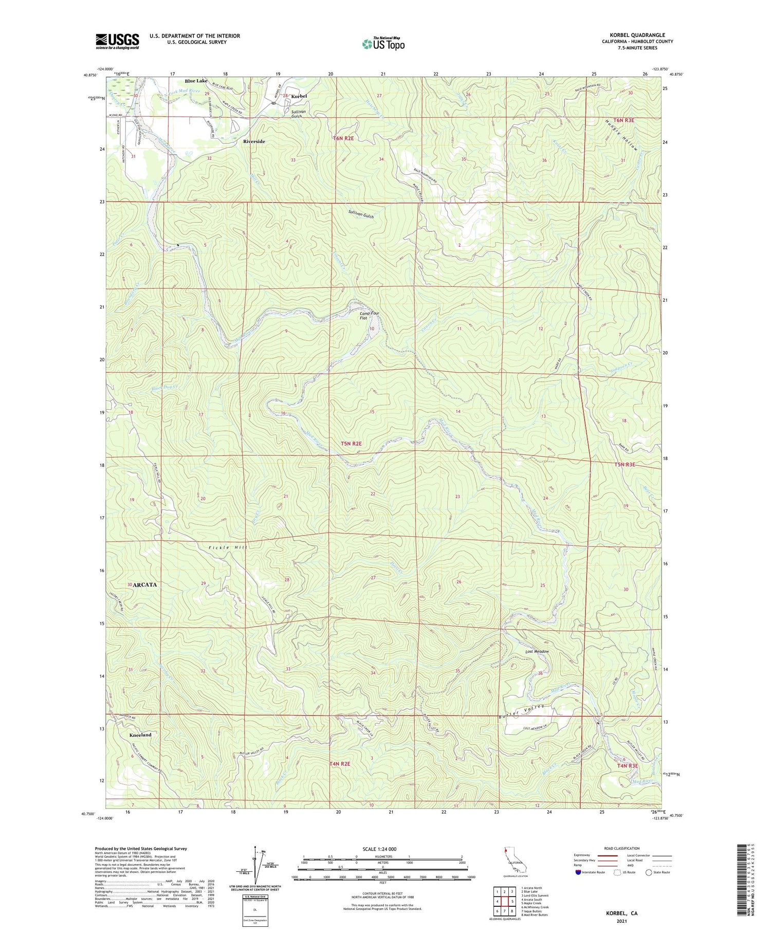
2021 topographic map quadrangle Korbel in the state of California. Scale: 1:24000. Based on the newly updated USGS 7.5' US Topo map series, this map is in the following counties: Humboldt. The map contains contour data, water features, and other items you are used to seeing on USGS maps, but also has updated roads and other features. This is the next generation of topographic maps. Printed on high-quality waterproof paper with UV fade-resistant inks.
Quads adjacent to this one:
West: Arcata South
Northwest: Arcata North
North: Blue Lake
Northeast: Lord-Ellis Summit
East: Maple Creek
Southeast: Mad River Buttes
South: Iaqua Buttes
Southwest: McWhinney Creek
This map covers the same area as the classic USGS quad with code o40123g8.
Contains the following named places: Allard Ranch, Anderson Ranch, Angel Ranch, Archibald Ranch, B-Barr Ranch, Belmont School, Black Creek, Black Dog Creek, Blue Lake, Boulder Creek, Boundary Creek, Butler Prairie, Butler Valley, Butler Valley Ranch, Camp Four Flat, Canon Creek, City of Eureka Reservoir, Conner Ranch, Davis Creek, Devil Creek, Diamond Prairie, Dollar Ranch, Dry Creek, Falor Ranch, Fickle Hill, Garner Prairie, Hatchery Creek, Hatfield Prairie, Hungry Hollow, Indian Arrow Tree, Kneeland, Kneeland Fire Protection District, Kneeland Prairie School, Knutz Creek, Korbel, Korbel Post Office, Lost Meadow, Mad River Fish Hatchery, Maple Creek, Mill Creek, North Fork Mad River, Palmer Creek, Pritchett Ranch, Puter Creek, Riverside, Simpson Creek, Spring Prairie, Sullivan Gulch, Sweasey Dam, Vincent Creek


