MyTopo
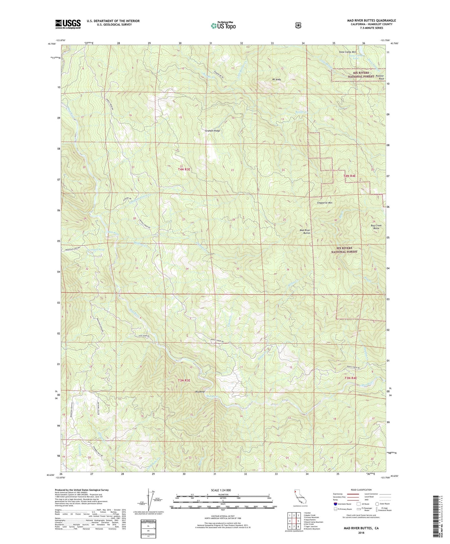
Mad River Buttes California US Topo Map
Couldn't load pickup availability
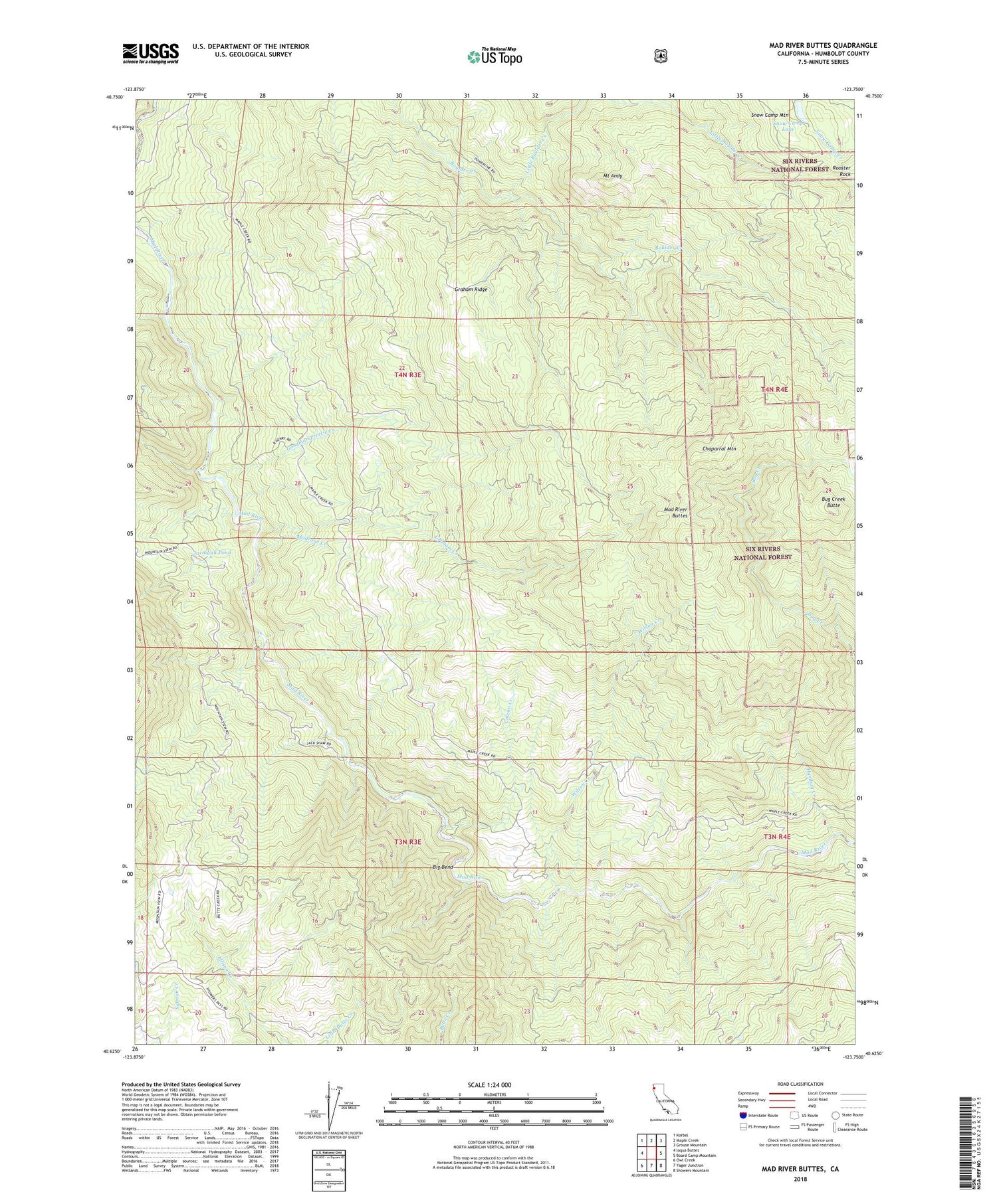
Also explore the Mad River Buttes Forest Service Topo of this same quad for updated USFS data
2022 topographic map quadrangle Mad River Buttes in the state of California. Scale: 1:24000. Based on the newly updated USGS 7.5' US Topo map series, this map is in the following counties: Humboldt. The map contains contour data, water features, and other items you are used to seeing on USGS maps, but also has updated roads and other features. This is the next generation of topographic maps. Printed on high-quality waterproof paper with UV fade-resistant inks.
Quads adjacent to this one:
West: Iaqua Buttes
Northwest: Korbel
North: Maple Creek
Northeast: Grouse Mountain
East: Board Camp Mountain
Southeast: Showers Mountain
South: Yager Junction
Southwest: Owl Creek
This map covers the same area as the classic USGS quad with code o40123f7.
Contains the following named places: Arcata Division, Benbow 1-041 Dam, Big Bend, Big Bend Ranch, Bug Creek, Bug Creek Butte, Chaparral Mountain, Cowan Creek, Goodman Prairie Creek, Graham Creek, Graham Ridge, Humbug Creek, Jarnigan Pond, Little Boulder Creek, Mad River Buttes, Madrone Creek, Morgan Creek, Mount Andy, Mount View Ranch, Rooster Rock, Snow Camp Lake, Snow Camp Mountain, Three Cabins, Wilson Creek