MyTopo
Owl Creek California US Topo Map
Couldn't load pickup availability
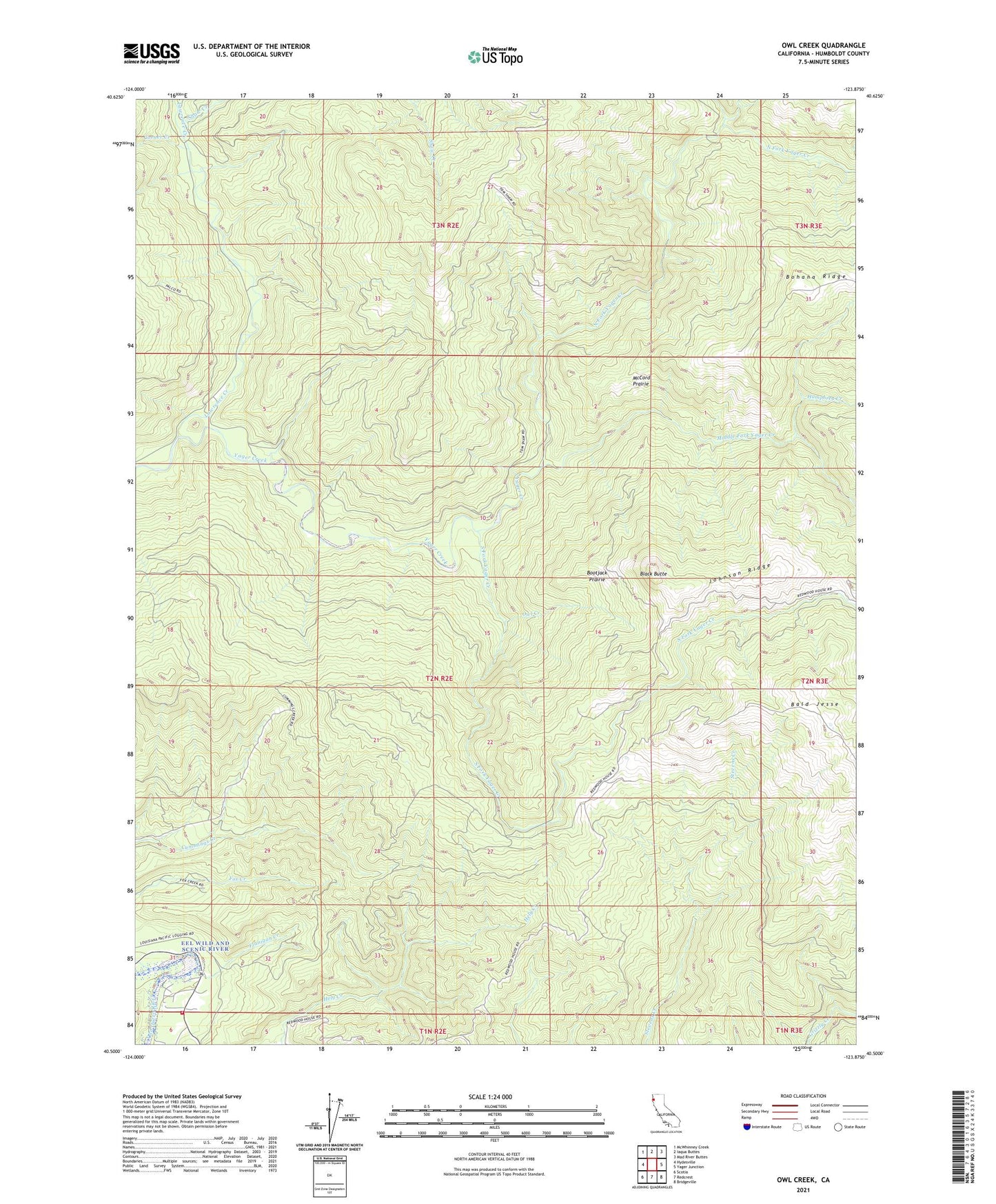
2021 topographic map quadrangle Owl Creek in the state of California. Scale: 1:24000. Based on the newly updated USGS 7.5' US Topo map series, this map is in the following counties: Humboldt. The map contains contour data, water features, and other items you are used to seeing on USGS maps, but also has updated roads and other features. This is the next generation of topographic maps. Printed on high-quality waterproof paper with UV fade-resistant inks.
Quads adjacent to this one:
West: Hydesville
Northwest: McWhinney Creek
North: Iaqua Buttes
Northeast: Mad River Buttes
East: Yager Junction
Southeast: Bridgeville
South: Redcrest
Southwest: Scotia
This map covers the same area as the classic USGS quad with code o40123e8.
Contains the following named places: Bald Jesse, Black Butte, Bohana Ridge, Bootjack Prairie, Carlotta Volunteer Fire Department Station 2, Corner Creek, Digger Creek, Flanigan Creek, Fortuna Division, Grouse Creek, Humphrey Creek, Johnson Ridge, Lawrence Creek, Lone Star Creek, McCord Prairie, Middle Fork Yager Creek, North Fork Yager Creek, Owl Creek, Redwood House, Shaw Creek, Shaws Ranch, South Fork Yager Creek