MyTopo
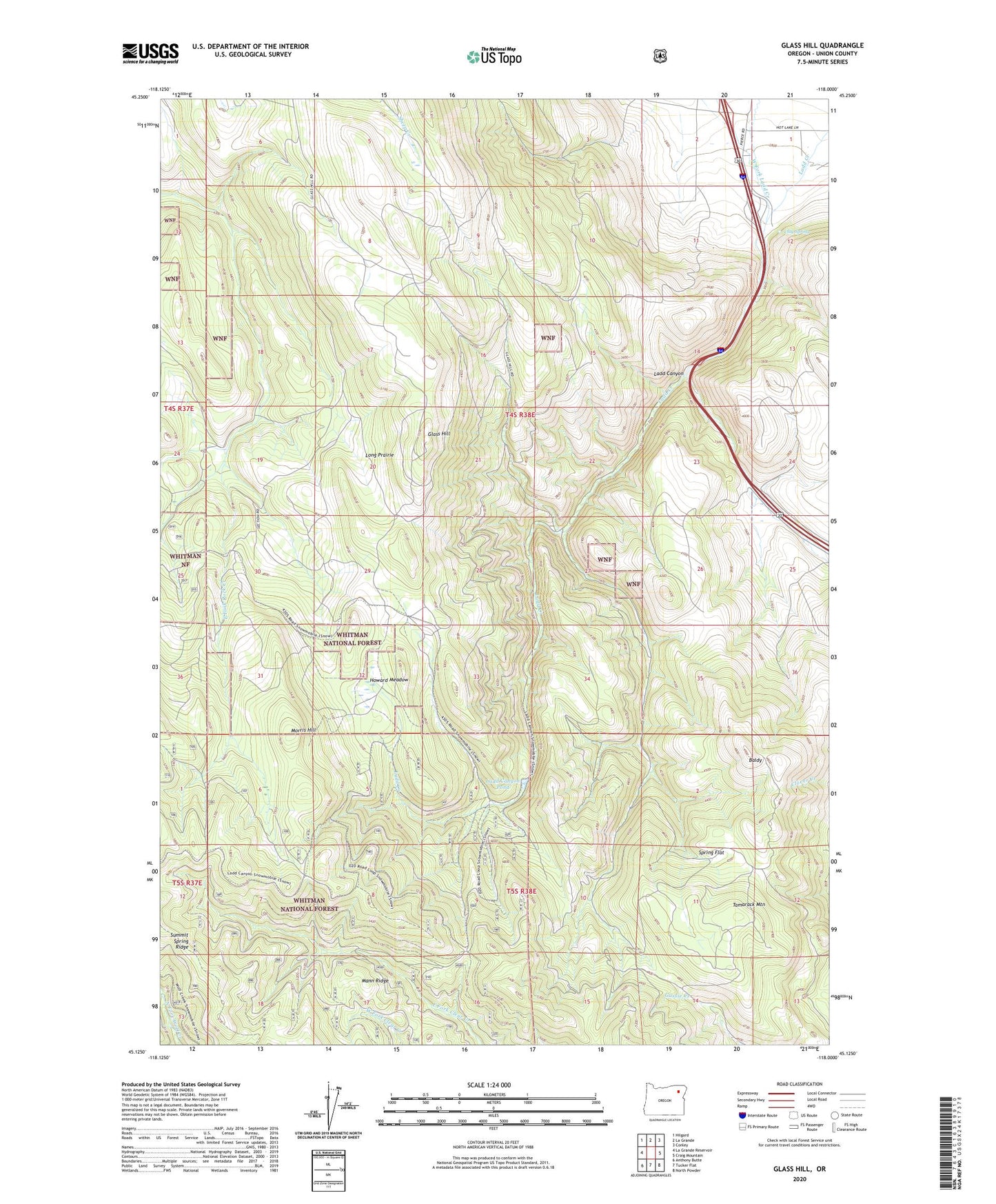
Glass Hill Oregon US Topo Map
Couldn't load pickup availability
Also explore the Glass Hill Forest Service Topo of this same quad for updated USFS data
2023 topographic map quadrangle Glass Hill in the state of Oregon. Scale: 1:24000. Based on the newly updated USGS 7.5' US Topo map series, this map is in the following counties: Union. The map contains contour data, water features, and other items you are used to seeing on USGS maps, but also has updated roads and other features. This is the next generation of topographic maps. Printed on high-quality waterproof paper with UV fade-resistant inks.
Quads adjacent to this one:
West: La Grande Reservoir
Northwest: Hilgard
North: La Grande
Northeast: Conley
East: Craig Mountain
Southeast: North Powder
South: Tucker Flat
Southwest: Anthony Butte
This map covers the same area as the classic USGS quad with code o45118b1.
Contains the following named places: Baldy, Charles Reynolds Safety Rest Area, Clay Spring, East Fork Rock Creek, Glass Hill, Howard Meadow, Howard Meadow Trail, Ladd Canyon, Ladd Canyon Pond, Ladd Canyon Sno-Park, Long Prairie, Mann Ridge, Morris Hill, Reinecke Cabin, Spring Flat, Tamarack Mountain, Vincent Ranch, West Fork Ladd Creek