MyTopo
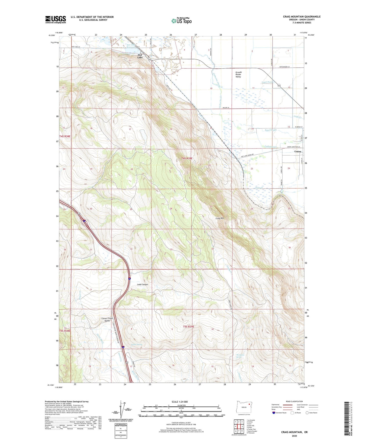
Craig Mountain Oregon US Topo Map
Couldn't load pickup availability
Also explore the Craig Mountain Forest Service Topo of this same quad for updated USFS data
2024 topographic map quadrangle Craig Mountain in the state of Oregon. Scale: 1:24000. Based on the newly updated USGS 7.5' US Topo map series, this map is in the following counties: Union. The map contains contour data, water features, and other items you are used to seeing on USGS maps, but also has updated roads and other features. This is the next generation of topographic maps. Printed on high-quality waterproof paper with UV fade-resistant inks.
Quads adjacent to this one:
West: Glass Hill
Northwest: La Grande
North: Conley
Northeast: Cove
East: Union
Southeast: Telocaset
South: North Powder
Southwest: Tucker Flat
This map covers the same area as the classic USGS quad with code o45117b8.
Contains the following named places: Craig Mountain, Davis Dam, Grout Ditch, Hot Lake, Hot Lake Post Office, Hot Lake Reservoir, Kaylor Spring, Little Creek, Manuel Museum, Pond Slough, Pyle, Pyles Creek, Scott Ditch, Thompson Spring, Umpleby Ranch Airstrip, Union Junction, Union Sewer Treatment Plant, Upper Davis Dam, Vogel Pond