MyTopo
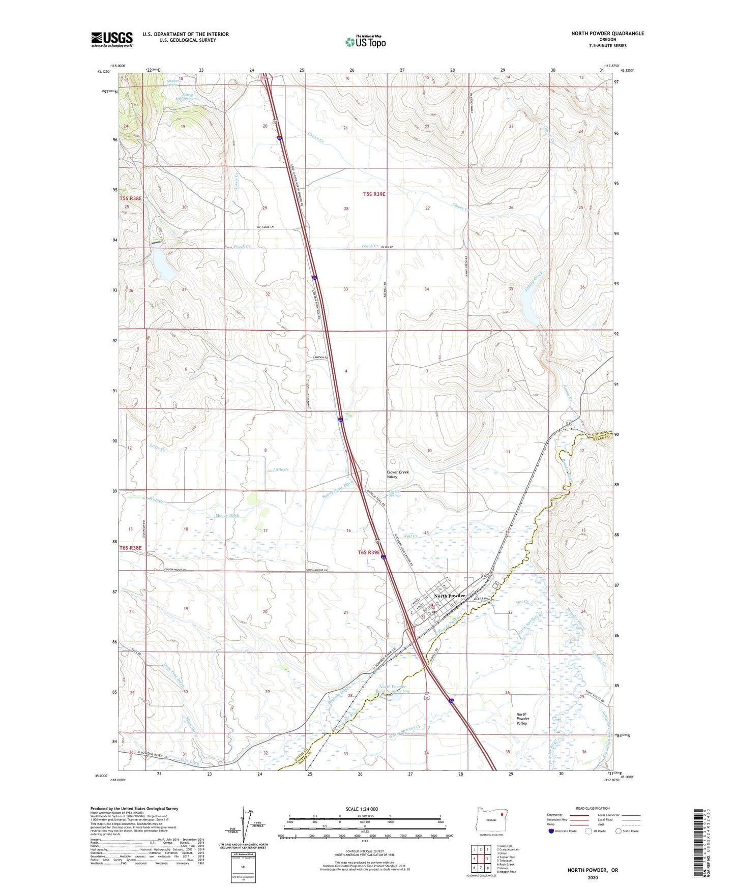
North Powder Oregon US Topo Map
Couldn't load pickup availability
Also explore the North Powder Forest Service Topo of this same quad for updated USFS data
2023 topographic map quadrangle North Powder in the state of Oregon. Scale: 1:24000. Based on the newly updated USGS 7.5' US Topo map series, this map is in the following counties: Union, Baker. The map contains contour data, water features, and other items you are used to seeing on USGS maps, but also has updated roads and other features. This is the next generation of topographic maps. Printed on high-quality waterproof paper with UV fade-resistant inks.
Quads adjacent to this one:
West: Tucker Flat
Northwest: Glass Hill
North: Craig Mountain
Northeast: Union
East: Telocaset
Southeast: Magpie Peak
South: Haines
Southwest: Rock Creek
This map covers the same area as the classic USGS quad with code o45117a8.
Contains the following named places: City of North Powder, Clover Creek, Clover Creek Valley, Dorion Historical Marker, Gentry Creek, Gussie Creek, Hot Creek, Jimmy Creek, Little Creek, Lun, Moody Ditch, North Powder, North Powder City Hall, North Powder Pond Number One, North Powder Post Office, North Powder Public Library, North Powder River, North Powder Rural Fire Protection District, North Powder Sewer Treatment Plant, North Powder Valley, Parker Springs, Peach Creek, Pearson Ditch, Powder Valley School, Pratt Ranch Airstrip, Shaw Brant Ditch, Shaw Dam, Shaw Ditch, Shaw Reservoir, Sixteen Mile Spring, Stephens Spring, Sunnyslope Ditch, Warm Springs Creek, Wolf Creek, ZIP Code: 97867