MyTopo
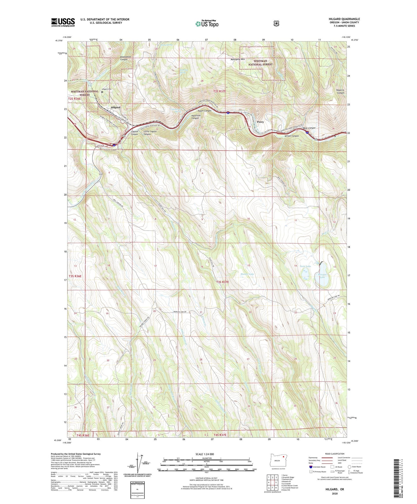
Hilgard Oregon US Topo Map
Couldn't load pickup availability
Also explore the Hilgard Forest Service Topo of this same quad for updated USFS data
2024 topographic map quadrangle Hilgard in the state of Oregon. Scale: 1:24000. Based on the newly updated USGS 7.5' US Topo map series, this map is in the following counties: Union. The map contains contour data, water features, and other items you are used to seeing on USGS maps, but also has updated roads and other features. This is the next generation of topographic maps. Printed on high-quality waterproof paper with UV fade-resistant inks.
Quads adjacent to this one:
West: Kamela SE
Northwest: Huron
North: Drumhill Ridge
Northeast: Summerville
East: La Grande
Southeast: Glass Hill
South: La Grande Reservoir
Southwest: Little Beaver Creek
This map covers the same area as the classic USGS quad with code o45118c2.
Contains the following named places: Bear Canyon, Beartrap Spring, Blacksmith Canyon, Cottonwood Spring, Coyote Canyon, Five Points Creek, Graves Creek, Hamilton Canyon, Hilgard, Hilgard Cemetery, Hilgard Junction State Park, Hilgard Post Office, Hunter Lake, Little Coyote Canyon, Little Graves Creek, Little Rock Creek, Little Whiskey Creek, Mahogany Mountain, Morgan Lake, Morgan Lake Campground Boat Ramp, Morgan Lake Dam, Morgan Lake Park, Mouse Spring, Oregon Youth Authority Riverbend Sewer Treatment Plant, Peach Canyon, Pelican Creek, Perry, Perry Post Office, Perry School, RiverBend Youth Correctional Facility, Robbs Creek, Rock Creek, Sheep Creek, Strober Ranch, Twin Lake, Whiskey Creek, Wilson Canyon