MyTopo
Rawlins NW Wyoming US Topo Map
Couldn't load pickup availability
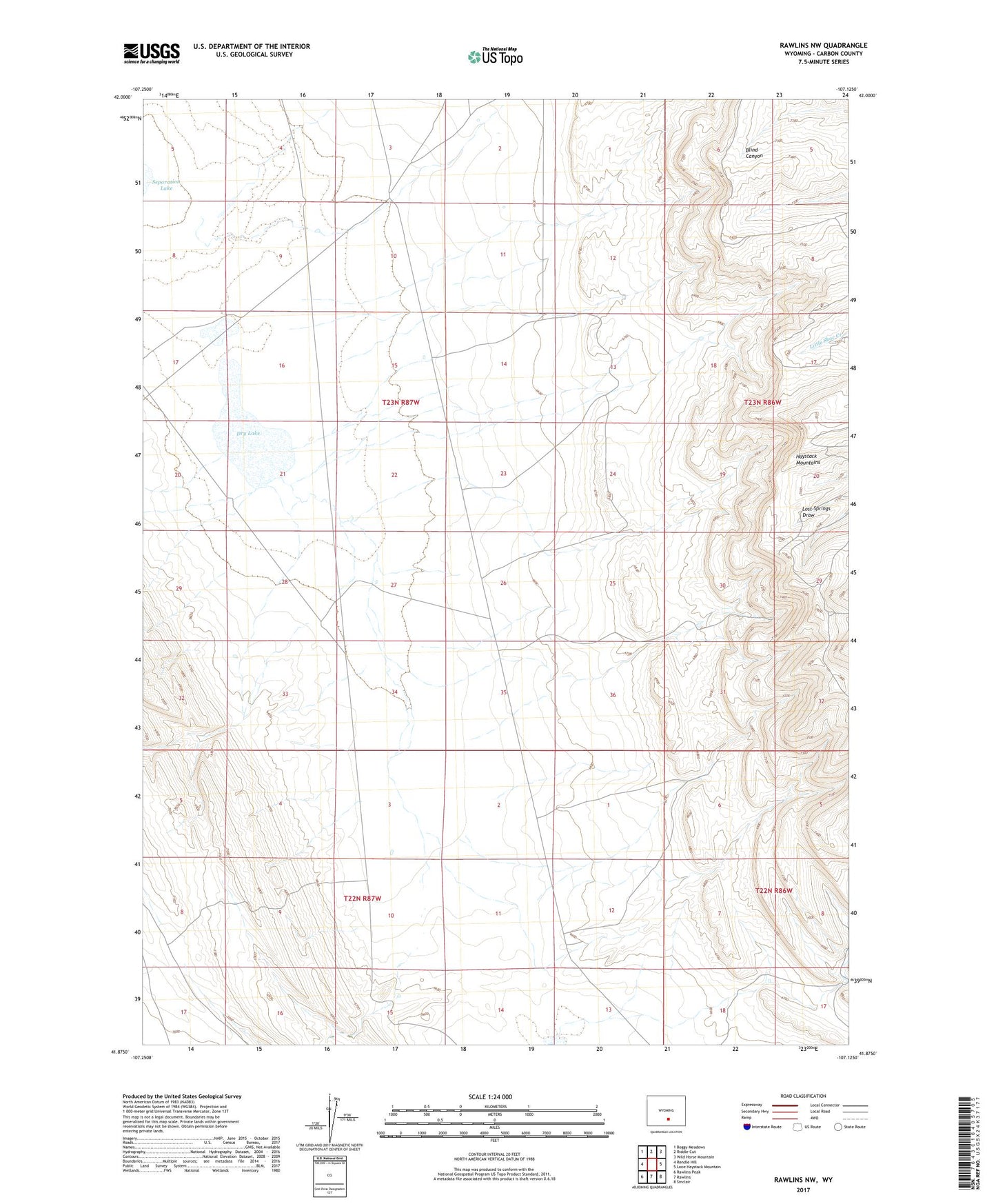
2021 topographic map quadrangle Rawlins NW in the state of Wyoming. Scale: 1:24000. Based on the newly updated USGS 7.5' US Topo map series, this map is in the following counties: Carbon. The map contains contour data, water features, and other items you are used to seeing on USGS maps, but also has updated roads and other features. This is the next generation of topographic maps. Printed on high-quality waterproof paper with UV fade-resistant inks.
Quads adjacent to this one:
West: Rendle Hill
Northwest: Boggy Meadows
North: Riddle Cut
Northeast: Wild Horse Mountain
East: Lone Haystack Mountain
Southeast: Sinclair
South: Rawlins
Southwest: Rawlins Peak
This map covers the same area as the classic USGS quad with code o41107h2.
Contains the following named places: Dry Lake, Meadow Station 4