MyTopo
Sinclair Wyoming US Topo Map
Couldn't load pickup availability
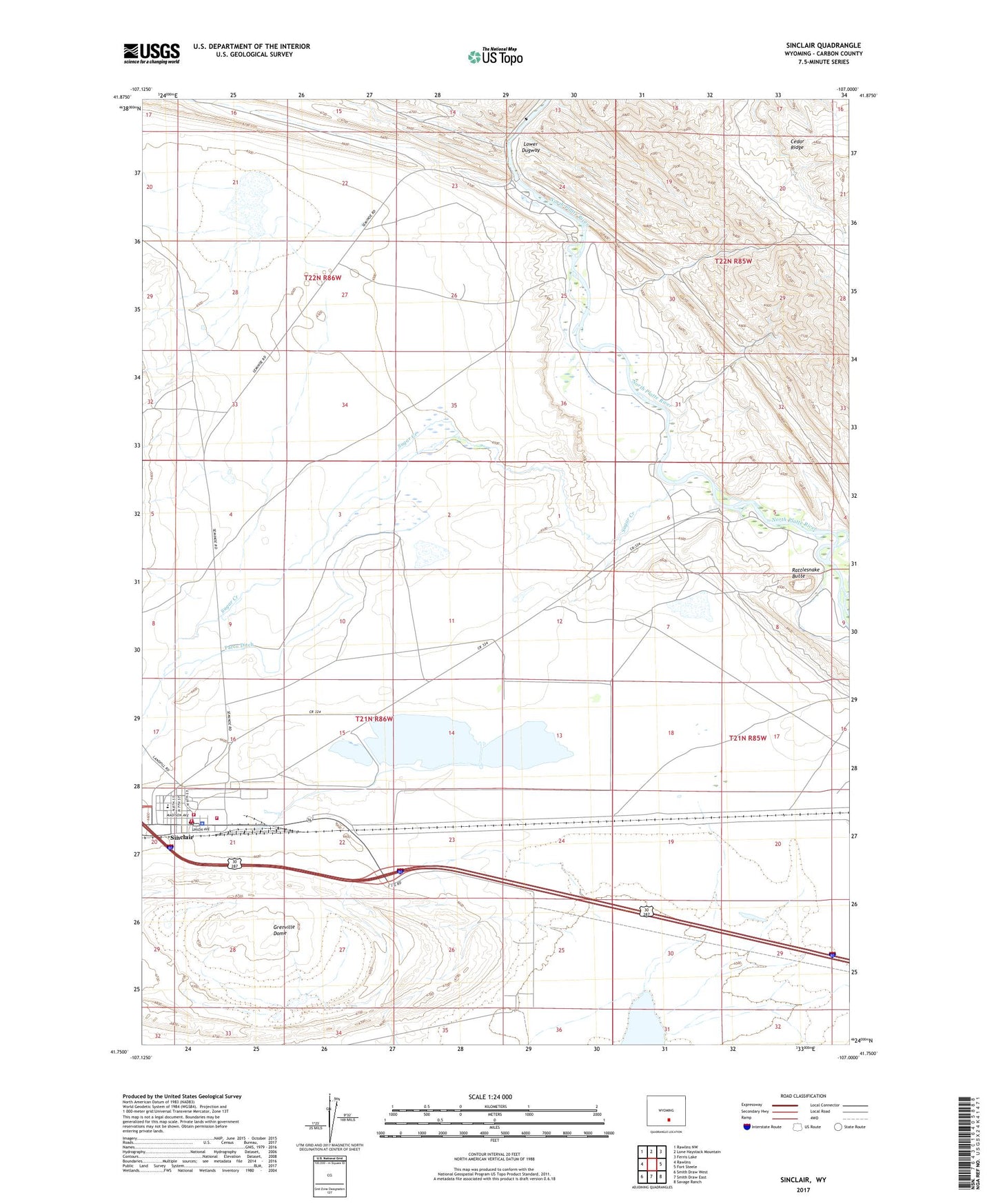
2021 topographic map quadrangle Sinclair in the state of Wyoming. Scale: 1:24000. Based on the newly updated USGS 7.5' US Topo map series, this map is in the following counties: Carbon. The map contains contour data, water features, and other items you are used to seeing on USGS maps, but also has updated roads and other features. This is the next generation of topographic maps. Printed on high-quality waterproof paper with UV fade-resistant inks.
Quads adjacent to this one:
West: Rawlins
Northwest: Rawlins NW
North: Lone Haystack Mountain
Northeast: Ferris Lake
East: Fort Steele
Southeast: Savage Ranch
South: Smith Draw East
Southwest: Smith Draw West
This map covers the same area as the classic USGS quad with code o41107g1.
Contains the following named places: Duncan Ranch, Grenville Dome, Parco Ditch, Rattlesnake Butte, Sinclair, Sinclair Police Department, Sinclair Post Office, Sinclair Recreation Park, Sinclair Refinery Volunteer Fire Department, Sinclair School, Sinclair Volunteer Fire Department, Sinclair Volunteer Fire Department Station 2, Sugar Creek, Town of Sinclair