MyTopo
Rendle Hill Wyoming US Topo Map
Couldn't load pickup availability
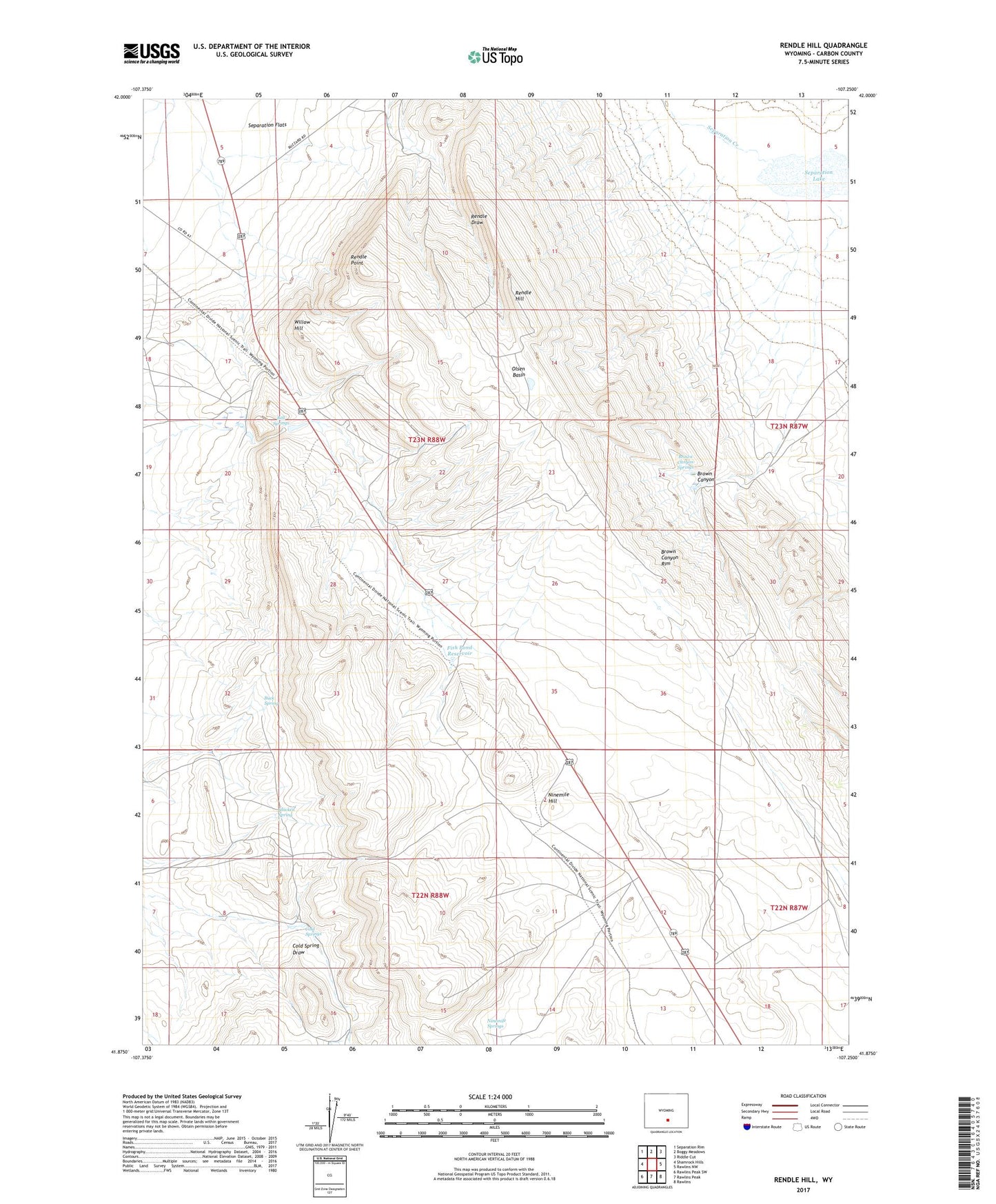
2021 topographic map quadrangle Rendle Hill in the state of Wyoming. Scale: 1:24000. Based on the newly updated USGS 7.5' US Topo map series, this map is in the following counties: Carbon. The map contains contour data, water features, and other items you are used to seeing on USGS maps, but also has updated roads and other features. This is the next generation of topographic maps. Printed on high-quality waterproof paper with UV fade-resistant inks.
Quads adjacent to this one:
West: Shamrock Hills
Northwest: Separation Rim
North: Boggy Meadows
Northeast: Riddle Cut
East: Rawlins NW
Southeast: Rawlins
South: Rawlins Peak
Southwest: Rawlins Peak SW
This map covers the same area as the classic USGS quad with code o41107h3.
Contains the following named places: Bell Springs, Brown Canyon, Brown Canyon Rim, Brown Canyon Springs, Buck Spring, Chicken Spring, Cold Springs, Fish Pond Reservoir, Ninemile Hill, Ninemile Springs, Olsen Basin, Olsen Ranch, Rendle Hill, Rendle Point, Rendle Ranch Headquarters, Separation Creek, Separation Lake, Willow Hill