MyTopo
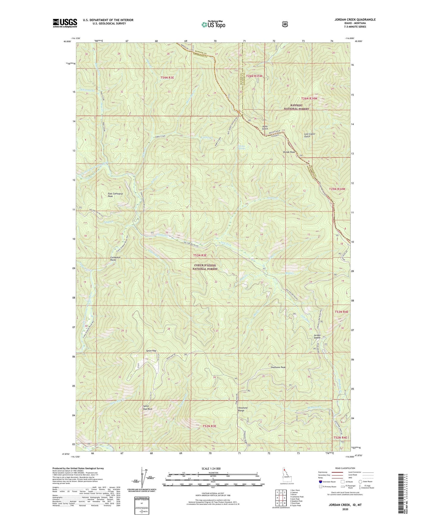
Jordan Creek Idaho US Topo Map
Couldn't load pickup availability
Also explore the Jordan Creek Forest Service Topo of this same quad for updated USFS data
2024 topographic map quadrangle Jordan Creek in the states of Idaho, Montana. Scale: 1:24000. Based on the newly updated USGS 7.5' US Topo map series, this map is in the following counties: Shoshone, Sanders, Bonner. The map contains contour data, water features, and other items you are used to seeing on USGS maps, but also has updated roads and other features. This is the next generation of topographic maps. Printed on high-quality waterproof paper with UV fade-resistant inks.
Quads adjacent to this one:
West: Cathedral Peak
Northwest: Derr Point
North: Cabinet
Northeast: Heron
East: Gem Peak
Southeast: Taylor Peak
South: Pond Peak
Southwest: Spyglass Peak
Contains the following named places: Alden Creek, Blacktail Creek, Bluff Creek, Calamity Creek, Cathedral Creek, Cathedral Rocks, Coeur d'Alene River National Recreation Trail, Cub Creek, Deer Creek, Divide Peak, East Alden Creek, East Cathedral Peak, Falls Creek, Hemlock Creek, Jordan Camp, Jordan Creek, Jordan Saddle, Jordan Springs, Lost Fork, Plant Creek, Sheep Run Creek, Sho Creek, Shoshone Peak, Spion Kop, Spion Kop Creek, Spion Kop Rock, Steamboat Rock, Tsuga Creek, Whitetail Creek